
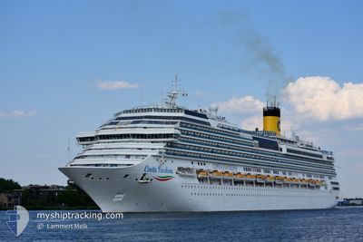
COSTA FAVOLOSA
Passengers Ship
Current Trip
| Time Travelled | 4 h, 38 mins |
|---|---|
| Remaining Time | 6 h, 47 mins |
| Distance Travelled | 54.18 nm |
| Remaining Distance | --- |
| AVG Speed | 11.6 Noeuds |
| MAX Speed | 15.3 Noeuds |
| AVG Wind | 10.7 knots |
| MAX Wind | 12 knots |
| MIN Temp | 21.6°C / 70.88°F |
| MAX Temp | 22.2°C / 71.96°F |
| Tirant d eau | 8.3 m |
| Position reçue | 1 d depuis |
Current Position
| Longitude | --- |
|---|---|
| Latitude | --- |
| Etat | Under way using engine |
| Vitesse | 20.3 Noeuds |
| Parcours | 216.6° |
| Zone | South Atlantic Ocean |
| Station | T-AIS |
| Position reçue | 1 d depuis |
Info
Information
The current position of COSTA FAVOLOSA is in South Atlantic Ocean with coordinates -28.97189° / -48.72168° as reported on 2025-03-16 03:38 by AIS to our vessel tracker app. The vessel's current speed is 20.3 Noeuds and is heading at the port of BUENOS AIRES. The estimated time of arrival as calculated by MyShipTracking vessel tracking app is 2025-03-18 06:59 LT
The vessel COSTA FAVOLOSA (IMO: 9479852, MMSI: 247311100) is a Passengers Ship that was built in 2011 ( 14 Age ). It's sailing under the flag of [IT] Italy.
In this page you can find informations about the vessels current position, last detected port calls, and current voyage information. If the vessels is not in coverage by AIS you will find the latest position.
The current position of COSTA FAVOLOSA is detected by our AIS receivers and we are not responsible for the reliability of the data. The last position was recorded while the vessel was in Coverage by the Ais receivers of our vessel tracking app.
The current draught of COSTA FAVOLOSA as reported by AIS is 8.3 meters
Weather
| Temperature | 22.1°C / 71.78°F |
|---|---|
| Wind Speed | 9 knots |
| Direction | 47° NE |
| Pressure | 1017 hPa |
| Humidity | 78.6 % |
| Cloud Coverage | 15 % |
Featured Company
Last Port Calls
| Port | Arrival | Departure | Time In Port |
|---|---|---|---|
| 2025-03-17 08:26 | 2025-03-17 19:34 | 11 h | |
| 2025-03-13 11:38 | 2025-03-13 22:26 | 10 h | |
| 2025-03-10 06:46 | 2025-03-10 19:19 | 12 h | |
| 2025-03-09 10:06 | 2025-03-09 19:30 | 9 h | |
| 2025-03-05 12:14 | 2025-03-05 22:14 | 10 h | |
| 2025-03-02 06:38 | 2025-03-02 19:53 | 13 h | |
| 2025-03-01 09:11 | 2025-03-01 19:18 | 10 h | |
| 2025-02-25 10:14 | 2025-02-25 21:46 | 11 h | |
| 2025-02-22 07:12 | 2025-02-22 19:50 | 12 h | |
| 2025-02-21 08:26 | 2025-02-21 19:22 | 10 h |
Most Visited Ports (Last year)
| Port | Arrivals | |
|---|---|---|
| 16 | ||
| 16 | ||
| 13 | ||
| 13 | ||
| 9 | ||
| 8 |
Last Trips
| Origin | Departure | Destination | Arrival | Distance | |
|---|---|---|---|---|---|
| 2025-03-13 22:26 | 2025-03-17 08:26 | 1137.73 nm | |||
| 2025-03-10 19:19 | 2025-03-13 11:38 | 1155.83 nm | |||
| 2025-03-09 19:30 | 2025-03-10 06:46 | 139.51 nm | |||
| 2025-03-05 22:14 | 2025-03-09 10:06 | 1149.88 nm | |||
| 2025-03-02 19:53 | 2025-03-05 12:14 | 1152.37 nm | |||
| 2025-03-01 19:18 | 2025-03-02 06:38 | 147.68 nm | |||
| 2025-02-25 21:46 | 2025-03-01 09:11 | 1128.57 nm | |||
| 2025-02-22 19:50 | 2025-02-25 10:14 | 1152.42 nm | |||
| 2025-02-21 19:22 | 2025-02-22 07:12 | 149.59 nm | |||
| 2025-02-17 21:42 | 2025-02-21 08:26 | 1145.89 nm |
Events
| Heure | Evenement | Détails | Position/ Destination | Info |
|---|---|---|---|---|
| 2025-03-17 22:34 | PORT DE DEPART |
|
-34.91243 / -56.22493
UYMVD
|
Vitesse: 4.9 kn Parcours: 190° |
| 2025-03-17 22:22 | Démarrage |
-34.90109 / -56.21624
[UY] MONTEVIDEO
|
Vitesse: 3.8 kn Parcours: 254° |
|
| 2025-03-17 11:43 | Arret |
-34.90162 / -56.21137
[UY] MONTEVIDEO
|
Vitesse: 0.2 kn Parcours: 205° |
|
| 2025-03-17 11:26 | Port d'arrivée |
|
-34.90540 / -56.22484
[UY] MONTEVIDEO
|
Vitesse: 6.8 kn Parcours: 352° |
| 2025-03-16 03:49 | Etat Changé | Default Under way using engine |
-29.02200 / -48.76146
UYMVD
|
Vitesse: 20.3 kn Parcours: 216.6° |
| 2025-03-16 03:38 | Hors de la zone couverte |
-28.97189 / -48.72168
South Atlantic Ocean
UYMVD
|
Vitesse: 20.3 kn Parcours: 216.6° |
|
| 2025-03-16 03:37 | Etat Changé | Under way using engine Default |
-28.96600 / -48.71663
UYMVD
|
Vitesse: 19.7 kn Parcours: 217° |
| 2025-03-16 03:34 | Etat Changé | Default Under way using engine |
-28.95291 / -48.70552
UYMVD
|
Vitesse: 20.1 kn Parcours: 215.7° |
| 2025-03-15 20:36 | Changement de destination | UYMVD BRCBU |
-26.96413 / -48.55337
UYMVD
|
Vitesse: 16.5 kn Parcours: 92.2° |
| 2025-03-15 20:36 | Changement d'ETA | 2025/03/17 10:30 2025/03/15 11:30 |
-26.96413 / -48.55337
UYMVD
|
Vitesse: 16.5 kn Parcours: 92.2° |