
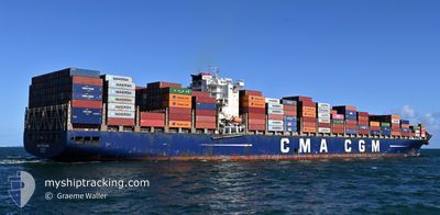
CMA CGM SAMSON
Container Ship
Current Trip
| Time Travelled | 1 day |
|---|---|
| Remaining Time | --- |
| Distance Travelled | 729.52 nm |
| Remaining Distance | --- |
| AVG Speed | 15.4 Knopen |
| MAX Speed | 17.9 Knopen |
| AVG Wind | 16.4 knots |
| MAX Wind | 20.3 knots |
| MIN Temp | 9.1°C / 48.38°F |
| MAX Temp | 25.4°C / 77.72°F |
| Diepgang | 13.5 M |
| Positie ontvangen | 9 h, 56 m geleden |
Current Position
| Lengtegraad | --- |
|---|---|
| Breedtegraat | --- |
| Status | Under way using engine |
| Snelheid | 16.6 Knopen |
| Koers | 97° |
| Gebied | North Atlantic Ocean |
| Station | T-AIS |
| Positie ontvangen | 9 h, 56 m geleden |
Info
Information
The current position of CMA CGM SAMSON is in North Atlantic Ocean with coordinates 23.68195° / -82.54458° as reported on 2025-02-16 02:16 by AIS to our vessel tracker app. The vessel's current speed is 16.6 Knopen and is heading at the port of SINGAPORE. The estimated time of arrival as calculated by MyShipTracking vessel tracking app is 2025-03-21 21:30 LT
The vessel CMA CGM SAMSON (IMO: 9436379, MMSI: 256687000) is a Container Ship that was built in 2011 ( 14 Jaar oud ). It's sailing under the flag of [MT] Malta.
In this page you can find informations about the vessels current position, last detected port calls, and current voyage information. If the vessels is not in coverage by AIS you will find the latest position.
The current position of CMA CGM SAMSON is detected by our AIS receivers and we are not responsible for the reliability of the data. The last position was recorded while the vessel was in Coverage by the Ais receivers of our vessel tracking app.
The current draught of CMA CGM SAMSON as reported by AIS is 13.5 meters
Weather
| Temperature | 24.1°C / 75.38°F |
|---|---|
| Wind Speed | 14 knots |
| Direction | 139° SE |
| Pressure | 1016 hPa |
| Humidity | 76.6 % |
| Cloud Coverage | 100 % |
Featured Company
Last Port Calls
| Port | Arrival | Departure | Time In Port |
|---|---|---|---|
| 2025-02-13 11:41 | 2025-02-14 13:03 | 1 d | |
| 2025-02-11 00:23 | 2025-02-12 13:39 | 1 d | |
| 2025-02-05 22:55 | 2025-02-08 20:18 | 2 d | |
| 2025-01-10 09:03 | 2025-01-11 18:52 | 1 d | |
| 2025-01-04 11:45 | 2025-01-05 14:08 | 1 d |
Last Trips
| Origin | Departure | Destination | Arrival | Distance | |
|---|---|---|---|---|---|
| 2025-02-12 07:39 | 2025-02-13 05:41 | 234.29 nm | |||
| 2025-02-08 14:18 | 2025-02-10 18:23 | 527.59 nm | |||
| 2025-01-12 03:52 | 2025-02-05 16:55 | 9796.90 nm | |||
| 2025-01-05 22:08 | 2025-01-10 18:03 | 1296.60 nm | |||
| 2024-11-28 04:08 | 2025-01-04 19:45 | 845.42 nm |
Events
| Tijd | Evenement | Details | Positie / Bestemming | Info |
|---|---|---|---|---|
| 2025-02-16 02:34 | Status Changed | Default Under way using engine |
23.67110 / -82.45789
SGSIN
|
Snelheid: 16.6 kn Koers: 97° |
| 2025-02-16 02:16 | Status Changed | Under way using engine Default |
23.68195 / -82.54458
SGSIN
|
Snelheid: 16.7 kn Koers: 97° |
| 2025-02-16 02:16 | Buitenbereik |
23.68195 / -82.54458
North Atlantic Ocean
|
Snelheid: 16.6 kn Koers: 97° |
|
| 2025-02-16 01:59 | Status Changed | Default Under way using engine |
23.69107 / -82.63025
SGSIN
|
Snelheid: 16.6 kn Koers: 94° |
| 2025-02-16 01:55 | Gevonden in zee | Cuban part of the North Atlantic Ocean |
23.69282 / -82.65188
North Atlantic Ocean
|
Snelheid: 16.6 kn Koers: 94° |
| 2025-02-16 01:54 | Status Changed | Under way using engine Default |
23.69330 / -82.65841
SGSIN
|
Snelheid: 16.7 kn Koers: 95° |
| 2025-02-16 01:45 | Binnenbereik |
23.69282 / -82.65188
North Atlantic Ocean
|
Snelheid: 16.6 kn Koers: 94° |
|
| 2025-02-14 13:03 | Status Changed | Default Under way using engine |
29.75357 / -90.02351
SGSIN
|
Snelheid: 15.7 kn Koers: 213° |
| 2025-02-14 13:03 | Vertrekhaven |
|
29.75357 / -90.02351
SGSIN
|
Snelheid: 15.7 kn Koers: 213° |
| 2025-02-14 12:56 | Buitenbereik |
29.78122 / -90.01862
Gulf of Mexico
|
Snelheid: 15.7 kn Koers: 212° |