
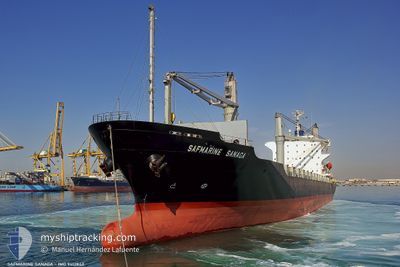
CELSIUS NEW ORLEANS
Container Ship
Current Trip
OMSLL
| Time Travelled | 10 h, 53 mins |
|---|---|
| Remaining Time | --- |
| Distance Travelled | 128.77 nm |
| Remaining Distance | --- |
| AVG Speed | 12.2 Knopen |
| MAX Speed | 13.6 Knopen |
| AVG Wind | 23.6 knots |
| MAX Wind | 34 knots |
| MIN Temp | 25.4°C / 77.72°F |
| MAX Temp | 26.7°C / 80.06°F |
| Diepgang | 9.1 M |
| Positie ontvangen | 3 d geleden |
Current Position
| Lengtegraad | 57.30462° |
|---|---|
| Breedtegraat | 24.93376° |
| Status | Under way using engine |
| Snelheid | 12.3 Knopen |
| Koers | 134° |
| Gebied | Gulf of Oman |
| Station | T-AIS |
| Positie ontvangen | 3 d geleden |
Info
Information
The current position of CELSIUS NEW ORLEANS is in Gulf of Oman with coordinates 24.93376° / 57.30462° as reported on 2024-07-02 07:50 by AIS to our vessel tracker app. The vessel's current speed is 12.3 Knopen
The vessel CELSIUS NEW ORLEANS (IMO: 9412842, MMSI: 538009878) is a Container Ship that was built in 2007 ( 17 Jaar oud ). It's sailing under the flag of [MH] Marshall Is.
In this page you can find informations about the vessels current position, last detected port calls, and current voyage information. If the vessels is not in coverage by AIS you will find the latest position.
The current position of CELSIUS NEW ORLEANS is detected by our AIS receivers and we are not responsible for the reliability of the data. The last position was recorded while the vessel was in Coverage by the Ais receivers of our vessel tracking app.
The current draught of CELSIUS NEW ORLEANS as reported by AIS is 9.1 meters
Weather
| Temperature | 25.5°C / 77.9°F |
|---|---|
| Wind Speed | 29 knots |
| Direction | 220° SW |
| Pressure | 1000.1 hPa |
| Humidity | 91 % |
| Cloud Coverage | 100 % |
Featured Company
Last Port Calls
| Port | Arrival | Departure | Time In Port |
|---|---|---|---|
| 2024-07-05 04:42 | 2024-07-05 16:22 | 11 h | |
| 2024-06-30 00:52 | 2024-07-01 14:17 | 1 d | |
| 2024-06-23 23:25 | 2024-06-26 12:37 | 2 d | |
| 2024-06-20 08:05 | 2024-06-21 18:46 | 1 d | |
| 2024-06-15 08:25 | 2024-06-16 05:49 | 21 h | |
| 2024-06-14 16:47 | 2024-06-15 07:56 | 15 h | |
| 2024-06-11 13:00 | 2024-06-13 02:42 | 1 d | |
| 2024-06-03 07:58 | 2024-06-04 22:15 | 1 d | |
| 2024-05-28 11:06 | 2024-05-29 12:58 | 1 d | |
| 2024-05-09 23:26 | 2024-05-11 01:49 | 1 d |
Last Trips
| Origin | Departure | Destination | Arrival | Distance | |
|---|---|---|---|---|---|
| 2024-07-01 18:17 | 2024-07-05 08:42 | 990.47 nm | |||
| 2024-06-26 15:37 | 2024-06-30 04:52 | 500.15 nm | |||
| 2024-06-21 22:46 | 2024-06-24 02:25 | 487.95 nm | |||
| 2024-06-16 08:49 | 2024-06-20 12:05 | 490.18 nm | |||
| 2024-06-15 10:56 | 2024-06-15 11:25 | 0.41 nm | |||
| 2024-06-13 06:42 | 2024-06-14 19:47 | 491.26 nm | |||
| 2024-06-05 01:15 | 2024-06-11 17:00 | 498.98 nm | |||
| 2024-05-29 16:58 | 2024-06-03 10:58 | 497.42 nm | |||
| 2024-05-11 03:49 | 2024-05-28 15:06 | 3347.00 nm | |||
| 2024-05-08 02:42 | 2024-05-10 01:26 | 566.88 nm |
Events
| Tijd | Evenement | Details | Positie / Bestemming | Info |
|---|---|---|---|---|
| 2024-07-05 16:22 | Vertrekhaven |
|
16.94647 / 54.06150
OMSLL
|
Snelheid: 6.4 kn Koers: 92° |
| 2024-07-05 16:03 | Start beweging |
16.94925 / 54.02229
[OM] SALALAH
|
Snelheid: 6.6 kn Koers: 70° |
|
| 2024-07-05 05:09 | Stop beweging |
16.94294 / 54.00118
[OM] SALALAH
|
Snelheid: 0.3 kn Koers: 67° |
|
| 2024-07-05 04:42 | Aankomsthaven |
|
16.94533 / 54.01142
[OM] SALALAH
|
Snelheid: 3.9 kn Koers: 278° |
| 2024-07-02 07:54 | Status Changed | Default Under way using engine |
24.92455 / 57.31486
OMSLL
|
Snelheid: 12.3 kn Koers: 134° |
| 2024-07-02 07:50 | Buitenbereik |
24.93376 / 57.30462
Gulf of Oman
OMSLL
|
Snelheid: 12.3 kn Koers: 134° |
|
| 2024-07-02 06:39 | Wijzig zee gebeid | Omani part of the Gulf of Oman United Arab Emirates part of the Gulf of Oman |
25.10221 / 57.11515
Gulf of Oman
OMSLL
|
Snelheid: 12.1 kn Koers: 134° |
| 2024-07-02 04:20 | ETA Changed | 2024/07/05 03:30 2024/07/04 17:00 |
25.57390 / 56.83480
OMSLL
|
Snelheid: 15.4 kn Koers: 154° |
| 2024-07-02 03:59 | Wijzig zee gebeid | United Arab Emirates part of the Gulf of Oman Omani part of the Gulf of Oman |
25.66065 / 56.81901
Gulf of Oman
OMSLL
|
Snelheid: 15.3 kn Koers: 171° |
| 2024-07-02 02:52 | Wijzig zee gebeid | Omani part of the Gulf of Oman Omani part of the Persian Gulf |
25.93999 / 56.76192
Gulf of Oman
OMSLL
|
Snelheid: 15.3 kn Koers: 172° |