
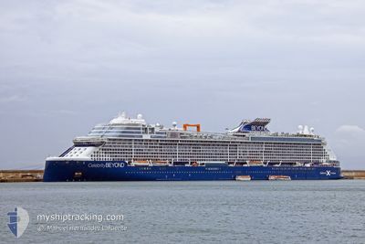
CELEBRITY BEYOND
Passenger
Current Trip
| Time Travelled | 2 days |
|---|---|
| Remaining Time | 9 h, 35 mins |
| Distance Travelled | 995.59 nm |
| Remaining Distance | 175.63 nm |
| AVG Speed | 19.4 Knopen |
| MAX Speed | 21 Knopen |
| AVG Wind | 10.3 knots |
| MAX Wind | 13.8 knots |
| MIN Temp | 25.2°C / 77.36°F |
| MAX Temp | 27.6°C / 81.68°F |
| Diepgang | 8.5 M |
| Positie ontvangen | 9 m geleden |
Current Position
| Lengtegraad | -77.08477° |
|---|---|
| Breedtegraat | 25.74023° |
| Status | Under way using engine |
| Snelheid | 17.4 Knopen |
| Koers | 283.7° |
| Gebied | North Atlantic Ocean |
| Station | T-AIS |
| Positie ontvangen | 9 m geleden |
Info
Information
The current position of CELEBRITY BEYOND is in North Atlantic Ocean with coordinates 25.74023° / -77.08477° as reported on 2024-05-12 00:26 by AIS to our vessel tracker app. The vessel's current speed is 17.4 Knopen and is heading at the port of PORT EVERGLADES. The estimated time of arrival as calculated by MyShipTracking vessel tracking app is 2024-05-12 10:10 LT
The vessel CELEBRITY BEYOND (IMO: 9838395, MMSI: 215808000) is a Passenger It's sailing under the flag of [MT] Malta.
In this page you can find informations about the vessels current position, last detected port calls, and current voyage information. If the vessels is not in coverage by AIS you will find the latest position.
The current position of CELEBRITY BEYOND is detected by our AIS receivers and we are not responsible for the reliability of the data. The last position was recorded while the vessel was in Coverage by the Ais receivers of our vessel tracking app.
The current draught of CELEBRITY BEYOND as reported by AIS is 8.5 meters
Weather
| Temperature | 26.3°C / 79.34°F |
|---|---|
| Wind Speed | 8 knots |
| Direction | 241° WSW |
| Pressure | 1011.5 hPa |
| Humidity | 86.3 % |
| Cloud Coverage | 1 % |
Featured Company
Last Port Calls
| Port | Arrival | Departure | Time In Port |
|---|---|---|---|
| 2024-05-09 11:02 | 2024-05-09 21:10 | 10 h | |
| 2024-05-06 10:14 | 2024-05-06 19:22 | 9 h | |
| 2024-05-05 10:14 | 2024-05-05 20:20 | 10 h | |
| 2024-05-01 11:22 | 2024-05-02 00:22 | 12 h | |
| 2024-04-27 09:59 | 2024-04-27 20:21 | 10 h | |
| 2024-04-25 11:24 | 2024-04-25 23:15 | 11 h | |
| 2024-04-22 10:21 | 2024-04-22 20:59 | 10 h | |
| 2024-04-19 10:35 | 2024-04-19 20:38 | 10 h | |
| 2024-04-18 14:08 | 2024-04-18 23:15 | 9 h | |
| 2024-04-18 12:55 | 2024-04-18 13:26 | 31 m |
Most Visited Ports (Last year)
| Port | Arrivals | |
|---|---|---|
| 19 | ||
| 17 | ||
| 17 | ||
| 10 | ||
| 9 | ||
| 8 |
Last Trips
| Origin | Departure | Destination | Arrival | Distance | |
|---|---|---|---|---|---|
| 2024-05-06 15:22 | 2024-05-09 07:02 | 1045.05 nm | |||
| 2024-05-05 16:20 | 2024-05-06 06:14 | 183.32 nm | |||
| 2024-05-01 20:22 | 2024-05-05 06:14 | 1212.04 nm | |||
| 2024-04-27 16:21 | 2024-05-01 07:22 | 1152.05 nm | |||
| 2024-04-25 18:15 | 2024-04-27 05:59 | 540.85 nm | |||
| 2024-04-22 16:59 | 2024-04-25 06:24 | 754.33 nm | |||
| 2024-04-19 16:38 | 2024-04-22 06:21 | 1122.58 nm | |||
| 2024-04-18 19:15 | 2024-04-19 06:35 | 54.50 nm | |||
| 2024-04-18 09:26 | 2024-04-18 10:08 | 2.94 nm | |||
| 2024-04-17 16:37 | 2024-04-18 08:55 | 294.40 nm |
Events
| Tijd | Evenement | Details | Positie / Bestemming | Info |
|---|---|---|---|---|
| 2024-05-12 00:23 | Status Changed | Under way using engine Default |
25.73665 / -77.06871
US PEF
|
Snelheid: 17 kn Koers: 284° |
| 2024-05-12 00:05 | Status Changed | Default Under way using engine |
25.71628 / -76.97620
US PEF
|
Snelheid: 16.9 kn Koers: 283.3° |
| 2024-05-11 23:42 | Status Changed | Under way using engine Default |
25.69063 / -76.85960
US PEF
|
Snelheid: 17 kn Koers: 282° |
| 2024-05-11 23:42 | Binnenbereik |
25.69063 / -76.85960
North Atlantic Ocean
US PEF
|
Snelheid: 16.7 kn Koers: 281° |
|
| 2024-05-11 22:43 | Status Changed | Default Under way using engine |
25.63167 / -76.57166
US PEF
|
Snelheid: 17 kn Koers: 306.8° |
| 2024-05-11 22:41 | Buitenbereik |
25.62624 / -76.56237
North Atlantic Ocean
US PEF
|
Snelheid: 17 kn Koers: 306.8° |
|
| 2024-05-11 22:34 | Status Changed | Under way using engine Default |
25.60506 / -76.53430
US PEF
|
Snelheid: 18 kn Koers: 309° |
| 2024-05-11 22:34 | Binnenbereik |
25.60506 / -76.53430
North Atlantic Ocean
US PEF
|
Snelheid: 17.2 kn Koers: 309.4° |
|
| 2024-05-11 18:52 | Status Changed | Default Under way using engine |
25.03350 / -75.46838
US PEF
|
Snelheid: 18.3 kn Koers: 299.9° |
| 2024-05-11 18:48 | Buitenbereik |
25.02152 / -75.44555
North Atlantic Ocean
US PEF
|
Snelheid: 18.3 kn Koers: 299.9° |