

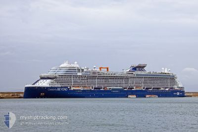
CELEBRITY BEYOND
Passenger

Current Trip
| Time Travelled | 4 h, 26 mins |
|---|---|
| Remaining Time | 10 h, 42 mins |
| Distance Travelled | 83.48 nm |
| Remaining Distance | 213.18 nm |
| AVG Speed | 19.5 Noeuds |
| MAX Speed | 20.3 Noeuds |
| AVG Wind | 16.8 knots |
| MAX Wind | 18 knots |
| MIN Temp | 26.1°C / 78.98°F |
| MAX Temp | 26.5°C / 79.7°F |
| Tirant d eau | 8.5 m |
| Position reçue | 1 m depuis |
Current Position
| Longitude | --- |
|---|---|
| Latitude | --- |
| Etat | Under way using engine |
| Vitesse | 19.6 Noeuds |
| Parcours | 320.2° |
| Zone | Caribbean Sea |
| Station | T-AIS |
| Position reçue | 1 m depuis |
Information
The current position of CELEBRITY BEYOND is in Caribbean Sea with coordinates 14.05624° / -60.71604° as reported on 2025-02-21 01:12 by AIS to our vessel tracker app. The vessel's current speed is 19.6 Noeuds and is heading at the port of ST JOHNS. The estimated time of arrival as calculated by MyShipTracking vessel tracking app is 2025-02-21 11:55 LT
The vessel CELEBRITY BEYOND (IMO: 9838395, MMSI: 215808000) is a Passenger It's sailing under the flag of [MT] Malta.
In this page you can find informations about the vessels current position, last detected port calls, and current voyage information. If the vessels is not in coverage by AIS you will find the latest position.
The current position of CELEBRITY BEYOND is detected by our AIS receivers and we are not responsible for the reliability of the data. The last position was recorded while the vessel was in Coverage by the Ais receivers of our vessel tracking app.
The current draught of CELEBRITY BEYOND as reported by AIS is 8.5 meters
Weather
| Temperature | 26.2°C / 79.16°F |
|---|---|
| Wind Speed | 17 knots |
| Direction | 83° E |
| Pressure | 1016.9 hPa |
| Humidity | 72.1 % |
| Cloud Coverage | --- |


Featured Company
Last Port Calls
| Port | Arrival | Departure | Time In Port |
|---|---|---|---|
| 2025-02-20 10:51 | 2025-02-20 20:47 | 9 h | |
| 2025-02-19 10:12 | 2025-02-19 21:51 | 11 h | |
| 2025-02-18 12:08 | 2025-02-18 22:18 | 10 h | |
| 2025-02-17 10:31 | 2025-02-17 21:09 | 10 h | |
| 2025-02-14 11:25 | 2025-02-14 22:01 | 10 h | |
| 2025-02-11 11:11 | 2025-02-11 21:51 | 10 h | |
| 2025-02-07 21:43 | 2025-02-08 02:39 | 4 h | |
| 2025-02-06 10:55 | 2025-02-06 20:13 | 9 h | |
| 2025-02-03 11:11 | 2025-02-03 21:34 | 10 h | |
| 2025-01-31 12:47 | 2025-01-31 21:27 | 8 h |
Most Visited Ports (Last year)
| Port | Arrivals | |
|---|---|---|
| 46 | ||
| 20 | ||
| 10 | ||
| 10 | ||
| 9 | ||
| 7 |
Last Trips
| Origin | Departure | Destination | Arrival | Distance | |
|---|---|---|---|---|---|
| 2025-02-19 17:51 | 2025-02-20 06:51 | 146.63 nm | |||
| 2025-02-18 18:18 | 2025-02-19 06:12 | 129.72 nm | |||
| 2025-02-17 17:09 | 2025-02-18 08:08 | 272.61 nm | |||
| 2025-02-14 17:01 | 2025-02-17 06:31 | 1079.36 nm | |||
| 2025-02-11 17:51 | 2025-02-14 06:25 | 1148.99 nm | |||
| 2025-02-07 21:39 | 2025-02-11 07:11 | 778.95 nm | |||
| 2025-02-06 15:13 | 2025-02-07 16:43 | 301.50 nm | |||
| 2025-02-03 16:34 | 2025-02-06 05:55 | 1133.47 nm | |||
| 2025-01-31 17:27 | 2025-02-03 06:11 | 1212.38 nm | |||
| 2025-01-30 17:14 | 2025-01-31 08:47 | 295.50 nm |
Events
| Heure | Evenement | Détails | Position/ Destination | Info |
|---|---|---|---|---|
| 2025-02-21 00:58 | Changement de zone | Saint Lucia part of the Caribbean Sea Barbados part of the Caribbean Sea |
13.99946 / -60.66362
Caribbean Sea
AG SJO
|
Vitesse: 19.6 kn Parcours: 317° |
| 2025-02-21 00:58 | Etat Changé | Under way using engine Default |
13.99946 / -60.66362
AG SJO
|
Vitesse: 19.6 kn Parcours: 319° |
| 2025-02-21 00:43 | Dans la zone couverte |
13.99946 / -60.66362
Caribbean Sea
AG SJO
|
Vitesse: 19.6 kn Parcours: 317° |
|
| 2025-02-20 21:42 | Etat Changé | Default Under way using engine |
13.28318 / -59.86742
AG SJO
|
Vitesse: 19.5 kn Parcours: 311.9° |
| 2025-02-20 21:35 | Hors de la zone couverte |
13.25868 / -59.83978
Caribbean Sea
AG SJO
|
Vitesse: 19.5 kn Parcours: 311.9° |
|
| 2025-02-20 20:53 | Changement de destination | AG SJO GD STG |
13.11154 / -59.65966
AG SJO
|
Vitesse: 14.9 kn Parcours: 296.7° |
| 2025-02-20 20:53 | Changement d'ETA | 2025/02/21 12:15 2025/02/19 10:00 |
13.11154 / -59.65966
AG SJO
|
Vitesse: 14.9 kn Parcours: 296.7° |
| 2025-02-20 20:49 | Changement de zone | Barbados part of the Caribbean Sea Saint Vincent and the Grenadines part of the Caribbean Sea |
13.10845 / -59.64765
Caribbean Sea
|
Vitesse: 11.8 kn Parcours: 272.6° |
| 2025-02-20 20:47 | Etat Changé | Under way using engine Default |
13.10842 / -59.64069
GD STG
|
Vitesse: 1.5 kn Parcours: 254° |
| 2025-02-20 20:47 | PORT DE DEPART |
|
13.10842 / -59.64069
GD STG
|
Vitesse: 1.5 kn Parcours: 254° |