
CAPTAINJ.NEOFOTISTOS
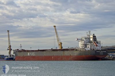
Bulk Carrier
Current Trip
| Time Travelled | 13 days |
|---|---|
| Remaining Time | --- |
| Distance Travelled | 3551.42 nm |
| Remaining Distance | --- |
| AVG Speed | 11.3 Knopen |
| MAX Speed | 12.8 Knopen |
| AVG Wind | 13 knots |
| MAX Wind | 23.8 knots |
| MIN Temp | 13.1°C / 55.58°F |
| MAX Temp | 29.3°C / 84.74°F |
| Diepgang | 13 M |
| Positie ontvangen | 8 d geleden |
Current Position
| Lengtegraad | -40.50675° |
|---|---|
| Breedtegraat | -21.93883° |
| Status | Under way using engine |
| Snelheid | 11.7 Knopen |
| Koers | 37.3° |
| Gebied | South Atlantic Ocean |
| Station | T-AIS |
| Positie ontvangen | 8 d geleden |
Info
Information
The current position of CAPTAINJ.NEOFOTISTOS is in South Atlantic Ocean with coordinates -21.93883° / -40.50675° as reported on 2024-05-04 11:16 by AIS to our vessel tracker app. The vessel's current speed is 11.7 Knopen and is heading at the port of GIBRALTAR. The estimated time of arrival as calculated by MyShipTracking vessel tracking app is 2024-05-19 05:00 LT
The vessel CAPTAINJ.NEOFOTISTOS (IMO: 9617430, MMSI: 636016657) is a Bulk Carrier that was built in 2012 ( 12 Jaar oud ). It's sailing under the flag of [LR] Liberia.
In this page you can find informations about the vessels current position, last detected port calls, and current voyage information. If the vessels is not in coverage by AIS you will find the latest position.
The current position of CAPTAINJ.NEOFOTISTOS is detected by our AIS receivers and we are not responsible for the reliability of the data. The last position was recorded while the vessel was in Coverage by the Ais receivers of our vessel tracking app.
The current draught of CAPTAINJ.NEOFOTISTOS as reported by AIS is 13 meters
Weather
| Temperature | 25.2°C / 77.36°F |
|---|---|
| Wind Speed | 11 knots |
| Direction | 18° NNE |
| Pressure | 1012.8 hPa |
| Humidity | 80.3 % |
| Cloud Coverage | 73 % |
Featured Company
Last Port Calls
| Port | Arrival | Departure | Time In Port |
|---|---|---|---|
| 2024-04-24 23:45 | 2024-04-29 12:23 | 4 d | |
| 2024-04-02 07:46 | 2024-04-08 06:45 | 5 d |
Last Trips
| Origin | Departure | Destination | Arrival | Distance | |
|---|---|---|---|---|---|
| 2024-04-08 03:45 | 2024-04-24 20:45 | 864.10 nm | |||
| 2024-02-20 18:20 | 2024-04-02 04:46 | 5533.41 nm |
Events
| Tijd | Evenement | Details | Positie / Bestemming | Info |
|---|---|---|---|---|
| 2024-05-04 11:21 | Status Changed | Default Under way using engine |
-21.92730 / -40.49540
GIGIB
|
Snelheid: 11.7 kn Koers: 37.3° |
| 2024-05-04 11:16 | Buitenbereik |
-21.93883 / -40.50675
South Atlantic Ocean
GIGIB
|
Snelheid: 11.7 kn Koers: 37.3° |
|
| 2024-05-04 11:08 | Status Changed | Under way using engine Default |
-21.95831 / -40.52609
GIGIB
|
Snelheid: 11.6 kn Koers: 40° |
| 2024-05-04 10:16 | Status Changed | Default Under way using engine |
-22.08128 / -40.64920
GIGIB
|
Snelheid: 11.4 kn Koers: 41.5° |
| 2024-05-04 10:12 | Status Changed | Under way using engine Default |
-22.09017 / -40.65822
GIGIB
|
Snelheid: 11.4 kn Koers: 42° |
| 2024-05-04 09:49 | Status Changed | Default Under way using engine |
-22.14493 / -40.71068
GIGIB
|
Snelheid: 11.4 kn Koers: 36.8° |
| 2024-05-04 09:23 | Status Changed | Under way using engine Default |
-22.20861 / -40.76486
GIGIB
|
Snelheid: 11.2 kn Koers: 35° |
| 2024-05-04 09:16 | Binnenbereik |
-22.20861 / -40.76486
South Atlantic Ocean
GIGIB
|
Snelheid: 11.2 kn Koers: 34.4° |
|
| 2024-05-04 03:00 | Status Changed | Default Under way using engine |
-23.04026 / -41.72626
GIGIB
|
Snelheid: 11.8 kn Koers: 46.2° |
| 2024-05-04 02:51 | Buitenbereik |
-23.05825 / -41.74838
South Atlantic Ocean
GIGIB
|
Snelheid: 11.8 kn Koers: 46.2° |