
CAPTAINJ.NEOFOTISTOS
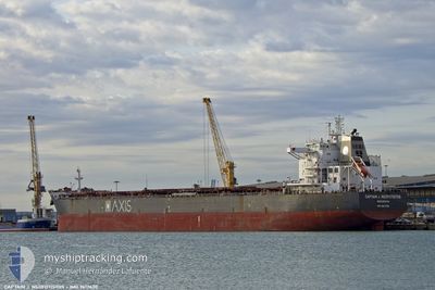
Bulk Carrier
Current Trip
| Time Travelled | 37 days |
|---|---|
| Remaining Time | --- |
| Distance Travelled | 7371.39 nm |
| Remaining Distance | --- |
| AVG Speed | 10.8 Knots |
| MAX Speed | 10.8 Knots |
| AVG Wind | 13.4 knots |
| MAX Wind | 29 knots |
| MIN Temp | 15.5°C / 59.9°F |
| MAX Temp | 37.8°C / 100.04°F |
| Dybgang | 13.2 m |
| Position Modtaget | 7 d siden |
Current Position
| Longitude | 34.48927° |
|---|---|
| Latitude | 28.04449° |
| Status | Under way using engine |
| Fart | 10.9 Knots |
| Kurs | 15.5° |
| Område | Gulf of Aqaba |
| Station | T-AIS |
| Position Modtaget | 7 d siden |
Info
Information
The current position of CAPTAINJ.NEOFOTISTOS is in Gulf of Aqaba with coordinates 28.04449° / 34.48927° as reported on 2024-05-29 08:04 by AIS to our vessel tracker app. The vessel's current speed is 10.9 Knots
The vessel CAPTAINJ.NEOFOTISTOS (IMO: 9617430, MMSI: 636016657) is a Bulk Carrier that was built in 2012 ( 12 år gamle ). It's sailing under the flag of [LR] Liberia.
In this page you can find informations about the vessels current position, last detected port calls, and current voyage information. If the vessels is not in coverage by AIS you will find the latest position.
The current position of CAPTAINJ.NEOFOTISTOS is detected by our AIS receivers and we are not responsible for the reliability of the data. The last position was recorded while the vessel was in Coverage by the Ais receivers of our vessel tracking app.
The current draught of CAPTAINJ.NEOFOTISTOS as reported by AIS is 13.2 meters
Weather
| Temperature | 28.6°C / 83.48°F |
|---|---|
| Wind Speed | 8 knots |
| Direction | 346° NNW |
| Pressure | 1003.2 hPa |
| Humidity | 71.5 % |
| Cloud Coverage | --- |
Featured Company
Last Port Calls
| Port | Arrival | Departure | Time In Port |
|---|---|---|---|
| 2024-05-28 05:36 | 2024-05-28 15:10 | 9 h | |
| 2024-04-24 20:45 | 2024-04-29 09:23 | 4 d | |
| 2024-04-02 04:46 | 2024-04-08 03:45 | 5 d |
Most Visited Ports (Last year)
| Port | Arrivals | |
|---|---|---|
| 3 | ||
| 2 | ||
| 2 | ||
| 1 | ||
| 1 | ||
| 1 |
Last Trips
| Origin | Departure | Destination | Arrival | Distance | |
|---|---|---|---|---|---|
| 2024-04-29 09:23 | 2024-05-28 05:36 | 7380.10 nm | |||
| 2024-04-08 03:45 | 2024-04-24 20:45 | 864.10 nm | |||
| 2024-02-20 18:20 | 2024-04-02 04:46 | 5533.41 nm |
Events
| Tid | Hændelsen | Detaljer | Position / Dest | Info |
|---|---|---|---|---|
| 2024-06-04 15:00 | START Sejllads | 1.16 nm, South West of AQABA INDUSTRIAL |
29.36153 / 34.94564
JO AQJ
|
Fart: 7 kn Kurs: 273° |
| 2024-05-29 08:04 | Udenfor Dækning |
28.04449 / 34.48927
Gulf of Aqaba
JO AQJ
|
Fart: 10.9 kn Kurs: 15.5° |
|
| 2024-05-29 08:04 | STOP Sejllads |
28.04313 / 34.48874
JO AQJ
|
Fart: Kurs: 15° |
|
| 2024-05-29 07:23 | Fundet i havområde | Saudi Arabian part of the Gulf of Aqaba |
27.92046 / 34.45338
Gulf of Aqaba
JO AQJ
|
Fart: 11.3 kn Kurs: 22° |
| 2024-05-29 07:13 | Fundet i havområde | Egyptian part of the Gulf of Aqaba |
27.89108 / 34.43980
Gulf of Aqaba
JO AQJ
|
Fart: 11.1 kn Kurs: 22.4° |
| 2024-05-29 06:25 | Status er ændret | Under way using engine Default |
27.75071 / 34.37959
JO AQJ
|
Fart: 11.7 kn Kurs: 21° |
| 2024-05-29 06:00 | Status er ændret | Default Under way using engine |
27.67554 / 34.34537
JO AQJ
|
Fart: 11.2 kn Kurs: 22° |
| 2024-05-29 05:49 | ETA er ændret | 2024/05/29 19:00 2024/05/29 20:00 |
27.64462 / 34.32985
JO AQJ
|
Fart: 10.9 kn Kurs: 24.4° |
| 2024-05-29 05:44 | Ændre havområde | Egyptian part of the Red Sea Egyptian part of the Gulf of Suez |
27.63218 / 34.32234
Red Sea
JO AQJ
|
Fart: 10.9 kn Kurs: 28.1° |
| 2024-05-29 05:44 | Status er ændret | Under way using engine Default |
27.63173 / 34.32207
JO AQJ
|
Fart: 10.9 kn Kurs: 34° |