
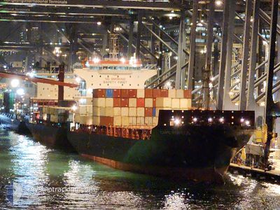
CAPE FORTIUS
Cargo
Current Trip
| Time Travelled | 7 h, 37 mins |
|---|---|
| Remaining Time | 2 days |
| Distance Travelled | 87.11 nm |
| Remaining Distance | 1043.90 nm |
| AVG Speed | 13.8 Knopen |
| MAX Speed | 17.9 Knopen |
| AVG Wind | 7.3 knots |
| MAX Wind | 11.5 knots |
| MIN Temp | 8.4°C / 47.12°F |
| MAX Temp | 13.3°C / 55.94°F |
| Diepgang | 9.5 M |
| Positie ontvangen | 3 h, 42 m geleden |
Current Position
| Lengtegraad | --- |
|---|---|
| Breedtegraat | --- |
| Status | Under way using engine |
| Snelheid | 16.4 Knopen |
| Koers | 207.6° |
| Gebied | Philippine Sea |
| Station | T-AIS |
| Positie ontvangen | 3 h, 42 m geleden |
Info
Information
The current position of CAPE FORTIUS is in Philippine Sea with coordinates 33.80361° / 134.86615° as reported on 2025-02-27 20:23 by AIS to our vessel tracker app. The vessel's current speed is 16.4 Knopen and is heading at the port of KAOHSIUNG. The estimated time of arrival as calculated by MyShipTracking vessel tracking app is 2025-03-02 22:36 LT
The vessel CAPE FORTIUS (IMO: 9734147, MMSI: 212540000) is a Cargo It's sailing under the flag of [CY] Cyprus.
In this page you can find informations about the vessels current position, last detected port calls, and current voyage information. If the vessels is not in coverage by AIS you will find the latest position.
The current position of CAPE FORTIUS is detected by our AIS receivers and we are not responsible for the reliability of the data. The last position was recorded while the vessel was in Coverage by the Ais receivers of our vessel tracking app.
The current draught of CAPE FORTIUS as reported by AIS is 9.5 meters
Weather
| Temperature | 10.8°C / 51.44°F |
|---|---|
| Wind Speed | 7 knots |
| Direction | 299° WNW |
| Pressure | 1022.9 hPa |
| Humidity | 82.2 % |
| Cloud Coverage | 100 % |
Featured Company
Last Port Calls
| Port | Arrival | Departure | Time In Port |
|---|---|---|---|
| 2025-02-27 11:16 | 2025-02-28 01:29 | 14 h | |
| 2025-02-25 18:37 | 2025-02-26 11:17 | 16 h | |
| 2025-02-24 23:54 | 2025-02-25 17:39 | 17 h | |
| 2025-02-23 14:31 | 2025-02-24 00:40 | 10 h | |
| 2025-02-19 08:36 | 2025-02-19 17:03 | 8 h | |
| 2025-02-16 07:45 | 2025-02-17 14:41 | 1 d | |
| 2025-02-14 12:29 | 2025-02-16 02:37 | 1 d | |
| 2025-02-11 23:04 | 2025-02-12 13:15 | 14 h | |
| 2025-02-10 10:22 | 2025-02-11 00:43 | 14 h | |
| 2025-02-05 19:36 | 2025-02-06 12:37 | 17 h |
Last Trips
| Origin | Departure | Destination | Arrival | Distance | |
|---|---|---|---|---|---|
| 2025-02-26 11:17 | 2025-02-27 11:16 | 354.50 nm | |||
| 2025-02-25 17:39 | 2025-02-25 18:37 | 11.08 nm | |||
| 2025-02-24 00:40 | 2025-02-24 23:54 | 369.24 nm | |||
| 2025-02-19 17:03 | 2025-02-23 14:31 | 1416.00 nm | |||
| 2025-02-17 14:41 | 2025-02-19 08:36 | 652.05 nm | |||
| 2025-02-16 02:37 | 2025-02-16 07:45 | 16.00 nm | |||
| 2025-02-12 13:15 | 2025-02-14 12:29 | 648.53 nm | |||
| 2025-02-11 00:43 | 2025-02-11 23:04 | 352.49 nm | |||
| 2025-02-06 12:37 | 2025-02-10 10:22 | 1436.26 nm | |||
| 2025-02-05 18:01 | 2025-02-05 19:36 | 14.70 nm |
Events
| Tijd | Evenement | Details | Positie / Bestemming | Info |
|---|---|---|---|---|
| 2025-02-27 20:30 | Status Changed | Default Under way using engine |
33.77951 / 134.84956
TW KHH
|
Snelheid: 16.4 kn Koers: 207.6° |
| 2025-02-27 20:23 | Status Changed | Under way using engine Default |
33.80361 / 134.86615
TW KHH
|
Snelheid: 16.5 kn Koers: 195° |
| 2025-02-27 20:23 | Buitenbereik |
33.80361 / 134.86615
Philippine Sea
TW KHH
|
Snelheid: 16.4 kn Koers: 207.6° |
|
| 2025-02-27 19:58 | Status Changed | Default Under way using engine |
33.91753 / 134.88342
TW KHH
|
Snelheid: 14.7 kn Koers: 180.5° |
| 2025-02-27 19:47 | Status Changed | Under way using engine Default |
33.96197 / 134.88383
TW KHH
|
Snelheid: 13.1 kn Koers: 183° |
| 2025-02-27 19:45 | Status Changed | Default Under way using engine |
33.96652 / 134.88425
TW KHH
|
Snelheid: 13.5 kn Koers: 220.7° |
| 2025-02-27 18:17 | Wijzig zee gebeid | Japanese part of the Philippine Sea Japanese part of the Inland Sea |
34.26804 / 134.97124
Philippine Sea
TW KHH
|
Snelheid: 16.2 kn Koers: 182.5° |
| 2025-02-27 16:29 | Vertrekhaven |
|
34.64925 / 135.26321
TW KHH
|
Snelheid: 10.7 kn Koers: 140° |
| 2025-02-27 16:21 | Start beweging |
34.65904 / 135.24533
[JP] KOBE
|
Snelheid: 3.2 kn Koers: 115° |
|
| 2025-02-27 15:55 | Status Changed | Under way using engine Moored |
34.65786 / 135.24107
[JP] KOBE
|
Snelheid: Koers: 334° |