
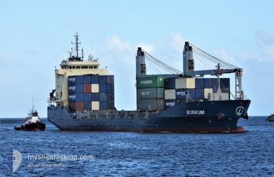
BORKUM
General Cargo
Current Trip
| Time Travelled | 5 days |
|---|---|
| Remaining Time | --- |
| Distance Travelled | 787.25 nm |
| Remaining Distance | --- |
| AVG Speed | 9.7 Knopen |
| MAX Speed | 11 Knopen |
| AVG Wind | 8.2 knots |
| MAX Wind | 19.1 knots |
| MIN Temp | 21.1°C / 69.98°F |
| MAX Temp | 24.4°C / 75.92°F |
| Diepgang | 6.8 M |
| Positie ontvangen | 1 d geleden |
Current Position
| Lengtegraad | 14.36396° |
|---|---|
| Breedtegraat | 36.11695° |
| Status | Under way using engine |
| Snelheid | 9.8 Knopen |
| Koers | 123.5° |
| Gebied | Mediterranean Sea - Eastern Basin |
| Station | T-AIS |
| Positie ontvangen | 1 d geleden |
Info
Information
The current position of BORKUM is in Mediterranean Sea - Eastern Basin with coordinates 36.11695° / 14.36396° as reported on 2024-06-08 16:39 by AIS to our vessel tracker app. The vessel's current speed is 9.8 Knopen
The vessel BORKUM (IMO: 9457153, MMSI: 305860000) is a General Cargo that was built in 2012 ( 12 Jaar oud ). It's sailing under the flag of [AG] Antigua Barbuda.
In this page you can find informations about the vessels current position, last detected port calls, and current voyage information. If the vessels is not in coverage by AIS you will find the latest position.
The current position of BORKUM is detected by our AIS receivers and we are not responsible for the reliability of the data. The last position was recorded while the vessel was in Coverage by the Ais receivers of our vessel tracking app.
The current draught of BORKUM as reported by AIS is 6.8 meters
Weather
| Temperature | 23.7°C / 74.66°F |
|---|---|
| Wind Speed | 10 knots |
| Direction | 165° SSE |
| Pressure | 1010.2 hPa |
| Humidity | 80.2 % |
| Cloud Coverage | 13 % |
Featured Company
Last Port Calls
| Port | Arrival | Departure | Time In Port |
|---|---|---|---|
| 2024-06-05 07:08 | 2024-06-05 12:56 | 5 h | |
| 2024-05-27 07:07 | 2024-05-29 20:29 | 2 d | |
| 2024-05-23 05:20 | 2024-05-24 23:10 | 1 d | |
| 2024-05-12 01:11 | 2024-05-12 07:32 | 6 h | |
| 2024-05-11 01:48 | 2024-05-12 00:11 | 22 h | |
| 2024-04-02 11:39 | 2024-04-02 21:58 | 10 h |
Most Visited Ports (Last year)
| Port | Arrivals | |
|---|---|---|
| 5 | ||
| 3 | ||
| 3 | ||
| 3 | ||
| 2 | ||
| 1 |
Last Trips
| Origin | Departure | Destination | Arrival | Distance | |
|---|---|---|---|---|---|
| 2024-05-29 20:29 | 2024-06-05 07:08 | 796.80 nm | |||
| 2024-05-24 23:10 | 2024-05-27 07:07 | 76.31 nm | |||
| 2024-05-12 07:32 | 2024-05-23 05:20 | 2455.85 nm | |||
| 2024-05-12 00:11 | 2024-05-12 01:11 | 3.20 nm | |||
| 2024-04-02 21:58 | 2024-05-11 01:48 | 9804.37 nm | |||
| 2024-03-26 06:12 | 2024-04-02 11:39 | 1958.83 nm |
Events
| Tijd | Evenement | Details | Positie / Bestemming | Info |
|---|---|---|---|---|
| 2024-06-09 08:25 | Stop beweging | 15.39 nm, East of MARSAXLOKK |
35.90398 / 14.84670
MALTA
|
Snelheid: Koers: 63° |
| 2024-06-09 07:41 | Start beweging | 12.03 nm, North East of MARSAXLOKK |
35.91010 / 14.76961
MALTA
|
Snelheid: 5.8 kn Koers: 100° |
| 2024-06-08 19:28 | Stop beweging | 11.71 nm, East of VALLETTA |
35.91485 / 14.76192
MALTA
|
Snelheid: 0.2 kn Koers: 159° |
| 2024-06-08 16:45 | Status Changed | Default Under way using engine |
36.10803 / 14.38085
MALTA
|
Snelheid: 9.8 kn Koers: 123.5° |
| 2024-06-08 16:39 | Buitenbereik |
36.11695 / 14.36396
Mediterranean Sea - Eastern Basin
MALTA
|
Snelheid: 9.8 kn Koers: 123.5° |
|
| 2024-06-08 15:42 | Destination Changed | MALTA SUEZ |
36.20027 / 14.19197
MALTA
|
Snelheid: 10 kn Koers: 115.5° |
| 2024-06-08 15:42 | ETA Changed | 2024/06/08 21:00 2024/06/12 10:00 |
36.20027 / 14.19197
MALTA
|
Snelheid: 10 kn Koers: 115.5° |
| 2024-06-08 15:39 | Status Changed | Under way using engine Default |
36.20330 / 14.18409
SUEZ
|
Snelheid: 10 kn Koers: 116° |
| 2024-06-08 15:39 | Binnenbereik |
36.20150 / 14.18883
Mediterranean Sea - Eastern Basin
SUEZ
|
Snelheid: 10 kn Koers: 115.6° |
|
| 2024-06-08 13:36 | Buitenbereik |
36.35927 / 13.80520
Mediterranean Sea - Eastern Basin
SUEZ
|
Snelheid: 9.8 kn Koers: 118.6° |