
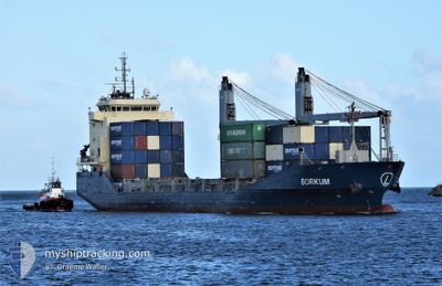
BORKUM
General Cargo
Current Trip
SUEZ CANAL
| Time Travelled | 9 days |
|---|---|
| Remaining Time | --- |
| Distance Travelled | 1678.56 nm |
| Remaining Distance | --- |
| AVG Speed | 7.5 Noeuds |
| MAX Speed | 11.7 Noeuds |
| AVG Wind | 18.2 knots |
| MAX Wind | 32.7 knots |
| MIN Temp | 12.4°C / 54.32°F |
| MAX Temp | 21.4°C / 70.52°F |
| Tirant d eau | 6.8 m |
| Position reçue | 3 d depuis |
Current Position
| Longitude | --- |
|---|---|
| Latitude | --- |
| Etat | Under way using engine |
| Vitesse | 9.2 Noeuds |
| Parcours | 299.6° |
| Zone | Mediterranean Sea - Eastern Basin |
| Station | T-AIS |
| Position reçue | 3 d depuis |
Info
Information
The current position of BORKUM is in Mediterranean Sea - Eastern Basin with coordinates 36.15035° / 14.28560° as reported on 2026-01-07 01:11 by AIS to our vessel tracker app. The vessel's current speed is 9.2 Noeuds
The vessel BORKUM (IMO: 9457153, MMSI: 305860000) is a General Cargo that was built in 2012 ( 14 Age ). It's sailing under the flag of [AG] Antigua Barbuda.
In this page you can find informations about the vessels current position, last detected port calls, and current voyage information. If the vessels is not in coverage by AIS you will find the latest position.
The current position of BORKUM is detected by our AIS receivers and we are not responsible for the reliability of the data. The last position was recorded while the vessel was in Coverage by the Ais receivers of our vessel tracking app.
The current draught of BORKUM as reported by AIS is 6.8 meters
Weather
| Temperature | 14.4°C / 57.92°F |
|---|---|
| Wind Speed | 27 knots |
| Direction | 311° NW |
| Pressure | 1017.4 hPa |
| Humidity | 59.2 % |
| Cloud Coverage | 8 % |
Featured Company
Last Port Calls
| Port | Arrival | Departure | Time In Port |
|---|---|---|---|
| 2026-01-02 09:14 | 2026-01-02 18:08 | 8 h | |
| 2025-12-30 06:48 | 2025-12-31 22:36 | 1 d | |
| 2025-12-24 12:48 | 2025-12-27 16:25 | 3 d | |
| 2025-12-21 07:30 | 2025-12-21 16:53 | 9 h | |
| 2025-12-16 00:59 | 2025-12-17 12:16 | 1 d | |
| 2025-12-13 20:25 | 2025-12-15 02:54 | 1 d | |
| 2025-12-11 05:35 | 2025-12-12 04:43 | 23 h | |
| 2025-12-03 12:52 | 2025-12-03 22:38 | 9 h | |
| 2025-11-06 06:34 | 2025-11-07 01:24 | 18 h |
Most Visited Ports (Last year)
| Port | Arrivals | |
|---|---|---|
| 6 | ||
| 3 | ||
| 3 | ||
| 2 | ||
| 2 | ||
| 2 |
Last Trips
| Origin | Departure | Destination | Arrival | Distance | |
|---|---|---|---|---|---|
| 2025-12-31 22:36 | 2026-01-02 09:14 | 292.44 nm | |||
| 2025-12-27 16:25 | 2025-12-30 06:48 | 568.35 nm | |||
| 2025-12-17 12:16 | 2025-12-24 12:48 | 1540.74 nm | |||
| 2025-12-17 12:16 | 2025-12-21 07:30 | 821.71 nm | |||
| 2025-12-15 02:54 | 2025-12-16 00:59 | 196.97 nm | |||
| 2025-12-12 04:43 | 2025-12-13 20:25 | 250.65 nm | |||
| 2025-12-03 22:38 | 2025-12-11 05:35 | 1264.01 nm | |||
| 2025-11-07 01:24 | 2025-12-03 12:52 | 5436.73 nm | |||
| 2025-10-27 23:17 | 2025-11-06 06:34 | 2042.16 nm |
Events
| Heure | Evenement | Détails | Position/ Destination | Info |
|---|---|---|---|---|
| 2026-01-07 01:15 | Etat Changé | Default Under way using engine |
36.15500 / 14.27167
SUEZ CANAL
|
Vitesse: 9.2 kn Parcours: 299.6° |
| 2026-01-07 01:11 | Hors de la zone couverte |
36.15035 / 14.28560
Mediterranean Sea - Eastern Basin
|
Vitesse: 9.2 kn Parcours: 299.6° |
|
| 2026-01-07 00:54 | Etat Changé | Under way using engine Default |
36.12917 / 14.33432
SUEZ CANAL
|
Vitesse: 9.6 kn Parcours: 316° |
| 2026-01-07 00:13 | Etat Changé | Default Under way using engine |
36.03217 / 14.39960
SUEZ CANAL
|
Vitesse: 10.2 kn Parcours: 345.1° |
| 2026-01-07 00:03 | Etat Changé | Under way using engine Default |
36.00510 / 14.40774
SUEZ CANAL
|
Vitesse: 3.6 kn Parcours: 346° |
| 2026-01-07 00:03 | Démarrage | 3.07 nm, North of BUGIBBA |
36.00510 / 14.40774
SUEZ CANAL
|
Vitesse: 7.8 kn Parcours: 345.4° |
| 2026-01-07 00:03 | Dans la zone couverte |
36.00510 / 14.40774
Mediterranean Sea - Eastern Basin
|
Vitesse: 7.8 kn Parcours: 345.4° |
|
| 2026-01-06 20:39 | Etat Changé | Default At anchor |
36.00045 / 14.40973
SUEZ CANAL
|
Vitesse: 0.2 kn Parcours: 335° |
| 2026-01-06 20:35 | Etat Changé | At anchor Default |
36.00062 / 14.40940
SUEZ CANAL
|
Vitesse: 0.2 kn Parcours: 337° |
| 2026-01-06 20:35 | Hors de la zone couverte |
36.00062 / 14.40940
Mediterranean Sea - Eastern Basin
|
Vitesse: 0.2 kn Parcours: 34.1° |