
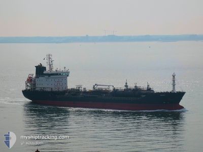
ASKARA
Oil/Chemical Tanker
Current Trip
TH MPT
| Time Travelled | 8 days |
|---|---|
| Remaining Time | --- |
| Distance Travelled | 2474.61 nm |
| Remaining Distance | --- |
| AVG Speed | 12.2 Knopen |
| MAX Speed | 15 Knopen |
| AVG Wind | 13 knots |
| MAX Wind | 23 knots |
| MIN Temp | 13.9°C / 57.02°F |
| MAX Temp | 30.5°C / 86.9°F |
| Diepgang | 5.5 M |
| Positie ontvangen | 3 d geleden |
Current Position
| Lengtegraad | 114.41560° |
|---|---|
| Breedtegraat | 21.93943° |
| Status | Under way using engine |
| Snelheid | 14.4 Knopen |
| Koers | 191.1° |
| Gebied | South China Sea |
| Station | T-AIS |
| Positie ontvangen | 3 d geleden |
Info
Information
The current position of ASKARA is in South China Sea with coordinates 21.93943° / 114.41560° as reported on 2024-05-04 10:59 by AIS to our vessel tracker app. The vessel's current speed is 14.4 Knopen
The vessel ASKARA (IMO: 9431886, MMSI: 249187000) is a Oil/Chemical Tanker that was built in 2008 ( 16 Jaar oud ). It's sailing under the flag of [MT] Malta.
In this page you can find informations about the vessels current position, last detected port calls, and current voyage information. If the vessels is not in coverage by AIS you will find the latest position.
The current position of ASKARA is detected by our AIS receivers and we are not responsible for the reliability of the data. The last position was recorded while the vessel was in Coverage by the Ais receivers of our vessel tracking app.
The current draught of ASKARA as reported by AIS is 5.5 meters
Weather
| Temperature | 30.5°C / 86.9°F |
|---|---|
| Wind Speed | 9 knots |
| Direction | 83° E |
| Pressure | 1008.7 hPa |
| Humidity | 67.3 % |
| Cloud Coverage | 89 % |
Featured Company
Last Trips
| Origin | Departure | Destination | Arrival | Distance | |
|---|---|---|---|---|---|
| 2024-04-27 11:32 | 2024-04-29 19:00 | 617.60 nm | |||
| 2024-04-15 01:34 | 2024-04-26 19:04 | 2481.41 nm | |||
| 2024-03-31 14:36 | 2024-04-11 22:10 | 2612.41 nm | |||
| 2024-03-08 09:59 | 2024-03-18 20:51 | 1829.61 nm |
Events
| Tijd | Evenement | Details | Positie / Bestemming | Info |
|---|---|---|---|---|
| 2024-05-04 11:05 | Status Changed | Default Under way using engine |
21.91567 / 114.40900
TH MPT
|
Snelheid: 14.4 kn Koers: 191.1° |
| 2024-05-04 10:59 | Status Changed | Under way using engine Default |
21.93943 / 114.41560
TH MPT
|
Snelheid: 14.5 kn Koers: 181° |
| 2024-05-04 10:59 | Buitenbereik |
21.93943 / 114.41560
South China Sea
|
Snelheid: 14.4 kn Koers: 191.1° |
|
| 2024-05-04 10:53 | Status Changed | Default Under way using engine |
21.96346 / 114.41665
TH MPT
|
Snelheid: 14.6 kn Koers: 181.5° |
| 2024-05-04 09:54 | Destination Changed | TH MPT HK HKG |
22.11152 / 114.30109
TH MPT
|
Snelheid: 12.8 kn Koers: 91.9° |
| 2024-05-04 09:54 | ETA Changed | 2024/09/05 04:00 2024/05/04 00:01 |
22.11152 / 114.30109
TH MPT
|
Snelheid: 12.8 kn Koers: 91.9° |
| 2024-05-04 09:48 | Status Changed | Under way using engine Default |
22.11247 / 114.27855
HK HKG
|
Snelheid: 12.2 kn Koers: 85° |
| 2024-05-04 09:44 | Status Changed | Default Under way using engine |
22.11153 / 114.26573
HK HKG
|
Snelheid: 12.1 kn Koers: 84.3° |
| 2024-05-04 09:18 | Status Changed | Under way using engine Default |
22.12017 / 114.17133
HK HKG
|
Snelheid: 12.6 kn Koers: 96° |
| 2024-05-04 09:12 | Status Changed | Default Under way using engine |
22.12917 / 114.15200
HK HKG
|
Snelheid: 11.1 kn Koers: 171.1° |