
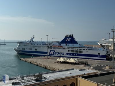
AF MIA
Ro-Ro/Passenger Ship
Current Trip
| Time Travelled | 15 h, 50 mins |
|---|---|
| Remaining Time | 45 mins |
| Distance Travelled | 262.53 nm |
| Remaining Distance | 48.79 nm |
| AVG Speed | 18.8 Knopen |
| MAX Speed | 19.4 Knopen |
| AVG Wind | 13.2 knots |
| MAX Wind | 20.2 knots |
| MIN Temp | 7.6°C / 45.68°F |
| MAX Temp | 10.8°C / 51.44°F |
| Diepgang | 6.8 M |
| Positie ontvangen | 1 h, 50 m geleden |
Current Position
| Lengtegraad | --- |
|---|---|
| Breedtegraat | --- |
| Status | Under way using engine |
| Snelheid | 18.5 Knopen |
| Koers | 109° |
| Gebied | Adriatic Sea |
| Station | T-AIS |
| Positie ontvangen | 1 h, 50 m geleden |
Info
Information
The current position of AF MIA is in Adriatic Sea with coordinates 41.53235° / 18.46977° as reported on 2026-01-09 07:39 by AIS to our vessel tracker app. The vessel's current speed is 18.5 Knopen and is heading at the port of DURRES. The estimated time of arrival as calculated by MyShipTracking vessel tracking app is 2026-01-09 11:15 LT
The vessel AF MIA (IMO: 9144811, MMSI: 247343200) is a Ro-Ro/Passenger Ship that was built in 1997 ( 29 Jaar oud ). It's sailing under the flag of [IT] Italy.
In this page you can find informations about the vessels current position, last detected port calls, and current voyage information. If the vessels is not in coverage by AIS you will find the latest position.
The current position of AF MIA is detected by our AIS receivers and we are not responsible for the reliability of the data. The last position was recorded while the vessel was in Coverage by the Ais receivers of our vessel tracking app.
The current draught of AF MIA as reported by AIS is 6.8 meters
Weather
| Temperature | 9.9°C / 49.82°F |
|---|---|
| Wind Speed | 17 knots |
| Direction | 177° S |
| Pressure | 1013.7 hPa |
| Humidity | 83.1 % |
| Cloud Coverage | 89 % |
Featured Company
Last Port Calls
| Port | Arrival | Departure | Time In Port |
|---|---|---|---|
| 2026-01-08 10:28 | 2026-01-08 18:40 | 8 h | |
| 2026-01-07 10:43 | 2026-01-07 17:31 | 6 h | |
| 2026-01-06 10:29 | 2026-01-06 18:09 | 7 h | |
| 2026-01-05 15:13 | 2026-01-05 17:55 | 2 h | |
| 2026-01-05 07:24 | 2026-01-05 09:47 | 2 h | |
| 2026-01-04 23:45 | 2026-01-05 01:34 | 1 h | |
| 2026-01-04 06:30 | 2026-01-04 10:24 | 3 h | |
| 2025-12-31 10:30 | 2026-01-03 17:04 | 3 d | |
| 2025-12-30 09:32 | 2025-12-30 17:15 | 7 h | |
| 2025-12-29 09:40 | 2025-12-29 17:04 | 7 h |
Last Trips
| Origin | Departure | Destination | Arrival | Distance | |
|---|---|---|---|---|---|
| 2026-01-07 17:31 | 2026-01-08 10:28 | 308.95 nm | |||
| 2026-01-06 18:09 | 2026-01-07 10:43 | 311.48 nm | |||
| 2026-01-05 17:55 | 2026-01-06 10:29 | 311.87 nm | |||
| 2026-01-05 09:47 | 2026-01-05 15:13 | 121.01 nm | |||
| 2026-01-05 01:34 | 2026-01-05 07:24 | 122.37 nm | |||
| 2026-01-04 10:24 | 2026-01-04 23:45 | 311.92 nm | |||
| 2026-01-03 17:04 | 2026-01-04 06:30 | 309.16 nm | |||
| 2025-12-30 17:15 | 2025-12-31 10:30 | 314.28 nm | |||
| 2025-12-29 17:04 | 2025-12-30 09:32 | 309.34 nm | |||
| 2025-12-28 17:08 | 2025-12-29 09:40 | 310.51 nm |
Events
| Tijd | Evenement | Details | Positie / Bestemming | Info |
|---|---|---|---|---|
| 2026-01-09 07:59 | Status Changed | Default Under way using engine |
41.49678 / 18.60038
ALDRZ
|
Snelheid: 18.5 kn Koers: 109° |
| 2026-01-09 07:39 | Buitenbereik |
41.53235 / 18.46977
Adriatic Sea
ALDRZ
|
Snelheid: 18.5 kn Koers: 109° |
|
| 2026-01-09 06:34 | Wijzig zee gebeid | Montenegrin part of the Adriatic Sea Croatian part of the Adriatic Sea |
41.65102 / 18.04673
Adriatic Sea
ALDRZ
|
Snelheid: 18.7 kn Koers: 110° |
| 2026-01-09 06:13 | Wijzig zee gebeid | Croatian part of the Adriatic Sea Italian part of the Adriatic Sea |
41.68872 / 17.91132
Adriatic Sea
ALDRZ
|
Snelheid: 18.7 kn Koers: 110° |
| 2026-01-09 05:42 | Binnenbereik |
41.73873 / 17.71867
Adriatic Sea
ALDRZ
|
Snelheid: 18.6 kn Koers: 110° |
|
| 2026-01-09 03:12 | Status Changed | Default Under way using engine |
42.01403 / 16.73372
ALDRZ
|
Snelheid: 19.1 kn Koers: 113° |
| 2026-01-09 03:09 | Buitenbereik |
42.02227 / 16.70818
Adriatic Sea
ALDRZ
|
Snelheid: 19.1 kn Koers: 113° |
|
| 2026-01-09 01:49 | Wijzig zee gebeid | Italian part of the Adriatic Sea Croatian part of the Adriatic Sea |
42.19008 / 16.19465
Adriatic Sea
ALDRZ
|
Snelheid: 19 kn Koers: 126° |
| 2026-01-09 01:17 | Wijzig zee gebeid | Croatian part of the Adriatic Sea Italian part of the Adriatic Sea |
42.29560 / 16.01503
Adriatic Sea
ALDRZ
|
Snelheid: 19.2 kn Koers: 127° |
| 2026-01-09 00:11 | Wijzig zee gebeid | Italian part of the Adriatic Sea Croatian part of the Adriatic Sea |
42.51675 / 15.65532
Adriatic Sea
ALDRZ
|
Snelheid: 18.7 kn Koers: 131° |