
AF MIA
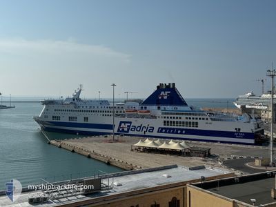
Ro-Ro/Passenger Ship
Current Trip
| Time Travelled | 11 h, 42 mins |
|---|---|
| Remaining Time | 2 h, 7 mins |
| Distance Travelled | 196.76 nm |
| Remaining Distance | 117.12 nm |
| AVG Speed | 21 Knots |
| MAX Speed | 23.1 Knots |
| AVG Wind | 12 knots |
| MAX Wind | 22.5 knots |
| MIN Temp | 13°C / 55.4°F |
| MAX Temp | 15.4°C / 59.72°F |
| Draught | 6.8 m |
| Position Received | 2 h, 28 m ago |
Current Position
| Longitude | --- |
|---|---|
| Latitude | --- |
| Status | Under way using engine |
| Speed | 22.1 Knots |
| Course | 295° |
| Area | Adriatic Sea |
| Station | T-AIS |
| Position Received | 2 h, 28 m ago |
Info
Information
The current position of AF MIA is in Adriatic Sea with coordinates 42.99383° / 15.58843° as reported on 2025-12-06 04:25 by AIS to our vessel tracker app. The vessel's current speed is 22.1 Knots and is heading at the port of ANCONA. The estimated time of arrival as calculated by MyShipTracking vessel tracking app is 2025-12-06 09:00 LT
The vessel AF MIA (IMO: 9144811, MMSI: 247343200) is a Ro-Ro/Passenger Ship that was built in 1997 ( 28 years old ). It's sailing under the flag of [IT] Italy.
In this page you can find informations about the vessels current position, last detected port calls, and current voyage information. If the vessels is not in coverage by AIS you will find the latest position.
The current position of AF MIA is detected by our AIS receivers and we are not responsible for the reliability of the data. The last position was recorded while the vessel was in Coverage by the Ais receivers of our vessel tracking app.
The current draught of AF MIA as reported by AIS is 6.8 meters
Weather
| Temperature | 13.4°C / 56.12°F |
|---|---|
| Wind Speed | 18 knots |
| Direction | 332° NNW |
| Pressure | 1010.5 hPa |
| Humidity | 71.7 % |
| Cloud Coverage | 48 % |
Featured Company
Last Port Calls
| Port | Arrival | Departure | Time In Port |
|---|---|---|---|
| 2025-12-05 11:00 | 2025-12-05 19:11 | 8 h | |
| 2025-12-04 10:49 | 2025-12-04 18:25 | 7 h | |
| 2025-12-03 10:41 | 2025-12-03 18:22 | 7 h | |
| 2025-12-01 10:38 | 2025-12-02 18:05 | 1 d | |
| 2025-11-30 09:24 | 2025-11-30 18:17 | 8 h | |
| 2025-11-29 08:51 | 2025-11-29 16:56 | 8 h | |
| 2025-11-28 11:38 | 2025-11-28 16:34 | 4 h | |
| 2025-11-27 11:00 | 2025-11-27 18:37 | 7 h | |
| 2025-11-26 10:43 | 2025-11-26 18:17 | 7 h | |
| 2025-11-24 11:05 | 2025-11-25 18:16 | 1 d |
Last Trips
| Origin | Departure | Destination | Arrival | Distance | |
|---|---|---|---|---|---|
| 2025-12-04 19:25 | 2025-12-05 12:00 | 305.46 nm | |||
| 2025-12-03 19:22 | 2025-12-04 11:49 | 309.29 nm | |||
| 2025-12-02 19:05 | 2025-12-03 11:41 | 306.70 nm | |||
| 2025-11-30 19:17 | 2025-12-01 11:38 | 309.79 nm | |||
| 2025-11-29 17:56 | 2025-11-30 10:24 | 307.00 nm | |||
| 2025-11-28 17:34 | 2025-11-29 09:51 | 308.90 nm | |||
| 2025-11-27 19:37 | 2025-11-28 12:38 | 305.68 nm | |||
| 2025-11-26 19:17 | 2025-11-27 12:00 | 309.31 nm | |||
| 2025-11-25 19:16 | 2025-11-26 11:43 | 305.81 nm | |||
| 2025-11-23 19:26 | 2025-11-24 12:05 | 309.94 nm |
Events
| Time | Event | Details | Position / Dest | Info |
|---|---|---|---|---|
| 2025-12-06 04:26 | Status Changed | Default Under way using engine |
42.99752 / 15.57787
ITAOI
|
Speed: 22.1 kn Course: 295° |
| 2025-12-06 04:25 | Status Changed | Under way using engine Default |
42.99383 / 15.58843
ITAOI
|
Speed: 22.2 kn Course: 296° |
| 2025-12-06 04:25 | OUT of Coverage |
42.99383 / 15.58843
Adriatic Sea
ITAOI
|
Speed: 22.1 kn Course: 295° |
|
| 2025-12-06 04:13 | Status Changed | Default Under way using engine |
42.96113 / 15.67797
ITAOI
|
Speed: 21.9 kn Course: 296° |
| 2025-12-06 04:03 | Status Changed | Under way using engine Default |
42.93547 / 15.74870
ITAOI
|
Speed: 21.8 kn Course: 297° |
| 2025-12-06 04:03 | IN Coverage |
42.93547 / 15.74870
Adriatic Sea
ITAOI
|
Speed: 21.8 kn Course: 296° |
|
| 2025-12-05 22:36 | OUT of Coverage |
41.90533 / 18.10433
Adriatic Sea
ITAOI
|
Speed: 23 kn Course: 304° |
|
| 2025-12-05 22:23 | Change Sea Area | Croatian part of the Adriatic Sea Montenegrin part of the Adriatic Sea |
41.85860 / 18.20007
Adriatic Sea
ITAOI
|
Speed: 22.8 kn Course: 300° |
| 2025-12-05 20:40 | Change Sea Area | Montenegrin part of the Adriatic Sea Albanian part of the Adriatic Sea |
41.51077 / 18.91232
Adriatic Sea
ITAOI
|
Speed: 22 kn Course: 301° |
| 2025-12-05 20:14 | Status Changed | Under way using engine Default |
41.42432 / 19.09213
ITAOI
|
Speed: 21.5 kn Course: 301° |