
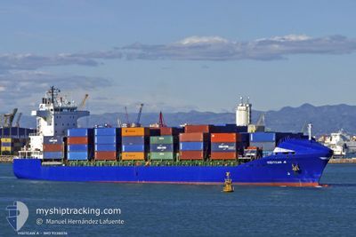
YIGITCAN A
Container Ship
Current Trip
| Time Travelled | 2 days |
|---|---|
| Remaining Time | --- |
| Distance Travelled | 454.38 nm |
| Remaining Distance | --- |
| AVG Speed | 10.4 Noeuds |
| MAX Speed | 13 Noeuds |
| AVG Wind | 11 knots |
| MAX Wind | 24.6 knots |
| MIN Temp | 13.4°C / 56.12°F |
| MAX Temp | 17.7°C / 63.86°F |
| Tirant d eau | 9 m |
| Position reçue | 1 h, 21 m depuis |
Current Position
| Longitude | 5.13238° |
|---|---|
| Latitude | 36.95415° |
| Etat | Under way using engine |
| Vitesse | 0.7 Noeuds |
| Parcours | 348° |
| Zone | Mediterranean Sea - Western Basin |
| Station | T-AIS |
| Position reçue | 1 h, 21 m depuis |
Info
Information
The current position of YIGITCAN A is in Mediterranean Sea - Western Basin with coordinates 36.95415° / 5.13238° as reported on 2024-05-03 13:03 by AIS to our vessel tracker app. The vessel's current speed is 0.7 Noeuds
The vessel YIGITCAN A (IMO: 9238076, MMSI: 215424000) is a Container Ship that was built in 2001 ( 23 Age ). It's sailing under the flag of [MT] Malta.
In this page you can find informations about the vessels current position, last detected port calls, and current voyage information. If the vessels is not in coverage by AIS you will find the latest position.
The current position of YIGITCAN A is detected by our AIS receivers and we are not responsible for the reliability of the data. The last position was recorded while the vessel was in Coverage by the Ais receivers of our vessel tracking app.
The current draught of YIGITCAN A as reported by AIS is 9 meters
Weather
| Temperature | 17.7°C / 63.86°F |
|---|---|
| Wind Speed | 5 knots |
| Direction | 18° NNE |
| Pressure | 1020.1 hPa |
| Humidity | 54.9 % |
| Cloud Coverage | 24 % |
Featured Company
Last Port Calls
| Port | Arrival | Departure | Time In Port |
|---|---|---|---|
| 2024-04-30 10:19 | 2024-04-30 19:20 | 9 h | |
| 2024-04-27 07:48 | 2024-04-28 07:23 | 23 h | |
| 2024-04-21 14:30 | 2024-04-25 20:27 | 4 d | |
| 2024-04-17 10:16 | 2024-04-19 02:02 | 1 d | |
| 2024-04-15 05:34 | 2024-04-16 06:59 | 1 d | |
| 2024-04-08 16:10 | 2024-04-13 22:07 | 5 d | |
| 2024-04-05 19:05 | 2024-04-06 19:13 | 1 d | |
| 2024-04-01 20:10 | 2024-04-03 21:08 | 2 d | |
| 2024-03-24 01:47 | 2024-03-29 03:03 | 5 d | |
| 2024-03-21 11:06 | 2024-03-22 01:13 | 14 h |
Last Trips
| Origin | Departure | Destination | Arrival | Distance | |
|---|---|---|---|---|---|
| 2024-04-28 09:23 | 2024-04-30 12:19 | 682.23 nm | |||
| 2024-04-25 21:27 | 2024-04-27 09:48 | 499.86 nm | |||
| 2024-04-19 04:02 | 2024-04-21 15:30 | 453.71 nm | |||
| 2024-04-16 08:59 | 2024-04-17 12:16 | 351.42 nm | |||
| 2024-04-13 23:07 | 2024-04-15 07:34 | 318.99 nm | |||
| 2024-04-06 21:13 | 2024-04-08 17:10 | 430.10 nm | |||
| 2024-04-03 23:08 | 2024-04-05 21:05 | 671.74 nm | |||
| 2024-03-29 04:03 | 2024-04-01 22:10 | 539.44 nm | |||
| 2024-03-22 02:13 | 2024-03-24 02:47 | 407.60 nm | |||
| 2024-03-19 10:39 | 2024-03-21 12:06 | 658.45 nm |
Events
| Heure | Evenement | Détails | Position/ Destination | Info |
|---|---|---|---|---|
| 2024-05-03 13:07 | Etat Changé | Default Under way using engine |
36.95334 / 5.13167
DZBJA
|
Vitesse: 0.7 kn Parcours: 348° |
| 2024-05-03 13:07 | Arret | 11.51 nm, North East of TARANIMT |
36.95334 / 5.13167
DZBJA
|
Vitesse: Parcours: -1° |
| 2024-05-03 13:03 | Hors de la zone couverte |
36.95415 / 5.13238
Mediterranean Sea - Western Basin
|
Vitesse: 0.7 kn Parcours: 112.9° |
|
| 2024-05-03 12:27 | Etat Changé | Under way using engine Default |
36.95527 / 5.12328
DZBJA
|
Vitesse: 1 kn Parcours: -1° |
| 2024-05-03 12:01 | Etat Changé | Default Under way using engine |
36.95167 / 5.11090
DZBJA
|
Vitesse: 4.3 kn Parcours: 336° |
| 2024-05-03 11:26 | Etat Changé | Under way using engine Default |
36.92024 / 5.17646
DZBJA
|
Vitesse: 5.5 kn Parcours: 145° |
| 2024-05-03 11:07 | Etat Changé | Default Under way using engine |
36.91361 / 5.18824
DZBJA
|
Vitesse: 7.3 kn Parcours: 294° |
| 2024-05-03 11:02 | Detecté en mer | Algerian part of the Mediterranean Sea - Western Basin |
36.90976 / 5.19914
Mediterranean Sea - Western Basin
|
Vitesse: 7.3 kn Parcours: 294° |
| 2024-05-03 11:02 | Etat Changé | Under way using engine Default |
36.90976 / 5.19914
DZBJA
|
Vitesse: 7.3 kn Parcours: 290° |
| 2024-05-03 10:52 | Dans la zone couverte |
36.90976 / 5.19914
Mediterranean Sea - Western Basin
|
Vitesse: 7.3 kn Parcours: 294° |