

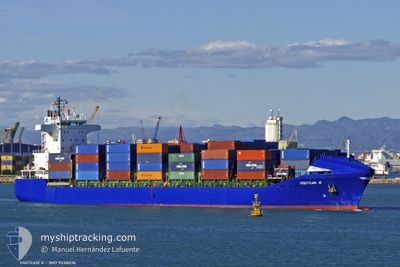
ONUR G A
Container Ship

Current Trip
| Time Travelled | 21 h, 45 mins |
|---|---|
| Remaining Time | 8 h, 0 mins |
| Distance Travelled | 247.32 nm |
| Remaining Distance | 107.44 nm |
| AVG Speed | 10.9 Knots |
| MAX Speed | 13.7 Knots |
| AVG Wind | 5.3 knots |
| MAX Wind | 12.7 knots |
| MIN Temp | 13.1°C / 55.58°F |
| MAX Temp | 16.6°C / 61.88°F |
| Dybgang | 8.3 m |
| Position Modtaget | 53 m siden |
Current Position
| Longitude | --- |
|---|---|
| Latitude | --- |
| Status | Under way using engine |
| Fart | 12.8 Knots |
| Kurs | 49.3° |
| Område | Sea of Marmara |
| Station | T-AIS |
| Position Modtaget | 53 m siden |
Information
The current position of ONUR G A is in Sea of Marmara with coordinates 40.30438° / 26.58630° as reported on 2025-03-28 16:12 by AIS to our vessel tracker app. The vessel's current speed is 12.8 Knots and is heading at the port of AMBARLI. The estimated time of arrival as calculated by MyShipTracking vessel tracking app is 2025-03-29 04:05 LT
The vessel ONUR G A (IMO: 9238076, MMSI: 215424000) is a Container Ship that was built in 2001 ( 24 år gamle ). It's sailing under the flag of [MT] Malta.
In this page you can find informations about the vessels current position, last detected port calls, and current voyage information. If the vessels is not in coverage by AIS you will find the latest position.
The current position of ONUR G A is detected by our AIS receivers and we are not responsible for the reliability of the data. The last position was recorded while the vessel was in Coverage by the Ais receivers of our vessel tracking app.
The current draught of ONUR G A as reported by AIS is 8.3 meters
Weather
| Temperature | 12.6°C / 54.68°F |
|---|---|
| Wind Speed | 9 knots |
| Direction | 94° E |
| Pressure | 1003.3 hPa |
| Humidity | 93.8 % |
| Cloud Coverage | 100 % |


Featured Company
Last Port Calls
| Port | Arrival | Departure | Time In Port |
|---|---|---|---|
| 2025-03-26 08:24 | 2025-03-27 21:20 | 1 d | |
| 2025-03-16 01:14 | 2025-03-17 16:39 | 1 d | |
| 2025-03-14 00:40 | 2025-03-15 07:41 | 1 d | |
| 2025-03-09 00:43 | 2025-03-09 15:01 | 14 h | |
| 2025-03-05 09:00 | 2025-03-07 17:36 | 2 d | |
| 2025-02-22 05:27 | 2025-02-22 15:50 | 10 h | |
| 2025-02-18 17:57 | 2025-02-19 18:33 | 1 d | |
| 2025-02-16 15:57 | 2025-02-18 00:33 | 1 d | |
| 2025-02-12 18:24 | 2025-02-13 03:29 | 9 h | |
| 2025-02-12 10:36 | 2025-02-12 18:03 | 7 h |
Last Trips
| Origin | Departure | Destination | Arrival | Distance | |
|---|---|---|---|---|---|
| 2025-03-17 16:39 | 2025-03-26 08:24 | 777.36 nm | |||
| 2025-03-15 07:41 | 2025-03-16 01:14 | 244.15 nm | |||
| 2025-03-09 15:01 | 2025-03-14 00:40 | 623.86 nm | |||
| 2025-03-07 17:36 | 2025-03-09 00:43 | 357.31 nm | |||
| 2025-02-22 15:50 | 2025-03-05 09:00 | 671.06 nm | |||
| 2025-02-19 18:33 | 2025-02-22 05:27 | 450.11 nm | |||
| 2025-02-18 00:33 | 2025-02-18 17:57 | 245.94 nm | |||
| 2025-02-13 03:29 | 2025-02-16 15:57 | 665.68 nm | |||
| 2025-02-12 18:03 | 2025-02-12 18:24 | 0.60 nm | |||
| 2025-02-11 03:16 | 2025-02-12 10:36 | 371.99 nm |
Events
| Tid | Hændelsen | Detaljer | Position / Dest | Info |
|---|---|---|---|---|
| 2025-03-28 16:17 | Status er ændret | Default Under way using engine |
40.31573 / 26.60349
TR AMR
|
Fart: 12.8 kn Kurs: 49.3° |
| 2025-03-28 13:45 | Ændre havområde | Turkish part of the Sea of Marmara Turkish part of the Aegean Sea |
40.01919 / 26.18870
Sea of Marmara
|
Fart: 5.6 kn Kurs: 75.4° |
| 2025-03-28 12:59 | Status er ændret | Under way using engine Default |
39.97759 / 26.03235
TR AMR
|
Fart: 8.3 kn Kurs: 50° |
| 2025-03-28 12:22 | Status er ændret | Default Under way using engine |
39.91436 / 25.94185
TR AMR
|
Fart: 10.3 kn Kurs: 40.3° |
| 2025-03-28 12:00 | Ændre havområde | Turkish part of the Aegean Sea Greek part of the Aegean Sea |
39.86558 / 25.89293
Aegean Sea
|
Fart: 10.1 kn Kurs: 31.7° |
| 2025-03-28 11:10 | Ændre havområde | Greek part of the Aegean Sea Turkish part of the Aegean Sea |
39.73543 / 25.91883
Aegean Sea
|
Fart: 10.2 kn Kurs: 322.5° |
| 2025-03-28 11:07 | Ændre havområde | Turkish part of the Aegean Sea Greek part of the Aegean Sea |
39.72876 / 25.92519
Aegean Sea
|
Fart: 8.8 kn Kurs: 341.7° |
| 2025-03-28 03:43 | Status er ændret | Under way using engine Default |
38.44332 / 24.95956
TR AMR
|
Fart: 12.8 kn Kurs: 28° |
| 2025-03-28 03:34 | Status er ændret | Default Under way using engine |
38.41627 / 24.94002
TR AMR
|
Fart: 12.8 kn Kurs: 31.2° |
| 2025-03-28 03:27 | Status er ændret | Under way using engine Default |
38.39461 / 24.92444
TR AMR
|
Fart: 12.8 kn Kurs: 29° |