
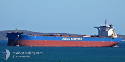
XIN FU HAI
Cargo
Current Trip
| Time Travelled | 16 days |
|---|---|
| Remaining Time | --- |
| Distance Travelled | 3438.09 nm |
| Remaining Distance | 420.58 nm |
| AVG Speed | 11 Noeuds |
| MAX Speed | 14.3 Noeuds |
| AVG Wind | 9.7 knots |
| MAX Wind | 26 knots |
| MIN Temp | 19.2°C / 66.56°F |
| MAX Temp | 30.6°C / 87.08°F |
| Tirant d eau | 18.4 m |
| Position reçue | 5 d depuis |
Current Position
| Longitude | 122.53108° |
|---|---|
| Latitude | 24.95598° |
| Etat | Under way using engine |
| Vitesse | 13.5 Noeuds |
| Parcours | 18.8° |
| Zone | Eastern China Sea |
| Station | T-AIS |
| Position reçue | 5 d depuis |
Info
Information
The current position of XIN FU HAI is in Eastern China Sea with coordinates 24.95598° / 122.53108° as reported on 2024-06-02 02:46 by AIS to our vessel tracker app. The vessel's current speed is 13.5 Noeuds and is heading at the port of QINGDAO. The estimated time of arrival as calculated by MyShipTracking vessel tracking app is 2024-06-05 02:00 LT
The vessel XIN FU HAI (IMO: 9738129, MMSI: 477915400) is a Cargo It's sailing under the flag of [HK] Hong Kong.
In this page you can find informations about the vessels current position, last detected port calls, and current voyage information. If the vessels is not in coverage by AIS you will find the latest position.
The current position of XIN FU HAI is detected by our AIS receivers and we are not responsible for the reliability of the data. The last position was recorded while the vessel was in Coverage by the Ais receivers of our vessel tracking app.
The current draught of XIN FU HAI as reported by AIS is 18.4 meters
Weather
| Temperature | 21.8°C / 71.24°F |
|---|---|
| Wind Speed | 5 knots |
| Direction | 131° SE |
| Pressure | 1009.6 hPa |
| Humidity | 80.2 % |
| Cloud Coverage | 99 % |
Featured Company
Last Port Calls
| Port | Arrival | Departure | Time In Port |
|---|---|---|---|
| 2024-05-19 05:53 | 2024-05-22 13:37 | 3 d | |
| 2024-05-02 16:00 | 2024-05-05 07:00 | 2 d |
Most Visited Ports (Last year)
| Port | Arrivals | |
|---|---|---|
| 6 | ||
| 2 | ||
| 2 | ||
| 1 | ||
| 1 | ||
| 1 |
Last Trips
| Origin | Departure | Destination | Arrival | Distance | |
|---|---|---|---|---|---|
| 2024-05-05 15:00 | 2024-05-19 13:53 | 3660.77 nm | |||
| 2024-03-21 07:50 | 2024-05-03 00:00 | 8364.72 nm |
Events
| Heure | Evenement | Détails | Position/ Destination | Info |
|---|---|---|---|---|
| 2024-06-06 08:45 | Arret | 7.67 nm, North West of CHANGSHU |
31.83007 / 120.84567
CN QDG
|
Vitesse: 0.1 kn Parcours: 335° |
| 2024-06-05 13:21 | Arret |
31.13328 / 122.84566
CN QDG
|
Vitesse: Parcours: 142° |
|
| 2024-06-05 00:12 | Démarrage | 7.23 nm, South West of ZHOUSHAN |
29.90509 / 122.08083
CN QDG
|
Vitesse: 5.5 kn Parcours: 30° |
| 2024-06-04 00:40 | Arret | 7.74 nm, South West of ZHOUSHAN |
29.89360 / 122.07769
CN QDG
|
Vitesse: 0.2 kn Parcours: 257° |
| 2024-06-03 19:07 | Démarrage |
29.73879 / 122.78199
CN QDG
|
Vitesse: 3.6 kn Parcours: 262° |
|
| 2024-06-03 07:21 | Arret |
29.73261 / 122.78426
CN QDG
|
Vitesse: Parcours: 11° |
|
| 2024-06-02 02:47 | Etat Changé | Default Under way using engine |
24.95951 / 122.53236
CN QDG
|
Vitesse: 13.5 kn Parcours: 18.8° |
| 2024-06-02 02:46 | Etat Changé | Under way using engine Default |
24.95598 / 122.53108
CN QDG
|
Vitesse: 13.6 kn Parcours: 20° |
| 2024-06-02 02:46 | Hors de la zone couverte |
24.95598 / 122.53108
Eastern China Sea
CN QDG
|
Vitesse: 13.5 kn Parcours: 18.8° |
|
| 2024-06-02 02:46 | Changement de zone | Taiwanese part of the Eastern China Sea Australian part of the Indian Ocean |
24.95598 / 122.53108
Eastern China Sea
CN QDG
|
Vitesse: 13.5 kn Parcours: 18.8° |