
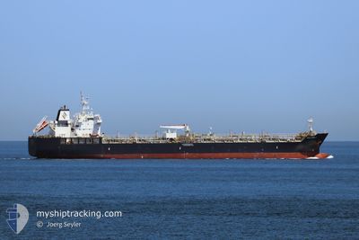
WILLARD J
Tanker
Current Trip
| Time Travelled | 4 days |
|---|---|
| Remaining Time | --- |
| Distance Travelled | 1390.53 nm |
| Remaining Distance | 317.80 nm |
| AVG Speed | 11.8 Noeuds |
| MAX Speed | 16.1 Noeuds |
| AVG Wind | 13.7 knots |
| MAX Wind | 22 knots |
| MIN Temp | 20.8°C / 69.44°F |
| MAX Temp | 26.6°C / 79.88°F |
| Tirant d eau | 7.2 m |
| Position reçue | 4 d depuis |
Current Position
| Longitude | --- |
|---|---|
| Latitude | --- |
| Etat | Under way using engine |
| Vitesse | 11.2 Noeuds |
| Parcours | 321.6° |
| Zone | Caribbean Sea |
| Station | T-AIS |
| Position reçue | 4 d depuis |
Info
Information
The current position of WILLARD J is in Caribbean Sea with coordinates 11.23657° / -74.95990° as reported on 2026-02-14 03:16 by AIS to our vessel tracker app. The vessel's current speed is 11.2 Noeuds and is heading at the port of HOUSTON. The estimated time of arrival as calculated by MyShipTracking vessel tracking app is 2026-02-18 17:00 LT
The vessel WILLARD J (IMO: 9749362, MMSI: 538006809) is a Tanker It's sailing under the flag of [MH] Marshall Is.
In this page you can find informations about the vessels current position, last detected port calls, and current voyage information. If the vessels is not in coverage by AIS you will find the latest position.
The current position of WILLARD J is detected by our AIS receivers and we are not responsible for the reliability of the data. The last position was recorded while the vessel was in Coverage by the Ais receivers of our vessel tracking app.
The current draught of WILLARD J as reported by AIS is 7.2 meters
Weather
| Temperature | 20.7°C / 69.26°F |
|---|---|
| Wind Speed | 9 knots |
| Direction | 196° SSW |
| Pressure | 1016.1 hPa |
| Humidity | 90.6 % |
| Cloud Coverage | 42 % |
Featured Company
Last Port Calls
| Port | Arrival | Departure | Time In Port |
|---|---|---|---|
| 2026-02-09 12:59 | 2026-02-13 20:52 | 4 d | |
| 2026-01-31 08:33 | 2026-02-02 12:19 | 2 d | |
| 2026-01-25 16:36 | 2026-01-26 12:45 | 20 h | |
| 2026-01-13 15:38 | 2026-01-14 22:52 | 1 d | |
| 2026-01-08 22:26 | 2026-01-10 16:36 | 1 d | |
| 2025-12-26 20:46 | 2025-12-28 00:50 | 1 d | |
| 2025-12-19 09:41 | 2025-12-20 10:10 | 1 d | |
| 2025-12-12 15:03 | 2025-12-12 19:07 | 4 h | |
| 2025-12-11 07:35 | 2025-12-12 14:55 | 1 d | |
| 2025-12-11 02:11 | 2025-12-11 07:10 | 4 h |
Most Visited Ports (Last year)
| Port | Arrivals | |
|---|---|---|
| 9 | ||
| 5 | ||
| 4 | ||
| 4 | ||
| 4 | ||
| 4 |
Last Trips
| Origin | Departure | Destination | Arrival | Distance | |
|---|---|---|---|---|---|
| 2026-02-02 12:19 | 2026-02-09 12:59 | 989.86 nm | |||
| 2026-01-26 12:45 | 2026-01-31 08:33 | 743.12 nm | |||
| 2026-01-14 22:52 | 2026-01-25 16:36 | 1924.44 nm | |||
| 2026-01-10 16:36 | 2026-01-13 15:38 | 56.00 nm | |||
| 2025-12-28 00:50 | 2026-01-08 22:26 | 2285.40 nm | |||
| 2025-12-20 10:10 | 2025-12-26 20:46 | 752.91 nm | |||
| 2025-12-12 19:07 | 2025-12-19 09:41 | 1571.65 nm | |||
| 2025-12-12 14:55 | 2025-12-12 15:03 | 1.59 nm | |||
| 2025-12-11 07:10 | 2025-12-11 07:35 | 2.83 nm | |||
| 2025-12-09 13:35 | 2025-12-11 02:11 | 428.83 nm |
Events
| Heure | Evenement | Détails | Position/ Destination | Info |
|---|---|---|---|---|
| 2026-02-14 03:29 | Etat Changé | Default Under way using engine |
11.27021 / -74.98392
CO BAQ >>> US HOU
|
Vitesse: 11.2 kn Parcours: 321.6° |
| 2026-02-14 03:16 | Hors de la zone couverte |
11.23657 / -74.95990
Caribbean Sea
CO BAQ >>> US HOU
|
Vitesse: 11.2 kn Parcours: 321.6° |
|
| 2026-02-14 01:52 | PORT DE DEPART |
|
11.03856 / -74.81305
CO BAQ >>> US HOU
|
Vitesse: 11.4 kn Parcours: 297° |
| 2026-02-14 01:17 | Démarrage |
10.97502 / -74.75634
[CO] BARRANQUILLA
|
Vitesse: 3.2 kn Parcours: 292° |
|
| 2026-02-14 01:15 | Etat Changé | Under way using engine Moored |
10.97536 / -74.75517
[CO] BARRANQUILLA
|
Vitesse: 0.3 kn Parcours: 165° |
| 2026-02-14 00:30 | Tirant d'eau modifié | 7.2 7 |
10.97577 / -74.75491
[CO] BARRANQUILLA
|
Vitesse: Parcours: 164° |
| 2026-02-14 00:30 | Changement de destination | CO BAQ >>> US HOU PA BLB >>>> CO BAQ |
10.97577 / -74.75491
[CO] BARRANQUILLA
|
Vitesse: Parcours: 164° |
| 2026-02-14 00:30 | Changement d'ETA | 2026/02/18 23:00 2026/02/09 18:00 |
10.97577 / -74.75491
[CO] BARRANQUILLA
|
Vitesse: Parcours: 164° |
| 2026-02-13 23:25 | Etat Changé | Moored Default |
10.97582 / -74.75489
[CO] BARRANQUILLA
|
Vitesse: Parcours: 164° |
| 2026-02-13 23:13 | Etat Changé | Default Moored |
10.97583 / -74.75490
[CO] BARRANQUILLA
|
Vitesse: Parcours: 164° |