

V BROS
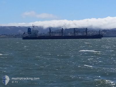
Bulk Carrier

Current Trip
EDMAK
| Time Travelled | 4 days |
|---|---|
| Remaining Time | --- |
| Distance Travelled | 720.37 nm |
| Remaining Distance | --- |
| AVG Speed | 11.8 Noeuds |
| MAX Speed | 15.3 Noeuds |
| AVG Wind | 11 knots |
| MAX Wind | 23.7 knots |
| MIN Temp | 11.5°C / 52.7°F |
| MAX Temp | 22.1°C / 71.78°F |
| Tirant d eau | 9.5 m |
| Position reçue | 1 d depuis |
Current Position
| Longitude | --- |
|---|---|
| Latitude | --- |
| Etat | Under way using engine |
| Vitesse | 11.8 Noeuds |
| Parcours | 235.5° |
| Zone | Eastern China Sea |
| Station | T-AIS |
| Position reçue | 1 d depuis |
Information
The current position of V BROS is in Eastern China Sea with coordinates 30.21929° / 129.26246° as reported on 2025-03-25 04:34 by AIS to our vessel tracker app. The vessel's current speed is 11.8 Noeuds
The vessel V BROS (IMO: 9474204, MMSI: 538010087) is a Bulk Carrier that was built in 2010 ( 15 Age ). It's sailing under the flag of [MH] Marshall Is.
In this page you can find informations about the vessels current position, last detected port calls, and current voyage information. If the vessels is not in coverage by AIS you will find the latest position.
The current position of V BROS is detected by our AIS receivers and we are not responsible for the reliability of the data. The last position was recorded while the vessel was in Coverage by the Ais receivers of our vessel tracking app.
The current draught of V BROS as reported by AIS is 9.5 meters
Weather
| Temperature | 21.4°C / 70.52°F |
|---|---|
| Wind Speed | 13 knots |
| Direction | 190° S |
| Pressure | 1008.5 hPa |
| Humidity | 96.3 % |
| Cloud Coverage | --- |


Featured Company
Events
| Heure | Evenement | Détails | Position/ Destination | Info |
|---|---|---|---|---|
| 2025-03-25 04:41 | Etat Changé | Default Under way using engine |
30.20632 / 129.24025
EDMAK
|
Vitesse: 11.8 kn Parcours: 235.5° |
| 2025-03-25 04:34 | Hors de la zone couverte |
30.21929 / 129.26246
Eastern China Sea
|
Vitesse: 11.8 kn Parcours: 235.5° |
|
| 2025-03-25 04:28 | Etat Changé | Under way using engine Default |
30.23072 / 129.28193
EDMAK
|
Vitesse: 11.8 kn Parcours: 236° |
| 2025-03-25 04:25 | Etat Changé | Default Under way using engine |
30.23597 / 129.29077
EDMAK
|
Vitesse: 11.8 kn Parcours: 234.2° |
| 2025-03-25 04:01 | Detecté en mer | Japanese part of the Eastern China Sea |
30.28173 / 129.36471
Eastern China Sea
|
Vitesse: 11.7 kn Parcours: 233.9° |
| 2025-03-25 04:01 | Etat Changé | Under way using engine Default |
30.28173 / 129.36471
EDMAK
|
Vitesse: 11.7 kn Parcours: 234° |
| 2025-03-25 03:42 | Dans la zone couverte |
30.28173 / 129.36471
Eastern China Sea
|
Vitesse: 11.7 kn Parcours: 233.9° |
|
| 2025-03-21 21:10 | PORT DE DEPART |
|
34.41672 / 133.44717
EDMAK
|
Vitesse: 12.3 kn Parcours: 180° |
| 2025-03-21 20:50 | Démarrage |
34.46603 / 133.44853
[JP] FUKUYAMA
|
Vitesse: 5.2 kn Parcours: 180° |
|
| 2025-03-18 21:58 | Arret |
34.46791 / 133.44606
[JP] FUKUYAMA
|
Vitesse: Parcours: 3° |