

V BROS
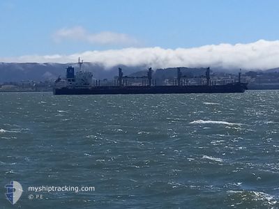
Bulk Carrier

Current Trip
EDMAK
| Time Travelled | 2 days |
|---|---|
| Remaining Time | --- |
| Distance Travelled | 261.30 nm |
| Remaining Distance | --- |
| AVG Speed | 11.7 Knots |
| MAX Speed | 15.3 Knots |
| AVG Wind | 10.2 knots |
| MAX Wind | 23.7 knots |
| MIN Temp | 11.5°C / 52.7°F |
| MAX Temp | 20°C / 68°F |
| Draught | 9.5 m |
| Position Received | 2024-12-24 10:03 |
Current Position
| Longitude | --- |
|---|---|
| Latitude | --- |
| Status | Under way using engine |
| Speed | 11.2 Knots |
| Course | 11.4° |
| Area | Indian Ocean |
| Station | T-AIS |
| Position Received | 2024-12-24 10:03 |
Information
The current position of V BROS is in Indian Ocean with coordinates -17.91535° / 113.82909° as reported on 2024-12-24 10:03 by AIS to our vessel tracker app. The vessel's current speed is 11.2 Knots
The vessel V BROS (IMO: 9474204, MMSI: 538010087) is a Bulk Carrier that was built in 2010 ( 15 years old ). It's sailing under the flag of [MH] Marshall Is.
In this page you can find informations about the vessels current position, last detected port calls, and current voyage information. If the vessels is not in coverage by AIS you will find the latest position.
The current position of V BROS is detected by our AIS receivers and we are not responsible for the reliability of the data. The last position was recorded while the vessel was in Coverage by the Ais receivers of our vessel tracking app.
The current draught of V BROS as reported by AIS is 9.5 meters
Weather
| Temperature | 18.3°C / 64.94°F |
|---|---|
| Wind Speed | 14 knots |
| Direction | 238° WSW |
| Pressure | 1012.3 hPa |
| Humidity | 65.2 % |
| Cloud Coverage | 100 % |


Featured Company
Events
| Time | Event | Details | Position / Dest | Info |
|---|---|---|---|---|
| 2025-03-21 21:10 | PORT DEPARTURE |
|
34.41672 / 133.44717
EDMAK
|
Speed: 12.3 kn Course: 180° |
| 2025-03-21 20:50 | START Moving |
34.46603 / 133.44853
[JP] FUKUYAMA
|
Speed: 5.2 kn Course: 180° |
|
| 2025-03-18 21:58 | STOP Moving |
34.46791 / 133.44606
[JP] FUKUYAMA
|
Speed: Course: 3° |
|
| 2025-03-18 21:18 | PORT ARRIVAL |
|
34.43584 / 133.44774
[JP] FUKUYAMA
|
Speed: 7.3 kn Course: 1° |
| 2025-03-18 20:58 | START Moving | 2.07 nm, South of FUKUYAMA |
34.39425 / 133.44315
EDMAK
|
Speed: 6.1 kn Course: 53° |
| 2025-03-17 00:33 | STOP Moving | 2.26 nm, South of FUKUYAMA |
34.39122 / 133.44058
EDMAK
|
Speed: 0.2 kn Course: 253° |
| 2025-03-14 09:38 | START Moving |
34.61836 / 130.17809
EDMAK
|
Speed: 6.1 kn Course: 67° |