
SWAN RIVER BRIDGE
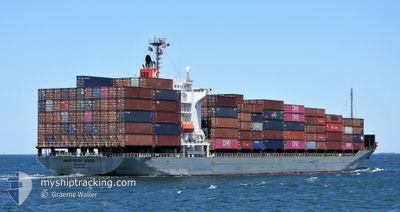
Container Ship
Current Trip
| Time Travelled | 1 day |
|---|---|
| Remaining Time | --- |
| Distance Travelled | 372.77 nm |
| Remaining Distance | 77.89 nm |
| AVG Speed | 12.3 Noeuds |
| MAX Speed | 19.5 Noeuds |
| AVG Wind | 17.1 knots |
| MAX Wind | 26.8 knots |
| MIN Temp | 16.4°C / 61.52°F |
| MAX Temp | 22.5°C / 72.5°F |
| Tirant d eau | 7.7 m |
| Position reçue | 1 d depuis |
Current Position
| Longitude | 134.31997° |
|---|---|
| Latitude | 33.29847° |
| Etat | Under way using engine |
| Vitesse | 10.5 Noeuds |
| Parcours | 218° |
| Zone | Philippine Sea |
| Station | T-AIS |
| Position reçue | 1 d depuis |
Info
Information
The current position of SWAN RIVER BRIDGE is in Philippine Sea with coordinates 33.29847° / 134.31997° as reported on 2024-05-05 11:20 by AIS to our vessel tracker app. The vessel's current speed is 10.5 Noeuds and is heading at the port of BUSAN. The estimated time of arrival as calculated by MyShipTracking vessel tracking app is 2024-05-06 22:00 LT
The vessel SWAN RIVER BRIDGE (IMO: 9550395, MMSI: 565156000) is a Container Ship that was built in 2010 ( 14 Age ). It's sailing under the flag of [SG] Singapore.
In this page you can find informations about the vessels current position, last detected port calls, and current voyage information. If the vessels is not in coverage by AIS you will find the latest position.
The current position of SWAN RIVER BRIDGE is detected by our AIS receivers and we are not responsible for the reliability of the data. The last position was recorded while the vessel was in Coverage by the Ais receivers of our vessel tracking app.
The current draught of SWAN RIVER BRIDGE as reported by AIS is 7.7 meters
Weather
| Temperature | 17.5°C / 63.5°F |
|---|---|
| Wind Speed | 16 knots |
| Direction | 232° SW |
| Pressure | 1011.4 hPa |
| Humidity | 83.1 % |
| Cloud Coverage | 100 % |
Featured Company
Last Port Calls
| Port | Arrival | Departure | Time In Port |
|---|---|---|---|
| 2024-05-03 22:51 | 2024-05-05 02:58 | 1 d | |
| 2024-05-02 22:04 | 2024-05-03 06:29 | 8 h | |
| 2024-05-02 07:59 | 2024-05-02 12:30 | 4 h | |
| 2024-05-01 08:40 | 2024-05-01 20:18 | 11 h | |
| 2024-04-29 01:45 | 2024-04-29 09:00 | 7 h | |
| 2024-04-26 07:49 | 2024-04-26 15:06 | 7 h | |
| 2024-04-22 17:51 | 2024-04-24 03:37 | 1 d | |
| 2024-04-19 08:03 | 2024-04-19 16:20 | 8 h | |
| 2024-04-18 00:16 | 2024-04-18 11:39 | 11 h | |
| 2024-04-15 05:37 | 2024-04-15 17:43 | 12 h |
Last Trips
| Origin | Departure | Destination | Arrival | Distance | |
|---|---|---|---|---|---|
| 2024-05-03 15:29 | 2024-05-04 07:51 | 237.33 nm | |||
| 2024-05-02 21:30 | 2024-05-03 07:04 | 127.53 nm | |||
| 2024-05-02 05:18 | 2024-05-02 16:59 | 126.32 nm | |||
| 2024-04-29 18:00 | 2024-05-01 17:40 | 612.20 nm | |||
| 2024-04-26 23:06 | 2024-04-29 10:45 | 917.83 nm | |||
| 2024-04-24 10:37 | 2024-04-26 15:49 | 804.93 nm | |||
| 2024-04-20 00:20 | 2024-04-23 00:51 | 803.25 nm | |||
| 2024-04-18 19:39 | 2024-04-19 16:03 | 226.49 nm | |||
| 2024-04-16 02:43 | 2024-04-18 08:16 | 713.88 nm | |||
| 2024-04-14 01:44 | 2024-04-15 14:37 | 463.60 nm |
Events
| Heure | Evenement | Détails | Position/ Destination | Info |
|---|---|---|---|---|
| 2024-05-05 11:31 | Etat Changé | Default Under way using engine |
33.27250 / 134.29509
KR PUS
|
Vitesse: 10.5 kn Parcours: 218° |
| 2024-05-05 11:20 | Etat Changé | Under way using engine Default |
33.29847 / 134.31997
KR PUS
|
Vitesse: 10.5 kn Parcours: 219° |
| 2024-05-05 11:20 | Hors de la zone couverte |
33.29847 / 134.31997
Philippine Sea
KR PUS
|
Vitesse: 10.5 kn Parcours: 218° |
|
| 2024-05-05 11:03 | Dans la zone couverte |
33.29847 / 134.31997
Philippine Sea
KR PUS
|
Vitesse: 10.5 kn Parcours: 218° |
|
| 2024-05-05 09:07 | Etat Changé | Default Under way using engine |
33.60200 / 134.63055
KR PUS
|
Vitesse: 10.5 kn Parcours: 219° |
| 2024-05-05 09:04 | Etat Changé | Under way using engine Default |
33.60883 / 134.63728
KR PUS
|
Vitesse: 10.5 kn Parcours: 219° |
| 2024-05-05 09:04 | Hors de la zone couverte |
33.60883 / 134.63728
Philippine Sea
KR PUS
|
Vitesse: 10.5 kn Parcours: 219° |
|
| 2024-05-05 08:36 | Etat Changé | Default Under way using engine |
33.67290 / 134.69978
KR PUS
|
Vitesse: 10.7 kn Parcours: 218° |
| 2024-05-05 08:29 | Etat Changé | Under way using engine Default |
33.68835 / 134.71487
KR PUS
|
Vitesse: 10.7 kn Parcours: 219° |
| 2024-05-05 08:23 | Etat Changé | Default Under way using engine |
33.70273 / 134.72871
KR PUS
|
Vitesse: 10.4 kn Parcours: 219° |