
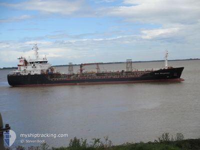
STOLT KINGFISHER
Oil/Chemical Tanker
Current Trip
| Time Travelled | 2 days |
|---|---|
| Remaining Time | --- |
| Distance Travelled | 667.79 nm |
| Remaining Distance | 52.82 nm |
| AVG Speed | 12.1 Noeuds |
| MAX Speed | 15.8 Noeuds |
| AVG Wind | 10.5 knots |
| MAX Wind | 18 knots |
| MIN Temp | 7.9°C / 46.22°F |
| MAX Temp | 12.2°C / 53.96°F |
| Tirant d eau | 5.5 m |
| Position reçue | 6 m depuis |
Current Position
| Longitude | 2.56155° |
|---|---|
| Latitude | 51.33082° |
| Etat | At anchor |
| Vitesse | |
| Parcours | 208° |
| Zone | North Sea |
| Station | T-AIS |
| Position reçue | 6 m depuis |
Info
Information
The current position of STOLT KINGFISHER is in North Sea with coordinates 51.33082° / 2.56155° as reported on 2024-04-30 05:17 by AIS to our vessel tracker app. The vessel's current speed is 0 Noeuds and is heading at the port of SLUISKIL. The estimated time of arrival as calculated by MyShipTracking vessel tracking app is 2024-04-29 15:30 LT
The vessel STOLT KINGFISHER (IMO: 9154323, MMSI: 235087256) is a Oil/Chemical Tanker that was built in 1998 ( 26 Age ). It's sailing under the flag of [GB] United Kingdom.
In this page you can find informations about the vessels current position, last detected port calls, and current voyage information. If the vessels is not in coverage by AIS you will find the latest position.
The current position of STOLT KINGFISHER is detected by our AIS receivers and we are not responsible for the reliability of the data. The last position was recorded while the vessel was in Coverage by the Ais receivers of our vessel tracking app.
The current draught of STOLT KINGFISHER as reported by AIS is 5.5 meters
Weather
| Temperature | 11°C / 51.8°F |
|---|---|
| Wind Speed | 9 knots |
| Direction | 158° SSE |
| Pressure | 1014.9 hPa |
| Humidity | 81.5 % |
| Cloud Coverage | 100 % |
Featured Company
Last Port Calls
| Port | Arrival | Departure | Time In Port |
|---|---|---|---|
| 2024-04-26 21:22 | 2024-04-27 13:06 | 15 h | |
| 2024-04-26 11:08 | 2024-04-26 11:57 | 48 m | |
| 2024-04-25 13:11 | 2024-04-26 10:38 | 21 h | |
| 2024-04-25 12:14 | 2024-04-25 12:49 | 35 m | |
| 2024-04-23 05:00 | 2024-04-25 09:38 | 2 d | |
| 2024-04-21 19:38 | 2024-04-22 14:24 | 18 h | |
| 2024-04-21 13:34 | 2024-04-21 17:18 | 3 h | |
| 2024-04-18 14:37 | 2024-04-19 06:24 | 15 h | |
| 2024-04-15 08:07 | 2024-04-16 08:42 | 1 d | |
| 2024-04-13 22:36 | 2024-04-14 21:01 | 22 h |
Most Visited Ports (Last year)
| Port | Arrivals | |
|---|---|---|
| 18 | ||
| 10 | ||
| 9 | ||
| 7 | ||
| 7 | ||
| 5 |
Last Trips
| Origin | Departure | Destination | Arrival | Distance | |
|---|---|---|---|---|---|
| 2024-04-26 12:57 | 2024-04-26 22:22 | 116.15 nm | |||
| 2024-04-26 11:38 | 2024-04-26 12:08 | 1.89 nm | |||
| 2024-04-25 13:49 | 2024-04-25 14:11 | 1.46 nm | |||
| 2024-04-22 15:24 | 2024-04-25 13:14 | 175.20 nm | |||
| 2024-04-22 15:24 | 2024-04-23 06:00 | 140.40 nm | |||
| 2024-04-19 08:24 | 2024-04-21 20:38 | 716.00 nm | |||
| 2024-04-19 08:24 | 2024-04-21 14:34 | 695.35 nm | |||
| 2024-04-16 09:42 | 2024-04-18 16:37 | 304.71 nm | |||
| 2024-04-14 22:01 | 2024-04-15 09:07 | 117.93 nm | |||
| 2024-04-13 06:43 | 2024-04-13 23:36 | 219.46 nm |
Events
| Heure | Evenement | Détails | Position/ Destination | Info |
|---|---|---|---|---|
| 2024-04-30 04:50 | Etat Changé | At anchor Default |
51.33087 / 2.56152
IMPEL>NLSLU
|
Vitesse: Parcours: 213° |
| 2024-04-30 04:44 | Etat Changé | Default At anchor |
51.33080 / 2.56155
IMPEL>NLSLU
|
Vitesse: Parcours: 214° |
| 2024-04-29 22:56 | Etat Changé | At anchor Default |
51.32973 / 2.55856
IMPEL>NLSLU
|
Vitesse: 0.1 kn Parcours: 64° |
| 2024-04-29 22:50 | Etat Changé | Default At anchor |
51.32972 / 2.55852
IMPEL>NLSLU
|
Vitesse: Parcours: 71° |
| 2024-04-29 16:02 | Arret | 13.81 nm, North West of NIEUWPOORT |
51.33085 / 2.56164
IMPEL>NLSLU
|
Vitesse: 0.1 kn Parcours: 225° |
| 2024-04-29 15:57 | Etat Changé | At anchor Under way using engine |
51.33068 / 2.56129
IMPEL>NLSLU
|
Vitesse: 0.5 kn Parcours: 219° |
| 2024-04-29 14:44 | Detecté en mer | Belgian part of the North Sea |
51.32386 / 2.36890
North Sea
IMPEL>NLSLU
|
Vitesse: 15.8 kn Parcours: 58.2° |
| 2024-04-29 14:38 | Etat Changé | Under way using engine Default |
51.31140 / 2.33661
IMPEL>NLSLU
|
Vitesse: 15.4 kn Parcours: 59° |
| 2024-04-29 14:36 | Etat Changé | Default Under way using engine |
51.30690 / 2.32485
IMPEL>NLSLU
|
Vitesse: 15.7 kn Parcours: 59.2° |
| 2024-04-29 12:20 | Changement de zone | French part of the North Sea French part of the English Channel |
51.01045 / 1.62128
North Sea
IMPEL>NLSLU
|
Vitesse: 13.2 kn Parcours: 38.5° |