
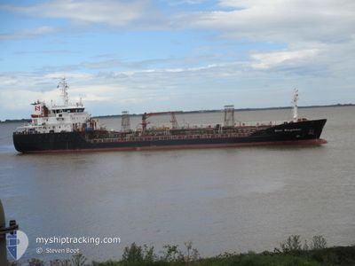
STOLT KINGFISHER
Oil/Chemical Tanker
Current Trip
| Time Travelled | 4 days |
|---|---|
| Remaining Time | --- |
| Distance Travelled | 1078.80 nm |
| Remaining Distance | --- |
| AVG Speed | 11.3 Knopen |
| MAX Speed | 15.6 Knopen |
| AVG Wind | 12.6 knots |
| MAX Wind | 29.7 knots |
| MIN Temp | 4.8°C / 40.64°F |
| MAX Temp | 18.3°C / 64.94°F |
| Diepgang | 6.8 M |
| Positie ontvangen | 13 h, 56 m geleden |
Current Position
| Lengtegraad | --- |
|---|---|
| Breedtegraat | --- |
| Status | Under way using engine |
| Snelheid | 12.8 Knopen |
| Koers | 38.7° |
| Gebied | North Atlantic Ocean |
| Station | T-AIS |
| Positie ontvangen | 13 h, 56 m geleden |
Info
Information
The current position of STOLT KINGFISHER is in North Atlantic Ocean with coordinates 38.46803° / -8.95281° as reported on 2025-12-06 14:21 by AIS to our vessel tracker app. The vessel's current speed is 12.8 Knopen and is heading at the port of SETUBAL. The estimated time of arrival as calculated by MyShipTracking vessel tracking app is 2025-12-06 14:00 LT
The vessel STOLT KINGFISHER (IMO: 9154323, MMSI: 235087256) is a Oil/Chemical Tanker that was built in 1998 ( 27 Jaar oud ). It's sailing under the flag of [GB] United Kingdom.
In this page you can find informations about the vessels current position, last detected port calls, and current voyage information. If the vessels is not in coverage by AIS you will find the latest position.
The current position of STOLT KINGFISHER is detected by our AIS receivers and we are not responsible for the reliability of the data. The last position was recorded while the vessel was in Coverage by the Ais receivers of our vessel tracking app.
The current draught of STOLT KINGFISHER as reported by AIS is 6.8 meters
Weather
| Temperature | 15.9°C / 60.62°F |
|---|---|
| Wind Speed | 5 knots |
| Direction | 200° SSW |
| Pressure | 1022.8 hPa |
| Humidity | 79.8 % |
| Cloud Coverage | 100 % |
Featured Company
Last Port Calls
| Port | Arrival | Departure | Time In Port |
|---|---|---|---|
| 2025-12-02 07:23 | 2025-12-02 08:05 | 42 m | |
| 2025-12-02 06:39 | 2025-12-02 07:00 | 20 m | |
| 2025-12-01 10:56 | 2025-12-02 05:46 | 18 h | |
| 2025-12-01 09:46 | 2025-12-01 10:08 | 22 m | |
| 2025-12-01 08:49 | 2025-12-01 09:24 | 35 m | |
| 2025-11-30 10:34 | 2025-12-01 05:43 | 19 h | |
| 2025-11-27 22:08 | 2025-11-29 11:24 | 1 d | |
| 2025-11-23 21:49 | 2025-11-25 20:48 | 1 d | |
| 2025-11-20 11:55 | 2025-11-21 05:24 | 17 h | |
| 2025-11-18 08:34 | 2025-11-18 09:15 | 40 m |
Most Visited Ports (Last year)
| Port | Arrivals | |
|---|---|---|
| 18 | ||
| 12 | ||
| 11 | ||
| 10 | ||
| 8 | ||
| 8 |
Last Trips
| Origin | Departure | Destination | Arrival | Distance | |
|---|---|---|---|---|---|
| 2025-12-02 07:00 | 2025-12-02 07:23 | 1.89 nm | |||
| 2025-12-02 05:46 | 2025-12-02 06:39 | 4.49 nm | |||
| 2025-12-01 10:08 | 2025-12-01 10:56 | 4.02 nm | |||
| 2025-12-01 09:24 | 2025-12-01 09:46 | 1.90 nm | |||
| 2025-11-29 11:24 | 2025-12-01 08:49 | 305.50 nm | |||
| 2025-11-29 11:24 | 2025-11-30 10:34 | 274.92 nm | |||
| 2025-11-25 20:48 | 2025-11-27 22:08 | 578.45 nm | |||
| 2025-11-21 05:24 | 2025-11-23 21:49 | 715.70 nm | |||
| 2025-11-18 09:15 | 2025-11-20 11:55 | 675.63 nm | |||
| 2025-11-18 08:08 | 2025-11-18 08:34 | 1.32 nm |
Events
| Tijd | Evenement | Details | Positie / Bestemming | Info |
|---|---|---|---|---|
| 2025-12-06 15:07 | Stop beweging | 2.75 nm, South of SETUBAL |
38.46186 / -8.83989
PTSET
|
Snelheid: 0.1 kn Koers: 280° |
| 2025-12-06 14:27 | Status Changed | Default Under way using engine |
38.48337 / -8.93623
PTSET
|
Snelheid: 12.8 kn Koers: 38.7° |
| 2025-12-06 14:21 | Status Changed | Under way using engine Default |
38.46803 / -8.95281
PTSET
|
Snelheid: 12.5 kn Koers: 41° |
| 2025-12-06 14:21 | Buitenbereik |
38.46803 / -8.95281
North Atlantic Ocean
PTSET
|
Snelheid: 12.8 kn Koers: 38.7° |
|
| 2025-12-06 14:11 | Status Changed | Default Under way using engine |
38.44245 / -8.98068
PTSET
|
Snelheid: 12.9 kn Koers: 39.5° |
| 2025-12-06 13:53 | Status Changed | Under way using engine Default |
38.40460 / -9.02213
PTSET
|
Snelheid: 5.2 kn Koers: 45° |
| 2025-12-06 13:47 | Status Changed | Default Under way using engine |
38.39930 / -9.03070
PTSET
|
Snelheid: 6 kn Koers: 63.1° |
| 2025-12-06 09:40 | Status Changed | Under way using engine Default |
38.53625 / -10.06754
PTSET
|
Snelheid: 13.7 kn Koers: 96° |
| 2025-12-06 09:25 | Status Changed | Default Under way using engine |
38.52654 / -10.13383
PTSET
|
Snelheid: 12.4 kn Koers: 124.9° |
| 2025-12-06 09:19 | Status Changed | Under way using engine Default |
38.53767 / -10.15162
PTSET
|
Snelheid: 13.4 kn Koers: 168° |