
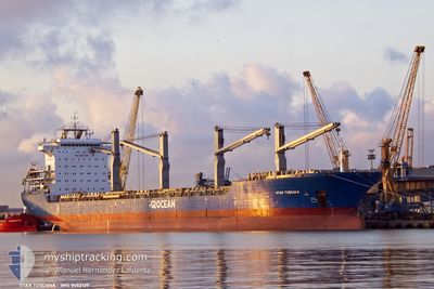
STAR TOSCANA
General Cargo
Current Trip
| Time Travelled | 7 days |
|---|---|
| Remaining Time | --- |
| Distance Travelled | 2173.61 nm |
| Remaining Distance | --- |
| AVG Speed | 11.7 Noeuds |
| MAX Speed | 15.2 Noeuds |
| AVG Wind | 10.8 knots |
| MAX Wind | 20.9 knots |
| MIN Temp | 24.4°C / 75.92°F |
| MAX Temp | 29°C / 84.2°F |
| Tirant d eau | 6.9 m |
| Position reçue | Maintenant |
Current Position
| Longitude | -60.86844° |
|---|---|
| Latitude | 14.20419° |
| Etat | Under way using engine |
| Vitesse | 10.6 Noeuds |
| Parcours | 116.9° |
| Zone | Caribbean Sea |
| Station | T-AIS |
| Position reçue | Maintenant |
Info
Information
The current position of STAR TOSCANA is in Caribbean Sea with coordinates 14.20419° / -60.86844° as reported on 2024-05-15 19:45 by AIS to our vessel tracker app. The vessel's current speed is 10.6 Noeuds and is heading at the port of PORTOCEL. The estimated time of arrival as calculated by MyShipTracking vessel tracking app is 2024-05-26 16:00 LT
The vessel STAR TOSCANA (IMO: 9452139, MMSI: 538008385) is a General Cargo that was built in 2012 ( 12 Age ). It's sailing under the flag of [MH] Marshall Is.
In this page you can find informations about the vessels current position, last detected port calls, and current voyage information. If the vessels is not in coverage by AIS you will find the latest position.
The current position of STAR TOSCANA is detected by our AIS receivers and we are not responsible for the reliability of the data. The last position was recorded while the vessel was in Coverage by the Ais receivers of our vessel tracking app.
The current draught of STAR TOSCANA as reported by AIS is 6.9 meters
Weather
| Temperature | 28.4°C / 83.12°F |
|---|---|
| Wind Speed | 12 knots |
| Direction | 84° E |
| Pressure | 1012.5 hPa |
| Humidity | 75.1 % |
| Cloud Coverage | 15 % |
Featured Company
Last Port Calls
| Port | Arrival | Departure | Time In Port |
|---|---|---|---|
| 2024-05-01 03:50 | 2024-05-08 07:29 | 7 d | |
| 2024-03-04 07:23 |
Last Trips
| Origin | Departure | Destination | Arrival | Distance | |
|---|---|---|---|---|---|
| 2024-03-04 08:23 | 2024-04-30 22:50 | 5950.13 nm |
Events
| Heure | Evenement | Détails | Position/ Destination | Info |
|---|---|---|---|---|
| 2024-05-15 18:52 | Detecté en mer | Saint Lucia part of the Caribbean Sea |
14.26844 / -61.01499
Caribbean Sea
BRPCL
|
Vitesse: 10.8 kn Parcours: 115° |
| 2024-05-15 18:38 | Tirant d'eau modifié | 6.9 6 |
14.28650 / -61.05397
BRPCL
|
Vitesse: 10.6 kn Parcours: 116° |
| 2024-05-15 18:38 | Changement d'ETA | 2024/05/26 16:00 |
14.28650 / -61.05397
BRPCL
|
Vitesse: 10.6 kn Parcours: 116° |
| 2024-05-15 18:32 | Tirant d'eau modifié | 6 6.9 |
14.29410 / -61.07088
BRPCL
|
Vitesse: 10.7 kn Parcours: 116° |
| 2024-05-15 14:26 | Etat Changé | Under way using engine Default |
14.61955 / -61.75494
BRPCL
|
Vitesse: 11 kn Parcours: 113° |
| 2024-05-15 14:21 | Etat Changé | Default Under way using engine |
14.62500 / -61.76833
BRPCL
|
Vitesse: 11 kn Parcours: 113.7° |
| 2024-05-15 14:12 | Detecté en mer | Guadeloupe and Martinique part of the Caribbean Sea |
14.63693 / -61.79580
Caribbean Sea
BRPCL
|
Vitesse: 11.1 kn Parcours: 113.9° |
| 2024-05-15 14:12 | Etat Changé | Under way using engine Default |
14.63760 / -61.79731
BRPCL
|
Vitesse: 11.1 kn Parcours: 114° |
| 2024-05-15 13:56 | Dans la zone couverte |
14.63693 / -61.79580
Caribbean Sea
BRPCL
|
Vitesse: 11.1 kn Parcours: 113.9° |
|
| 2024-05-14 16:24 | Démarrage |
16.45202 / -65.85143
BRPCL
|
Vitesse: 12 kn Parcours: 113° |