
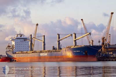
STAR TOSCANA
General Cargo
Current Trip
| Trip Time | 4 days |
|---|---|
| Trip Distance | 344.51 nm |
| AVG Speed | 9.9 Knots |
| MAX Speed | 13.3 Knots |
| Dybgang | 6.8 m |
| AVG Wind | 13.3 knots |
| MAX Wind | 22 knots |
| MIN Temp | 16.1°C / 60.98°F |
| MAX Temp | 22.8°C / 73.04°F |
| Position Modtaget | 6 d siden |
Current Position
| Longitude | --- |
|---|---|
| Latitude | --- |
| Status | Under way using engine |
| Fart | 12 Knots |
| Kurs | 214.9° |
| Område | South Atlantic Ocean |
| Station | T-AIS |
| Position Modtaget | 6 d siden |
Info
Information
The current position of STAR TOSCANA is in South Atlantic Ocean with coordinates -28.79113° / -48.70876° as reported on 2024-12-05 01:59 by AIS to our vessel tracker app. The vessel's current speed is 12 Knots and is currently inside the port of RIO GRANDE.
The vessel STAR TOSCANA (IMO: 9452139, MMSI: 538008385) is a General Cargo that was built in 2012 ( 12 år gamle ). It's sailing under the flag of [MH] Marshall Is.
In this page you can find informations about the vessels current position, last detected port calls, and current voyage information. If the vessels is not in coverage by AIS you will find the latest position.
The current position of STAR TOSCANA is detected by our AIS receivers and we are not responsible for the reliability of the data. The last position was recorded while the vessel was in Coverage by the Ais receivers of our vessel tracking app.
The current draught of STAR TOSCANA as reported by AIS is 6.8 meters
Weather
| Temperature | 19.9°C / 67.82°F |
|---|---|
| Wind Speed | 12 knots |
| Direction | 61° ENE |
| Pressure | 1016.5 hPa |
| Humidity | 74.4 % |
| Cloud Coverage | --- |
Featured Company
Last Port Calls
| Port | Arrival | Departure | Time In Port |
|---|---|---|---|
| 2024-12-08 20:08 | |||
| 2024-12-01 02:59 | 2024-12-04 18:57 | 3 d | |
| 2024-11-22 06:45 | 2024-11-26 05:47 | 3 d | |
| 2024-10-28 17:01 | 2024-11-07 00:47 | 9 d | |
| 2024-10-20 03:12 | 2024-10-22 22:36 | 2 d | |
| 2024-10-17 10:34 | 2024-10-18 19:47 | 1 d | |
| 2024-10-14 01:54 | 2024-10-14 20:00 | 18 h |
Most Visited Ports (Last year)
| Port | Arrivals | |
|---|---|---|
| 5 | ||
| 3 | ||
| 2 | ||
| 2 | ||
| 2 | ||
| 2 |
Last Trips
| Origin | Departure | Destination | Arrival | Distance | |
|---|---|---|---|---|---|
| 2024-12-04 18:57 | 2024-12-08 20:08 | 344.51 nm | |||
| 2024-11-26 05:47 | 2024-12-01 02:59 | 1516.74 nm | |||
| 2024-11-07 00:47 | 2024-11-22 06:45 | 3845.70 nm | |||
| 2024-10-22 22:36 | 2024-10-28 17:01 | 1133.69 nm | |||
| 2024-10-18 19:47 | 2024-10-20 03:12 | 327.15 nm | |||
| 2024-10-14 20:00 | 2024-10-17 10:34 | 664.76 nm | |||
| 2024-09-27 04:34 | 2024-10-14 01:54 | 4592.92 nm |
Events
| Tid | Hændelsen | Detaljer | Position / Dest | Info |
|---|---|---|---|---|
| 2024-12-08 23:16 | STOP Sejllads |
-32.03782 / -52.07587
[BR] RIO GRANDE
|
Fart: 0.2 kn Kurs: 345° |
|
| 2024-12-08 23:08 | Skibe i havn |
|
-32.03769 / -52.07527
[BR] RIO GRANDE
|
Fart: 1.8 kn Kurs: 342° |
| 2024-12-08 21:52 | START Sejllads | 1.96 nm, East of RIO GRANDE |
-32.01906 / -52.04866
BRRIG
|
Fart: 4.1 kn Kurs: 162° |
| 2024-12-06 03:11 | STOP Sejllads | 2.04 nm, East of RIO GRANDE |
-32.01636 / -52.04794
BRRIG
|
Fart: Kurs: 331° |
| 2024-12-05 02:05 | Status er ændret | Default Under way using engine |
-28.80982 / -48.72286
BRRIG
|
Fart: 12 kn Kurs: 214.9° |
| 2024-12-05 01:59 | Udenfor Dækning |
-28.79113 / -48.70876
South Atlantic Ocean
BRRIG
|
Fart: 12 kn Kurs: 214.9° |
|
| 2024-12-05 01:51 | Status er ændret | Under way using engine Default |
-28.76964 / -48.69273
BRRIG
|
Fart: 12 kn Kurs: 213° |
| 2024-12-05 01:47 | Status er ændret | Default Under way using engine |
-28.75866 / -48.68427
BRRIG
|
Fart: 11.6 kn Kurs: 213.5° |
| 2024-12-05 01:26 | Status er ændret | Under way using engine Default |
-28.70147 / -48.63970
BRRIG
|
Fart: 11.3 kn Kurs: 215° |
| 2024-12-05 01:13 | Status er ændret | Default Under way using engine |
-28.66672 / -48.61383
BRRIG
|
Fart: 11.2 kn Kurs: 212.5° |