
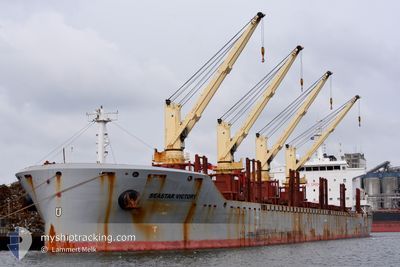
SEASTAR VICTORY
Cargo
Current Trip
| Time Travelled | 24 days |
|---|---|
| Remaining Time | --- |
| Distance Travelled | 6799.94 nm |
| Remaining Distance | --- |
| AVG Speed | 11.6 Noeuds |
| MAX Speed | 15.3 Noeuds |
| AVG Wind | 13.1 knots |
| MAX Wind | 35 knots |
| MIN Temp | 14.3°C / 57.74°F |
| MAX Temp | 29.4°C / 84.92°F |
| Tirant d eau | 10 m |
| Position reçue | 1 d depuis |
Current Position
| Longitude | -18.43113° |
|---|---|
| Latitude | 30.03288° |
| Etat | Under way using engine |
| Vitesse | 11.1 Noeuds |
| Parcours | 301.5° |
| Zone | North Atlantic Ocean |
| Station | T-AIS |
| Position reçue | 1 d depuis |
Info
Information
The current position of SEASTAR VICTORY is in North Atlantic Ocean with coordinates 30.03288° / -18.43113° as reported on 2024-05-13 14:30 by AIS to our vessel tracker app. The vessel's current speed is 11.1 Noeuds and is heading at the port of SOREL. The estimated time of arrival as calculated by MyShipTracking vessel tracking app is 2024-05-22 12:00 LT
The vessel SEASTAR VICTORY (IMO: 9612246, MMSI: 236112603) is a Cargo It's sailing under the flag of [GI] Gibraltar.
In this page you can find informations about the vessels current position, last detected port calls, and current voyage information. If the vessels is not in coverage by AIS you will find the latest position.
The current position of SEASTAR VICTORY is detected by our AIS receivers and we are not responsible for the reliability of the data. The last position was recorded while the vessel was in Coverage by the Ais receivers of our vessel tracking app.
The current draught of SEASTAR VICTORY as reported by AIS is 10 meters
Weather
| Temperature | 18.5°C / 65.3°F |
|---|---|
| Wind Speed | 11 knots |
| Direction | 51° NE |
| Pressure | 1024.5 hPa |
| Humidity | 67.2 % |
| Cloud Coverage | 89 % |
Featured Company
Last Port Calls
| Port | Arrival | Departure | Time In Port |
|---|---|---|---|
| 2024-04-18 04:48 | 2024-04-20 12:41 | 2 d | |
| 2024-04-01 17:55 | 2024-04-06 10:12 | 4 d |
Most Visited Ports (Last year)
| Port | Arrivals | |
|---|---|---|
| 4 | ||
| 3 | ||
| 2 | ||
| 2 | ||
| 1 | ||
| 1 |
Last Trips
| Origin | Departure | Destination | Arrival | Distance | |
|---|---|---|---|---|---|
| 2024-04-06 12:12 | 2024-04-18 07:48 | 865.25 nm | |||
| 2024-02-29 17:34 | 2024-04-01 19:55 | 7947.79 nm |
Events
| Heure | Evenement | Détails | Position/ Destination | Info |
|---|---|---|---|---|
| 2024-05-13 14:35 | Etat Changé | Default Under way using engine |
30.03993 / -18.44530
CA SOR
|
Vitesse: 11.1 kn Parcours: 301.5° |
| 2024-05-13 14:30 | Etat Changé | Under way using engine Default |
30.03288 / -18.43113
CA SOR
|
Vitesse: 11.3 kn Parcours: 292° |
| 2024-05-13 14:30 | Hors de la zone couverte |
30.03288 / -18.43113
North Atlantic Ocean
CA SOR
|
Vitesse: 11.1 kn Parcours: 301.5° |
|
| 2024-05-13 14:25 | Dans la zone couverte |
30.03288 / -18.43113
North Atlantic Ocean
CA SOR
|
Vitesse: 11.1 kn Parcours: 301.5° |
|
| 2024-05-13 11:04 | Etat Changé | Default Under way using engine |
29.70783 / -17.77357
CA SOR
|
Vitesse: 11.7 kn Parcours: 294.1° |
| 2024-05-13 10:53 | Hors de la zone couverte |
29.69003 / -17.73745
North Atlantic Ocean
CA SOR
|
Vitesse: 11.7 kn Parcours: 294.1° |
|
| 2024-05-13 10:49 | Dans la zone couverte |
29.68593 / -17.72947
North Atlantic Ocean
CA SOR
|
Vitesse: 12.3 kn Parcours: 291.2° |
|
| 2024-05-13 10:48 | Etat Changé | Under way using engine Default |
29.68165 / -17.72077
CA SOR
|
Vitesse: 12 kn Parcours: 288° |
| 2024-05-13 09:00 | Etat Changé | Default Under way using engine |
29.51020 / -17.37435
CA SOR
|
Vitesse: 11.8 kn Parcours: 308.3° |
| 2024-05-13 08:48 | Hors de la zone couverte |
29.49202 / -17.33738
North Atlantic Ocean
CA SOR
|
Vitesse: 11.8 kn Parcours: 308.3° |