
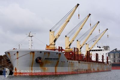
SEASTAR VICTORY
Cargo
Current Trip
| Time Travelled | 6 days |
|---|---|
| Remaining Time | 13 days |
| Distance Travelled | 1949.62 nm |
| Remaining Distance | 4184.51 nm |
| AVG Speed | 12 Knopen |
| MAX Speed | 15.3 Knopen |
| AVG Wind | 14.2 knots |
| MAX Wind | 35 knots |
| MIN Temp | 16.9°C / 62.42°F |
| MAX Temp | 25.6°C / 78.08°F |
| Diepgang | 9.6 M |
| Positie ontvangen | 1 d geleden |
Current Position
| Lengtegraad | 17.89782° |
|---|---|
| Breedtegraat | -34.15280° |
| Status | Under way using engine |
| Snelheid | 12 Knopen |
| Koers | 322° |
| Gebied | South Atlantic Ocean |
| Station | T-AIS |
| Positie ontvangen | 1 d geleden |
Info
Information
The current position of SEASTAR VICTORY is in South Atlantic Ocean with coordinates -34.15280° / 17.89782° as reported on 2024-04-26 08:14 by AIS to our vessel tracker app. The vessel's current speed is 12 Knopen and is heading at the port of LAS PALMAS. The estimated time of arrival as calculated by MyShipTracking vessel tracking app is 2024-05-10 13:20 LT
The vessel SEASTAR VICTORY (IMO: 9612246, MMSI: 236112603) is a Cargo It's sailing under the flag of [GI] Gibraltar.
In this page you can find informations about the vessels current position, last detected port calls, and current voyage information. If the vessels is not in coverage by AIS you will find the latest position.
The current position of SEASTAR VICTORY is detected by our AIS receivers and we are not responsible for the reliability of the data. The last position was recorded while the vessel was in Coverage by the Ais receivers of our vessel tracking app.
The current draught of SEASTAR VICTORY as reported by AIS is 9.6 meters
Weather
| Temperature | 19.2°C / 66.56°F |
|---|---|
| Wind Speed | 15 knots |
| Direction | 151° SSE |
| Pressure | 1010.2 hPa |
| Humidity | 83.3 % |
| Cloud Coverage | --- |
Featured Company
Last Port Calls
| Port | Arrival | Departure | Time In Port |
|---|---|---|---|
| 2024-04-18 04:48 | 2024-04-20 12:41 | 2 d | |
| 2024-04-01 17:55 | 2024-04-06 10:12 | 4 d | |
| 2024-02-27 17:29 | 2024-02-29 22:34 | 2 d | |
| 2024-02-15 16:45 | 2024-02-21 14:55 | 5 d |
Most Visited Ports (Last year)
| Port | Arrivals | |
|---|---|---|
| 4 | ||
| 3 | ||
| 2 | ||
| 2 | ||
| 1 | ||
| 1 |
Last Trips
| Origin | Departure | Destination | Arrival | Distance | |
|---|---|---|---|---|---|
| 2024-04-06 12:12 | 2024-04-18 07:48 | 865.25 nm | |||
| 2024-02-29 17:34 | 2024-04-01 19:55 | 7947.79 nm | |||
| 2024-02-21 09:55 | 2024-02-27 12:29 | 1478.49 nm | |||
| 2024-01-10 04:22 | 2024-02-15 11:45 | 9563.14 nm |
Events
| Tijd | Evenement | Details | Positie / Bestemming | Info |
|---|---|---|---|---|
| 2024-04-26 08:18 | Status Changed | Default Under way using engine |
-34.14320 / 17.88848
ES LPA
|
Snelheid: 12 kn Koers: 322° |
| 2024-04-26 08:14 | Buitenbereik |
-34.15280 / 17.89782
South Atlantic Ocean
ES LPA
|
Snelheid: 12 kn Koers: 322° |
|
| 2024-04-26 07:52 | Status Changed | Under way using engine Default |
-34.21250 / 17.95598
ES LPA
|
Snelheid: 12.2 kn Koers: 326° |
| 2024-04-26 07:39 | Status Changed | Default Under way using engine |
-34.24652 / 17.98923
ES LPA
|
Snelheid: 12.6 kn Koers: 323.1° |
| 2024-04-26 07:14 | Status Changed | Under way using engine Default |
-34.31628 / 18.05035
ES LPA
|
Snelheid: 12.5 kn Koers: 329° |
| 2024-04-26 07:10 | Status Changed | Default Under way using engine |
-34.32947 / 18.05957
ES LPA
|
Snelheid: 12.4 kn Koers: 332.2° |
| 2024-04-26 07:01 | Status Changed | Under way using engine Default |
-34.35643 / 18.07838
ES LPA
|
Snelheid: 12.5 kn Koers: 322° |
| 2024-04-26 06:54 | Status Changed | Default Under way using engine |
-34.37602 / 18.09600
ES LPA
|
Snelheid: 12.5 kn Koers: 321.7° |
| 2024-04-26 04:29 | Draught Changed | 9.6 8.6 |
-34.65477 / 18.58463
ES LPA
|
Snelheid: 13.5 kn Koers: 279.3° |
| 2024-04-26 04:29 | Destination Changed | ES LPA ZA RCB |
-34.65477 / 18.58463
ES LPA
|
Snelheid: 13.5 kn Koers: 279.3° |