
RHAPSODY
Tanker
Current Trip
| Time Travelled | 6 days |
|---|---|
| Remaining Time | --- |
| Distance Travelled | 1602.16 nm |
| Remaining Distance | --- |
| AVG Speed | 10.6 Noeuds |
| MAX Speed | 14.2 Noeuds |
| AVG Wind | 10.8 knots |
| MAX Wind | 20 knots |
| MIN Temp | 18.3°C / 64.94°F |
| MAX Temp | 28.2°C / 82.76°F |
| Tirant d eau | 11.6 m |
| Position reçue | 5 d depuis |
Current Position
| Longitude | -93.23073° |
|---|---|
| Latitude | 29.20965° |
| Etat | Under way using engine |
| Vitesse | 12 Noeuds |
| Parcours | 179.6° |
| Zone | Gulf of Mexico |
| Station | T-AIS |
| Position reçue | 5 d depuis |
Info
Information
The current position of RHAPSODY is in Gulf of Mexico with coordinates 29.20965° / -93.23073° as reported on 2024-04-23 02:40 by AIS to our vessel tracker app. The vessel's current speed is 12 Noeuds
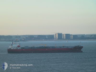
The vessel RHAPSODY (IMO: 9810666, MMSI: 563117900) is a Tanker It's sailing under the flag of [SG] Singapore.
In this page you can find informations about the vessels current position, last detected port calls, and current voyage information. If the vessels is not in coverage by AIS you will find the latest position.
The current position of RHAPSODY is detected by our AIS receivers and we are not responsible for the reliability of the data. The last position was recorded while the vessel was in Coverage by the Ais receivers of our vessel tracking app.
The current draught of RHAPSODY as reported by AIS is 11.6 meters
Weather
| Temperature | 28.1°C / 82.58°F |
|---|---|
| Wind Speed | 14 knots |
| Direction | 57° ENE |
| Pressure | 1010.1 hPa |
| Humidity | 80.1 % |
| Cloud Coverage | 48 % |
Featured Company
Last Port Calls
| Port | Arrival | Departure | Time In Port |
|---|---|---|---|
| 2024-04-21 13:09 | 2024-04-22 19:29 | 1 d | |
| 2024-04-06 10:25 | 2024-04-07 14:39 | 1 d | |
| 2024-04-01 19:56 | 2024-04-04 22:42 | 3 d | |
| 2024-03-28 06:04 | 2024-03-28 22:48 | 16 h | |
| 2024-03-24 23:48 | 2024-03-25 16:48 | 17 h | |
| 2024-03-21 19:32 | 2024-03-24 08:55 | 2 d | |
| 2024-03-17 00:26 | 2024-03-18 04:51 | 1 d | |
| 2024-03-06 16:18 | 2024-03-07 19:28 | 1 d | |
| 2024-02-03 23:27 | 2024-02-05 00:16 | 1 d | |
| 2024-02-01 00:34 |
Most Visited Ports (Last year)
| Port | Arrivals | |
|---|---|---|
| 6 | ||
| 4 | ||
| 3 | ||
| 2 | ||
| 2 | ||
| 2 |
Last Trips
| Origin | Departure | Destination | Arrival | Distance | |
|---|---|---|---|---|---|
| 2024-04-07 09:39 | 2024-04-21 08:09 | 622.43 nm | |||
| 2024-04-04 17:42 | 2024-04-06 05:25 | 439.51 nm | |||
| 2024-03-28 16:48 | 2024-04-01 14:56 | 741.81 nm | |||
| 2024-03-25 11:48 | 2024-03-28 00:04 | 730.61 nm | |||
| 2024-03-24 03:55 | 2024-03-24 18:48 | 45.87 nm | |||
| 2024-03-17 23:51 | 2024-03-21 14:32 | 560.09 nm | |||
| 2024-03-07 14:28 | 2024-03-16 19:26 | 1849.00 nm | |||
| 2024-02-05 09:16 | 2024-03-06 11:18 | 8623.38 nm | |||
| 2024-02-01 09:34 | 2024-02-04 08:27 | 595.74 nm |
Events
| Heure | Evenement | Détails | Position/ Destination | Info |
|---|---|---|---|---|
| 2024-04-28 19:04 | Arret | 3.74 nm, North West of COLON |
9.41040 / -79.93981
CRISTOBAL
|
Vitesse: 0.1 kn Parcours: 250° |
| 2024-04-23 02:53 | Etat Changé | Default Under way using engine |
29.16776 / -93.23147
CRISTOBAL
|
Vitesse: 12 kn Parcours: 179.6° |
| 2024-04-23 02:40 | Hors de la zone couverte |
29.20965 / -93.23073
Gulf of Mexico
CRISTOBAL
|
Vitesse: 12 kn Parcours: 179.6° |
|
| 2024-04-22 19:30 | Démarrage | 2.71 nm, South West of LAKE CHARLES |
30.20296 / -93.27861
CRISTOBAL
|
Vitesse: 3.5 kn Parcours: 234° |
| 2024-04-22 19:29 | PORT DE DEPART |
|
30.20393 / -93.27792
CRISTOBAL
|
Vitesse: 2.4 kn Parcours: 183° |
| 2024-04-22 19:03 | Tirant d'eau modifié | 11.6 10.1 |
30.21620 / -93.28136
[US] LAKE CHARLES
|
Vitesse: Parcours: 176° |
| 2024-04-22 19:03 | Changement de destination | CRISTOBAL US LCH |
30.21620 / -93.28136
[US] LAKE CHARLES
|
Vitesse: Parcours: 176° |
| 2024-04-22 19:03 | Changement d'ETA | 2024/04/27 23:00 2024/04/14 14:00 |
30.21620 / -93.28136
[US] LAKE CHARLES
|
Vitesse: Parcours: 176° |
| 2024-04-22 18:59 | Etat Changé | Under way using engine Default |
30.21617 / -93.28136
[US] LAKE CHARLES
|
Vitesse: Parcours: 176° |
| 2024-04-22 18:49 | Dans la zone couverte |
30.21618 / -93.28136
Gulf of Mexico
[US] LAKE CHARLES
|
Vitesse: Parcours: 204.6° |