
PORTO CHELI
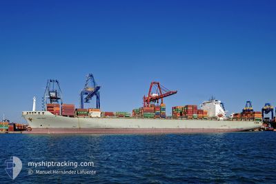
Container Ship
Current Trip
| Trip Time | 1 day |
|---|---|
| Trip Distance | 350.12 nm |
| AVG Speed | 13.3 Noeuds |
| MAX Speed | 16.8 Noeuds |
| Tirant d eau | 11.1 m |
| AVG Wind | 13.8 knots |
| MAX Wind | 30 knots |
| MIN Temp | 12.6°C / 54.68°F |
| MAX Temp | 16.2°C / 61.16°F |
| Position reçue | 3 m depuis |
Current Position
| Longitude | --- |
|---|---|
| Latitude | --- |
| Etat | Moored |
| Vitesse | |
| Parcours | 178° |
| Zone | Tyrrhenian Sea |
| Station | T-AIS |
| Position reçue | 3 m depuis |
Info
Information
The current position of PORTO CHELI is in Tyrrhenian Sea with coordinates 44.10755° / 9.84347° as reported on 2025-01-08 15:41 by AIS to our vessel tracker app. The vessel's current speed is 0 Noeuds and is currently inside the port of LA SPEZIA.
The vessel PORTO CHELI (IMO: 9221839, MMSI: 636020869) is a Container Ship that was built in 2001 ( 24 Age ). It's sailing under the flag of [LR] Liberia.
In this page you can find informations about the vessels current position, last detected port calls, and current voyage information. If the vessels is not in coverage by AIS you will find the latest position.
The current position of PORTO CHELI is detected by our AIS receivers and we are not responsible for the reliability of the data. The last position was recorded while the vessel was in Coverage by the Ais receivers of our vessel tracking app.
The current draught of PORTO CHELI as reported by AIS is 11.1 meters
Weather
| Temperature | 14.3°C / 57.74°F |
|---|---|
| Wind Speed | 14 knots |
| Direction | 208° SSW |
| Pressure | 1013.8 hPa |
| Humidity | 84.5 % |
| Cloud Coverage | 97 % |
Featured Company
Last Port Calls
| Port | Arrival | Departure | Time In Port |
|---|---|---|---|
| 2025-01-08 04:09 | |||
| 2025-01-05 15:43 | 2025-01-07 02:37 | 1 d | |
| 2025-01-02 17:53 | 2025-01-05 05:05 | 2 d | |
| 2024-12-28 09:29 | 2024-12-29 23:31 | 1 d | |
| 2024-12-10 07:31 | 2024-12-11 07:22 | 23 h | |
| 2024-12-06 06:40 | 2024-12-07 09:45 | 1 d | |
| 2024-12-02 18:03 | 2024-12-04 22:46 | 2 d | |
| 2024-11-30 18:59 | 2024-12-01 07:42 | 12 h | |
| 2024-11-22 19:00 | 2024-11-24 12:33 | 1 d | |
| 2024-11-20 08:50 | 2024-11-21 05:38 | 20 h |
Last Trips
| Origin | Departure | Destination | Arrival | Distance | |
|---|---|---|---|---|---|
| 2025-01-07 03:37 | 2025-01-08 05:09 | 350.12 nm | |||
| 2025-01-05 06:05 | 2025-01-05 16:43 | 172.38 nm | |||
| 2024-12-30 00:31 | 2025-01-02 18:53 | 716.12 nm | |||
| 2024-12-11 02:22 | 2024-12-28 10:29 | 4317.53 nm | |||
| 2024-12-07 03:45 | 2024-12-10 02:31 | 935.90 nm | |||
| 2024-12-04 16:46 | 2024-12-06 00:40 | 442.77 nm | |||
| 2024-12-01 01:42 | 2024-12-02 12:03 | 515.34 nm | |||
| 2024-11-24 07:33 | 2024-11-30 12:59 | 1414.23 nm | |||
| 2024-11-21 00:38 | 2024-11-22 14:00 | 143.69 nm | |||
| 2024-11-10 17:38 | 2024-11-20 03:50 | 3668.52 nm |
Events
| Heure | Evenement | Détails | Position/ Destination | Info |
|---|---|---|---|---|
| 2025-01-08 13:38 | Etat Changé | Moored Default |
44.10751 / 9.84347
[IT] LA SPEZIA
|
Vitesse: Parcours: 178° |
| 2025-01-08 13:35 | Etat Changé | Default Moored |
44.10754 / 9.84344
[IT] LA SPEZIA
|
Vitesse: Parcours: 178° |
| 2025-01-08 04:40 | Etat Changé | Moored Under way using engine |
44.10753 / 9.84343
[IT] LA SPEZIA
|
Vitesse: Parcours: 179° |
| 2025-01-08 04:39 | Arret |
44.10751 / 9.84344
[IT] LA SPEZIA
|
Vitesse: Parcours: 179° |
|
| 2025-01-08 04:09 | Port d'arrivée |
|
44.07644 / 9.85106
[IT] LA SPEZIA
|
Vitesse: 7.5 kn Parcours: 343.5° |
| 2025-01-08 02:43 | Etat Changé | Under way using engine Default |
43.80639 / 9.85327
ITLSZ
|
Vitesse: 15.7 kn Parcours: 30° |
| 2025-01-08 02:34 | Etat Changé | Default Under way using engine |
43.77050 / 9.82888
ITLSZ
|
Vitesse: 15.8 kn Parcours: 26.1° |
| 2025-01-08 02:26 | Etat Changé | Under way using engine Default |
43.73884 / 9.80813
ITLSZ
|
Vitesse: 15.8 kn Parcours: 33° |
| 2025-01-08 02:20 | Dans la zone couverte |
43.73884 / 9.80813
Tyrrhenian Sea
ITLSZ
|
Vitesse: 15.8 kn Parcours: 26.1° |
|
| 2025-01-07 23:33 | Hors de la zone couverte |
43.05218 / 9.64934
Tyrrhenian Sea
ITLSZ
|
Vitesse: 14.8 kn Parcours: 355.1° |