
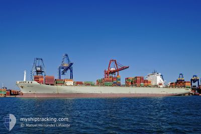
PORTO CHELI
Container Ship
Current Trip
| Time Travelled | 4 days |
|---|---|
| Remaining Time | --- |
| Distance Travelled | 2112.78 nm |
| Remaining Distance | --- |
| AVG Speed | 18.7 Knots |
| MAX Speed | 20.7 Knots |
| AVG Wind | 11.8 knots |
| MAX Wind | 21.1 knots |
| MIN Temp | 11.2°C / 52.16°F |
| MAX Temp | 19.4°C / 66.92°F |
| Draught | 14.6 m |
| Position Received | 1 d ago |
Current Position
| Longitude | -30.43393° |
|---|---|
| Latitude | 37.99893° |
| Status | Under way using engine |
| Speed | 19.7 Knots |
| Course | 268° |
| Area | North Atlantic Ocean |
| Station | T-AIS |
| Position Received | 1 d ago |
Info
Information
The current position of PORTO CHELI is in North Atlantic Ocean with coordinates 37.99893° / -30.43393° as reported on 2024-04-23 18:47 by AIS to our vessel tracker app. The vessel's current speed is 19.7 Knots and is heading at the port of FREEPORT (BS). The estimated time of arrival as calculated by MyShipTracking vessel tracking app is 2024-04-29 03:30 LT
The vessel PORTO CHELI (IMO: 9221839, MMSI: 636020869) is a Container Ship that was built in 2001 ( 23 years old ). It's sailing under the flag of [LR] Liberia.
In this page you can find informations about the vessels current position, last detected port calls, and current voyage information. If the vessels is not in coverage by AIS you will find the latest position.
The current position of PORTO CHELI is detected by our AIS receivers and we are not responsible for the reliability of the data. The last position was recorded while the vessel was in Coverage by the Ais receivers of our vessel tracking app.
The current draught of PORTO CHELI as reported by AIS is 14.6 meters
Weather
| Temperature | 19.4°C / 66.92°F |
|---|---|
| Wind Speed | 7 knots |
| Direction | 133° SE |
| Pressure | 1026.7 hPa |
| Humidity | 73.9 % |
| Cloud Coverage | 93 % |
Featured Company
Last Port Calls
| Port | Arrival | Departure | Time In Port |
|---|---|---|---|
| 2024-04-20 11:05 | 2024-04-21 04:18 | 17 h | |
| 2024-04-18 00:34 | 2024-04-19 04:53 | 1 d | |
| 2024-04-10 23:40 | 2024-04-14 12:39 | 3 d | |
| 2024-04-08 07:25 | 2024-04-09 13:18 | 1 d | |
| 2024-04-05 18:48 | 2024-04-07 21:42 | 2 d | |
| 2024-04-03 10:53 | 2024-04-04 09:30 | 22 h | |
| 2024-03-30 04:54 | 2024-03-31 08:47 | 1 d | |
| 2024-03-18 08:11 | 2024-03-20 11:09 | 2 d | |
| 2024-03-13 17:51 | 2024-03-14 11:31 | 17 h | |
| 2024-03-09 23:32 | 2024-03-11 19:39 | 1 d |
Most Visited Ports (Last year)
| Port | Arrivals | |
|---|---|---|
| 8 | ||
| 7 | ||
| 6 | ||
| 6 | ||
| 5 | ||
| 5 |
Last Trips
| Origin | Departure | Destination | Arrival | Distance | |
|---|---|---|---|---|---|
| 2024-04-19 06:53 | 2024-04-20 13:05 | 400.68 nm | |||
| 2024-04-14 14:39 | 2024-04-18 02:34 | 580.07 nm | |||
| 2024-04-09 15:18 | 2024-04-11 01:40 | 470.41 nm | |||
| 2024-04-07 23:42 | 2024-04-08 09:25 | 171.28 nm | |||
| 2024-04-04 11:30 | 2024-04-05 20:48 | 566.87 nm | |||
| 2024-03-31 10:47 | 2024-04-03 12:53 | 569.35 nm | |||
| 2024-03-20 07:09 | 2024-03-30 05:54 | 3907.21 nm | |||
| 2024-03-14 07:31 | 2024-03-18 04:11 | 197.98 nm | |||
| 2024-03-11 14:39 | 2024-03-13 13:51 | 847.36 nm | |||
| 2024-03-08 12:31 | 2024-03-09 17:32 | 439.59 nm |
Events
| Time | Event | Details | Position / Dest | Info |
|---|---|---|---|---|
| 2024-04-23 18:51 | Status Changed | Default Under way using engine |
37.99806 / -30.45543
BSFPO
|
Speed: 19.7 kn Course: 268° |
| 2024-04-23 18:47 | OUT of Coverage |
37.99893 / -30.43393
North Atlantic Ocean
BSFPO
|
Speed: 19.7 kn Course: 268° |
|
| 2024-04-23 10:31 | IN Coverage |
38.09440 / -26.97445
North Atlantic Ocean
BSFPO
|
Speed: 20.1 kn Course: 267.5° |
|
| 2024-04-23 10:28 | Status Changed | Under way using engine Default |
38.09562 / -26.95047
BSFPO
|
Speed: 20.3 kn Course: 267° |
| 2024-04-23 09:05 | Status Changed | Default Under way using engine |
38.12888 / -26.37003
BSFPO
|
Speed: 20.2 kn Course: 261.3° |
| 2024-04-23 09:01 | OUT of Coverage |
38.13212 / -26.34189
North Atlantic Ocean
BSFPO
|
Speed: 20.2 kn Course: 261.3° |
|
| 2024-04-23 03:00 | ETA Changed | 2024/04/29 03:30 2024/04/29 02:00 |
38.03625 / -23.84287
BSFPO
|
Speed: 19.8 kn Course: 277.3° |
| 2024-04-23 02:50 | Change Sea Area | Portuguese (Azores) part of the North Atlantic Ocean Portuguese part of the North Atlantic Ocean |
38.02890 / -23.77420
North Atlantic Ocean
BSFPO
|
Speed: 19.9 kn Course: 278.1° |
| 2024-04-23 02:48 | Status Changed | Under way using engine Default |
38.02757 / -23.76232
BSFPO
|
Speed: 20 kn Course: 278° |
| 2024-04-23 02:32 | IN Coverage |
38.02890 / -23.77420
North Atlantic Ocean
BSFPO
|
Speed: 19.9 kn Course: 278.1° |