
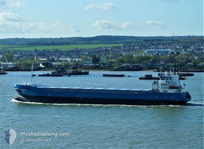
OHIOBORG
General Cargo
Current Trip
ESPAS
| Time Travelled | 1 day |
|---|---|
| Remaining Time | --- |
| Distance Travelled | 264.69 nm |
| Remaining Distance | --- |
| AVG Speed | 9.6 Noeuds |
| MAX Speed | 10.8 Noeuds |
| AVG Wind | 24.1 knots |
| MAX Wind | 30.8 knots |
| MIN Temp | 4.1°C / 39.38°F |
| MAX Temp | 6.2°C / 43.16°F |
| Tirant d eau | 5.3 m |
| Position reçue | Maintenant |
Current Position
| Longitude | --- |
|---|---|
| Latitude | --- |
| Etat | Under way using engine |
| Vitesse | 8.7 Noeuds |
| Parcours | 224° |
| Zone | Baltic Sea |
| Station | T-AIS |
| Position reçue | Maintenant |
Info
Information
The current position of OHIOBORG is in Baltic Sea with coordinates 55.16501° / 14.18034° as reported on 2025-03-05 09:58 by AIS to our vessel tracker app. The vessel's current speed is 8.7 Noeuds
The vessel OHIOBORG (IMO: 9423657, MMSI: 245176000) is a General Cargo that was built in 2007 ( 18 Age ). It's sailing under the flag of [NL] Netherlands.
In this page you can find informations about the vessels current position, last detected port calls, and current voyage information. If the vessels is not in coverage by AIS you will find the latest position.
The current position of OHIOBORG is detected by our AIS receivers and we are not responsible for the reliability of the data. The last position was recorded while the vessel was in Coverage by the Ais receivers of our vessel tracking app.
The current draught of OHIOBORG as reported by AIS is 5.3 meters
Weather
| Temperature | 4.6°C / 40.28°F |
|---|---|
| Wind Speed | 28 knots |
| Direction | 252° WSW |
| Pressure | 1014.9 hPa |
| Humidity | 77.6 % |
| Cloud Coverage | 100 % |
Featured Company
Last Port Calls
| Port | Arrival | Departure | Time In Port |
|---|---|---|---|
| 2025-03-02 11:52 | 2025-03-04 07:06 | 1 d | |
| 2025-03-01 06:01 | 2025-03-01 15:13 | 9 h | |
| 2025-02-22 04:19 | 2025-02-24 23:55 | 2 d | |
| 2025-02-20 02:01 | 2025-02-22 02:00 | 1 d | |
| 2025-02-11 22:45 | 2025-02-14 18:53 | 2 d | |
| 2025-02-05 17:10 | 2025-02-07 18:36 | 2 d | |
| 2025-02-04 05:37 | 2025-02-05 01:34 | 19 h | |
| 2025-01-30 03:21 | 2025-01-30 21:25 | 18 h | |
| 2025-01-28 03:55 | 2025-01-29 16:49 | 1 d | |
| 2025-01-23 23:09 | 2025-01-24 20:15 | 21 h |
Last Trips
| Origin | Departure | Destination | Arrival | Distance | |
|---|---|---|---|---|---|
| 2025-03-01 15:13 | 2025-03-02 11:52 | 231.98 nm | |||
| 2025-02-24 23:55 | 2025-03-01 06:01 | 1012.20 nm | |||
| 2025-02-22 02:00 | 2025-02-22 04:19 | 26.16 nm | |||
| 2025-02-14 18:53 | 2025-02-20 02:01 | 1081.06 nm | |||
| 2025-02-07 18:36 | 2025-02-11 22:45 | 943.15 nm | |||
| 2025-02-05 01:34 | 2025-02-05 17:10 | 173.41 nm | |||
| 2025-01-30 21:25 | 2025-02-04 05:37 | 1082.68 nm | |||
| 2025-01-29 16:49 | 2025-01-30 03:21 | 122.55 nm | |||
| 2025-01-24 20:15 | 2025-01-28 03:55 | 808.75 nm | |||
| 2025-01-23 06:22 | 2025-01-23 23:09 | 191.36 nm |
Events
| Heure | Evenement | Détails | Position/ Destination | Info |
|---|---|---|---|---|
| 2025-03-05 07:51 | Changement d'ETA | 2025/10/03 22:00 2025/03/10 22:00 |
55.37856 / 14.53297
ESPAS
|
Vitesse: 8.4 kn Parcours: 223.6° |
| 2025-03-05 07:14 | Detecté en mer | Swedish part of the Baltic Sea |
55.43645 / 14.64721
Baltic Sea
ESPAS
|
Vitesse: 8.7 kn Parcours: 239° |
| 2025-03-05 04:32 | Detecté en mer | Danish part of the Kattegat |
55.64102 / 15.23674
Kattegat
ESPAS
|
Vitesse: 8.8 kn Parcours: 238.6° |
| 2025-03-05 01:21 | Changement d'ETA | 2025/03/10 22:00 2025/10/03 22:00 |
55.87749 / 15.92231
ESPAS
|
Vitesse: 8.4 kn Parcours: 237.6° |
| 2025-03-04 22:11 | Changement d'ETA | 2025/10/03 22:00 2025/03/10 22:00 |
56.09800 / 16.56519
ESPAS
|
Vitesse: 9.2 kn Parcours: 241.2° |
| 2025-03-04 21:35 | Etat Changé | Under way using engine Default |
56.14895 / 16.71481
ESPAS
|
Vitesse: 9.2 kn Parcours: 236° |
| 2025-03-04 20:54 | Etat Changé | Default Under way using engine |
56.25643 / 16.77469
ESPAS
|
Vitesse: 10.4 kn Parcours: 196.2° |
| 2025-03-04 20:53 | Etat Changé | Under way using engine Default |
56.25740 / 16.77516
ESPAS
|
Vitesse: 10.6 kn Parcours: 196° |
| 2025-03-04 20:34 | Dans la zone couverte |
56.25740 / 16.77516
Baltic Sea
ESPAS
|
Vitesse: 10.4 kn Parcours: 196.2° |
|
| 2025-03-04 19:14 | Hors de la zone couverte |
56.54237 / 16.91738
Baltic Sea
ESPAS
|
Vitesse: 10.7 kn Parcours: 196° |