

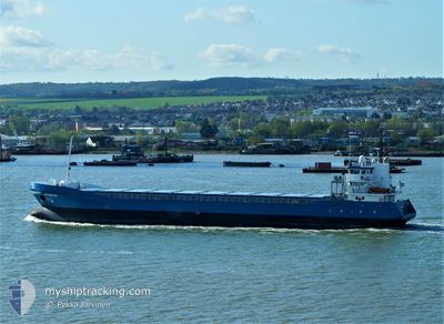
OHIOBORG
General Cargo

Current Trip
| Time Travelled | 4 days |
|---|---|
| Remaining Time | 1 h, 11 mins |
| Distance Travelled | 995.93 nm |
| Remaining Distance | 15.08 nm |
| AVG Speed | 8.8 Knopen |
| MAX Speed | 12.6 Knopen |
| AVG Wind | 5.9 knots |
| MAX Wind | 15 knots |
| MIN Temp | 0.5°C / 32.9°F |
| MAX Temp | 9°C / 48.2°F |
| Diepgang | 5.3 M |
| Positie ontvangen | 1 h, 58 m geleden |
Current Position
| Lengtegraad | --- |
|---|---|
| Breedtegraat | --- |
| Status | Under way using engine |
| Snelheid | 10.5 Knopen |
| Koers | 288.4° |
| Gebied | Gulf of Bothnia |
| Station | T-AIS |
| Positie ontvangen | 1 h, 58 m geleden |
Information
The current position of OHIOBORG is in Gulf of Bothnia with coordinates 60.64580° / 18.32751° as reported on 2025-03-01 01:39 by AIS to our vessel tracker app. The vessel's current speed is 10.5 Knopen and is heading at the port of GAVLE. The estimated time of arrival as calculated by MyShipTracking vessel tracking app is 2025-03-01 04:49 LT
The vessel OHIOBORG (IMO: 9423657, MMSI: 245176000) is a General Cargo that was built in 2007 ( 18 Jaar oud ). It's sailing under the flag of [NL] Netherlands.
In this page you can find informations about the vessels current position, last detected port calls, and current voyage information. If the vessels is not in coverage by AIS you will find the latest position.
The current position of OHIOBORG is detected by our AIS receivers and we are not responsible for the reliability of the data. The last position was recorded while the vessel was in Coverage by the Ais receivers of our vessel tracking app.
The current draught of OHIOBORG as reported by AIS is 5.3 meters
Weather
| Temperature | 0.5°C / 32.9°F |
|---|---|
| Wind Speed | 6 knots |
| Direction | 306° NW |
| Pressure | 1021.5 hPa |
| Humidity | 83.5 % |
| Cloud Coverage | 77 % |


Featured Company
Last Port Calls
| Port | Arrival | Departure | Time In Port |
|---|---|---|---|
| 2025-02-22 03:19 | 2025-02-24 22:55 | 2 d | |
| 2025-02-20 01:01 | 2025-02-22 01:00 | 1 d | |
| 2025-02-11 20:45 | 2025-02-14 16:53 | 2 d | |
| 2025-02-05 16:10 | 2025-02-07 17:36 | 2 d | |
| 2025-02-04 04:37 | 2025-02-05 00:34 | 19 h | |
| 2025-01-30 01:21 | 2025-01-30 19:25 | 18 h | |
| 2025-01-28 01:55 | 2025-01-29 14:49 | 1 d | |
| 2025-01-23 22:09 | 2025-01-24 19:15 | 21 h | |
| 2025-01-22 23:18 | 2025-01-23 05:22 | 6 h | |
| 2025-01-20 19:49 | 2025-01-22 23:01 | 2 d |
Last Trips
| Origin | Departure | Destination | Arrival | Distance | |
|---|---|---|---|---|---|
| 2025-02-22 02:00 | 2025-02-22 04:19 | 26.16 nm | |||
| 2025-02-14 18:53 | 2025-02-20 02:01 | 1081.06 nm | |||
| 2025-02-07 18:36 | 2025-02-11 22:45 | 943.15 nm | |||
| 2025-02-05 01:34 | 2025-02-05 17:10 | 173.41 nm | |||
| 2025-01-30 21:25 | 2025-02-04 05:37 | 1082.68 nm | |||
| 2025-01-29 16:49 | 2025-01-30 03:21 | 122.55 nm | |||
| 2025-01-24 20:15 | 2025-01-28 03:55 | 808.75 nm | |||
| 2025-01-23 06:22 | 2025-01-23 23:09 | 191.36 nm | |||
| 2025-01-23 00:01 | 2025-01-23 00:18 | 2.24 nm | |||
| 2025-01-20 20:17 | 2025-01-20 20:49 | 3.62 nm |
Events
| Tijd | Evenement | Details | Positie / Bestemming | Info |
|---|---|---|---|---|
| 2025-03-01 01:46 | Status Changed | Default Under way using engine |
60.65172 / 18.28993
SEGVX
|
Snelheid: 10.5 kn Koers: 288.4° |
| 2025-03-01 01:39 | Buitenbereik |
60.64580 / 18.32751
Gulf of Bothnia
SEGVX
|
Snelheid: 10.5 kn Koers: 288.4° |
|
| 2025-03-01 00:30 | Status Changed | Under way using engine Default |
60.56513 / 18.69001
SEGVX
|
Snelheid: 10.2 kn Koers: 292° |
| 2025-03-01 00:29 | Status Changed | Default Under way using engine |
60.56439 / 18.69366
SEGVX
|
Snelheid: 10.3 kn Koers: 291.7° |
| 2025-02-28 21:55 | Wijzig zee gebeid | Swedish part of the Gulf of Bothnia Finnish part of the Gulf of Bothnia |
60.21616 / 19.08991
Gulf of Bothnia
SEGVX
|
Snelheid: 10.8 kn Koers: 337.4° |
| 2025-02-28 18:49 | Gevonden in zee | Finnish part of the Gulf of Bothnia |
59.78488 / 19.78936
Gulf of Bothnia
SEGVX
|
Snelheid: 10.8 kn Koers: 319° |
| 2025-02-28 18:00 | ETA Changed | 2025/03/01 08:00 2026/01/03 08:00 |
59.67350 / 19.98042
SEGVX
|
Snelheid: 10.6 kn Koers: 318.3° |
| 2025-02-28 17:36 | Status Changed | Under way using engine Default |
59.62068 / 20.07085
SEGVX
|
Snelheid: 10.5 kn Koers: 319° |
| 2025-02-28 17:33 | Status Changed | Default Under way using engine |
59.61549 / 20.07977
SEGVX
|
Snelheid: 10.6 kn Koers: 319.2° |
| 2025-02-28 17:23 | Status Changed | Under way using engine Default |
59.59188 / 20.11997
SEGVX
|
Snelheid: 10.6 kn Koers: 319° |