

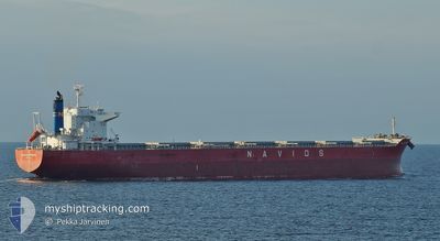
NAVIOS SPHERA
Cargo

Current Trip
MOBILE ALABAMA
| Time Travelled | 23 h, 22 mins |
|---|---|
| Remaining Time | --- |
| Distance Travelled | 221.92 nm |
| Remaining Distance | --- |
| AVG Speed | 10.8 Noeuds |
| MAX Speed | 12.3 Noeuds |
| AVG Wind | 7 knots |
| MAX Wind | 13 knots |
| MIN Temp | 25.6°C / 78.08°F |
| MAX Temp | 27°C / 80.6°F |
| Tirant d eau | 9.2 m |
| Position reçue | 20 h, 1 m depuis |
Current Position
| Longitude | --- |
|---|---|
| Latitude | --- |
| Etat | Under way using engine |
| Vitesse | 10 Noeuds |
| Parcours | 196.8° |
| Zone | Gulf of Mexico |
| Station | T-AIS |
| Position reçue | 20 h, 1 m depuis |
Information
The current position of NAVIOS SPHERA is in Gulf of Mexico with coordinates 30.12202° / -88.07420° as reported on 2025-06-02 17:04 by AIS to our vessel tracker app. The vessel's current speed is 10 Noeuds
The vessel NAVIOS SPHERA (IMO: 9738818, MMSI: 374092000) is a Cargo It's sailing under the flag of [PA] Panama.
In this page you can find informations about the vessels current position, last detected port calls, and current voyage information. If the vessels is not in coverage by AIS you will find the latest position.
The current position of NAVIOS SPHERA is detected by our AIS receivers and we are not responsible for the reliability of the data. The last position was recorded while the vessel was in Coverage by the Ais receivers of our vessel tracking app.
The current draught of NAVIOS SPHERA as reported by AIS is 9.2 meters
Weather
| Temperature | 27°C / 80.6°F |
|---|---|
| Wind Speed | 9 knots |
| Direction | 85° E |
| Pressure | 1013.7 hPa |
| Humidity | 71.1 % |
| Cloud Coverage | --- |


Featured Company
Last Port Calls
| Port | Arrival | Departure | Time In Port |
|---|---|---|---|
| 2025-05-30 13:56 | 2025-06-02 08:44 | 2 d | |
| 2025-05-22 00:44 | 2025-05-22 12:52 | 12 h | |
| 2025-05-18 06:15 | 2025-05-18 06:42 | 27 m | |
| 2025-04-28 04:34 | 2025-04-30 09:00 | 2 d |
Most Visited Ports (Last year)
| Port | Arrivals | |
|---|---|---|
| 3 | ||
| 3 | ||
| 2 | ||
| 1 | ||
| 1 | ||
| 1 |
Last Trips
| Origin | Departure | Destination | Arrival | Distance | |
|---|---|---|---|---|---|
| 2025-05-22 12:52 | 2025-05-30 13:56 | 468.11 nm | |||
| 2025-05-18 06:42 | 2025-05-22 00:44 | 80.37 nm | |||
| 2025-04-30 09:00 | 2025-05-18 06:15 | 5043.01 nm | |||
| 2025-03-29 21:14 | 2025-04-28 04:34 | 5291.93 nm |
Events
| Heure | Evenement | Détails | Position/ Destination | Info |
|---|---|---|---|---|
| 2025-06-02 17:06 | Etat Changé | Default Under way using engine |
30.11636 / -88.07480
MOBILE ALABAMA
|
Vitesse: 10 kn Parcours: 196.8° |
| 2025-06-02 17:04 | Hors de la zone couverte |
30.12202 / -88.07420
Gulf of Mexico
|
Vitesse: 10 kn Parcours: 196.8° |
|
| 2025-06-02 17:01 | Etat Changé | Under way using engine Default |
30.12882 / -88.06818
MOBILE ALABAMA
|
Vitesse: 10.4 kn Parcours: 202° |
| 2025-06-02 16:36 | Etat Changé | Default Under way using engine |
30.19486 / -88.04416
MOBILE ALABAMA
|
Vitesse: 10.1 kn Parcours: 169.5° |
| 2025-06-02 16:18 | Etat Changé | Under way using engine Default |
30.24286 / -88.03842
MOBILE ALABAMA
|
Vitesse: 9.7 kn Parcours: 186° |
| 2025-06-02 16:18 | Dans la zone couverte |
30.24286 / -88.03842
Gulf of Mexico
|
Vitesse: 10 kn Parcours: 174.3° |
|
| 2025-06-02 13:44 | PORT DE DEPART |
|
30.62498 / -88.03264
MOBILE ALABAMA
|
Vitesse: 7.2 kn Parcours: 181° |
| 2025-06-02 13:28 | Démarrage |
30.65238 / -88.03191
[US] MOBILE
|
Vitesse: 3.2 kn Parcours: 177° |
|
| 2025-05-31 15:23 | Changement d'ETA | 2025/05/31 01:12 2025/05/22 12:48 |
30.65722 / -88.03237
[US] MOBILE
|
Vitesse: Parcours: 181° |
| 2025-05-31 01:24 | Arret |
30.65730 / -88.03226
[US] MOBILE
|
Vitesse: 0.1 kn Parcours: 183° |