

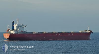
NAVIOS SPHERA
Cargo

Current Trip
| Time Travelled | 19 days |
|---|---|
| Remaining Time | --- |
| Distance Travelled | 4981.59 nm |
| Remaining Distance | --- |
| AVG Speed | 11 Knots |
| MAX Speed | 13.7 Knots |
| AVG Wind | 15.8 knots |
| MAX Wind | 25 knots |
| MIN Temp | 7.4°C / 45.32°F |
| MAX Temp | 27.9°C / 82.22°F |
| Draught | 14.7 m |
| Position Received | 6 d ago |
Current Position
| Longitude | --- |
|---|---|
| Latitude | --- |
| Status | Under way using engine |
| Speed | 11.1 Knots |
| Course | 316° |
| Area | Caribbean Sea |
| Station | T-AIS |
| Position Received | 6 d ago |
Information
The current position of NAVIOS SPHERA is in Caribbean Sea with coordinates 12.08176° / -68.50200° as reported on 2025-02-14 12:00 by AIS to our vessel tracker app. The vessel's current speed is 11.1 Knots and is heading at the port of CONVENT. The estimated time of arrival as calculated by MyShipTracking vessel tracking app is 2025-02-20 21:00 LT
The vessel NAVIOS SPHERA (IMO: 9738818, MMSI: 374092000) is a Cargo It's sailing under the flag of [PA] Panama.
In this page you can find informations about the vessels current position, last detected port calls, and current voyage information. If the vessels is not in coverage by AIS you will find the latest position.
The current position of NAVIOS SPHERA is detected by our AIS receivers and we are not responsible for the reliability of the data. The last position was recorded while the vessel was in Coverage by the Ais receivers of our vessel tracking app.
The current draught of NAVIOS SPHERA as reported by AIS is 14.7 meters
Weather
| Temperature | 7.9°C / 46.22°F |
|---|---|
| Wind Speed | 14 knots |
| Direction | 30° NNE |
| Pressure | 1029.2 hPa |
| Humidity | 52.3 % |
| Cloud Coverage | --- |


Featured Company
Events
| Time | Event | Details | Position / Dest | Info |
|---|---|---|---|---|
| 2025-02-14 12:07 | Status Changed | Default Under way using engine |
12.09818 / -68.51886
US CEN
|
Speed: 11.1 kn Course: 316° |
| 2025-02-14 12:00 | OUT of Coverage |
12.08176 / -68.50200
Caribbean Sea
US CEN
|
Speed: 11.1 kn Course: 316° |
|
| 2025-02-14 11:53 | Change Sea Area | Cura�aoan part of the Caribbean Sea Bonaire part of the Caribbean Sea |
12.06727 / -68.48623
Caribbean Sea
US CEN
|
Speed: 11.2 kn Course: 311.5° |
| 2025-02-14 11:24 | Status Changed | Under way using engine Default |
12.01338 / -68.41053
US CEN
|
Speed: 11.6 kn Course: 302° |
| 2025-02-14 11:21 | Status Changed | Default Under way using engine |
12.00816 / -68.40327
US CEN
|
Speed: 11.5 kn Course: 299.5° |
| 2025-02-14 11:16 | Status Changed | Under way using engine Default |
11.99972 / -68.38930
US CEN
|
Speed: 11.5 kn Course: 302° |
| 2025-02-14 11:14 | Status Changed | Default Under way using engine |
11.99644 / -68.38359
US CEN
|
Speed: 11.5 kn Course: 301.2° |
| 2025-02-14 10:49 | Change Sea Area | Bonaire part of the Caribbean Sea South African part of the South Atlantic Ocean |
11.95486 / -68.31188
Caribbean Sea
US CEN
|
Speed: 11.3 kn Course: 297.4° |
| 2025-02-14 10:46 | Status Changed | Under way using engine Default |
11.95125 / -68.30526
US CEN
|
Speed: 11.2 kn Course: 297° |
| 2025-02-14 10:46 | Draught Changed | 14.7 7.5 |
11.94103 / -68.28603
US CEN
|
Speed: 11.2 kn Course: 297° |