
NAVIGATOR GALAXY
Lpg Tanker
Current Trip
| Time Travelled | 11 days |
|---|---|
| Remaining Time | --- |
| Distance Travelled | 2976.17 nm |
| Remaining Distance | --- |
| AVG Speed | 12.2 Noeuds |
| MAX Speed | 15.3 Noeuds |
| AVG Wind | 12 knots |
| MAX Wind | 20 knots |
| MIN Temp | 15.3°C / 59.54°F |
| MAX Temp | 33.6°C / 92.48°F |
| Tirant d eau | 8.9 m |
| Position reçue | 1 d depuis |
Current Position
| Longitude | -26.88592° |
|---|---|
| Latitude | 38.37020° |
| Etat | Under way using engine |
| Vitesse | 13.4 Noeuds |
| Parcours | 37.6° |
| Zone | North Atlantic Ocean |
| Station | T-AIS |
| Position reçue | 1 d depuis |
Info
Information
The current position of NAVIGATOR GALAXY is in North Atlantic Ocean with coordinates 38.37020° / -26.88592° as reported on 2024-05-14 09:51 by AIS to our vessel tracker app. The vessel's current speed is 13.4 Noeuds and is heading at the port of BORDEAUX. The estimated time of arrival as calculated by MyShipTracking vessel tracking app is 2024-05-18 18:00 LT
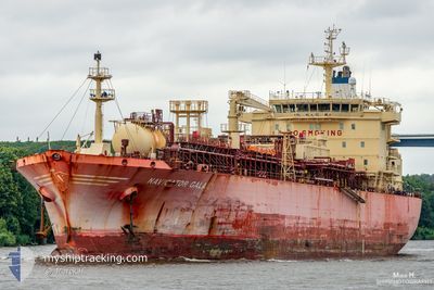
The vessel NAVIGATOR GALAXY (IMO: 9536363, MMSI: 636015946) is a Lpg Tanker that was built in 2011 ( 13 Age ). It's sailing under the flag of [LR] Liberia.
In this page you can find informations about the vessels current position, last detected port calls, and current voyage information. If the vessels is not in coverage by AIS you will find the latest position.
The current position of NAVIGATOR GALAXY is detected by our AIS receivers and we are not responsible for the reliability of the data. The last position was recorded while the vessel was in Coverage by the Ais receivers of our vessel tracking app.
The current draught of NAVIGATOR GALAXY as reported by AIS is 8.9 meters
Weather
| Temperature | 15.6°C / 60.08°F |
|---|---|
| Wind Speed | 19 knots |
| Direction | 313° NW |
| Pressure | 1017.8 hPa |
| Humidity | 90.5 % |
| Cloud Coverage | 100 % |
Featured Company
Last Port Calls
| Port | Arrival | Departure | Time In Port |
|---|---|---|---|
| 2024-05-03 07:54 | 2024-05-04 04:50 | 20 h | |
| 2024-04-14 22:31 | 2024-04-16 00:13 | 1 d | |
| 2024-04-10 05:44 | 2024-04-10 20:14 | 14 h | |
| 2024-04-05 02:48 | 2024-04-06 08:22 | 1 d | |
| 2024-04-03 01:35 | 2024-04-03 03:05 | 1 h | |
| 2024-03-28 08:24 | 2024-04-02 17:35 | 5 d | |
| 2024-03-21 20:43 | 2024-03-23 12:26 | 1 d | |
| 2024-03-20 06:40 | 2024-03-21 18:17 | 1 d | |
| 2024-03-13 04:30 | 2024-03-14 10:42 | 1 d | |
| 2024-03-05 05:57 | 2024-03-07 06:24 | 2 d |
Last Trips
| Origin | Departure | Destination | Arrival | Distance | |
|---|---|---|---|---|---|
| 2024-04-16 00:13 | 2024-05-03 07:54 | 5143.11 nm | |||
| 2024-04-10 20:14 | 2024-04-14 22:31 | 978.65 nm | |||
| 2024-04-06 08:22 | 2024-04-10 05:44 | 1070.43 nm | |||
| 2024-04-03 03:05 | 2024-04-05 02:48 | 468.14 nm | |||
| 2024-04-02 17:35 | 2024-04-03 01:35 | 84.66 nm | |||
| 2024-03-23 12:26 | 2024-03-28 08:24 | 837.37 nm | |||
| 2024-03-21 18:17 | 2024-03-21 20:43 | 12.63 nm | |||
| 2024-03-14 10:42 | 2024-03-20 06:40 | 832.31 nm | |||
| 2024-03-07 06:24 | 2024-03-13 04:30 | 840.53 nm | |||
| 2024-03-03 14:41 | 2024-03-05 05:57 | 359.16 nm |
Events
| Heure | Evenement | Détails | Position/ Destination | Info |
|---|---|---|---|---|
| 2024-05-14 09:57 | Etat Changé | Default Under way using engine |
38.38778 / -26.86986
FRBOD
|
Vitesse: 13.4 kn Parcours: 37.6° |
| 2024-05-14 09:51 | Hors de la zone couverte |
38.37020 / -26.88592
North Atlantic Ocean
FRBOD
|
Vitesse: 13.4 kn Parcours: 37.6° |
|
| 2024-05-14 08:55 | Etat Changé | Under way using engine Default |
38.24783 / -27.09297
FRBOD
|
Vitesse: 13.5 kn Parcours: 61° |
| 2024-05-14 08:51 | Etat Changé | Default Under way using engine |
38.24069 / -27.10796
FRBOD
|
Vitesse: 13.5 kn Parcours: 58.8° |
| 2024-05-14 08:36 | Etat Changé | Under way using engine Default |
38.21123 / -27.17377
FRBOD
|
Vitesse: 12.8 kn Parcours: 59° |
| 2024-05-14 08:26 | Etat Changé | Default Under way using engine |
38.19446 / -27.20997
FRBOD
|
Vitesse: 12.2 kn Parcours: 58.9° |
| 2024-05-14 08:17 | Etat Changé | Under way using engine Default |
38.17770 / -27.24470
FRBOD
|
Vitesse: 12.2 kn Parcours: 58° |
| 2024-05-14 08:08 | Etat Changé | Default Under way using engine |
38.16273 / -27.27535
FRBOD
|
Vitesse: 12.5 kn Parcours: 58.8° |
| 2024-05-14 08:01 | Etat Changé | Under way using engine Default |
38.14954 / -27.30203
FRBOD
|
Vitesse: 12.3 kn Parcours: 56° |
| 2024-05-14 07:25 | Etat Changé | Default Under way using engine |
38.08328 / -27.42898
FRBOD
|
Vitesse: 12.2 kn Parcours: 58.1° |