
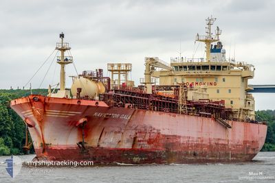
NAVIGATOR GALAXY
Lpg Tanker
Current Trip
| Time Travelled | 17 days |
|---|---|
| Remaining Time | 1 day |
| Distance Travelled | 4518.61 nm |
| Remaining Distance | 549.97 nm |
| AVG Speed | 12.6 Knots |
| MAX Speed | 18.1 Knots |
| AVG Wind | 11.1 knots |
| MAX Wind | 24 knots |
| MIN Temp | 10.8°C / 51.44°F |
| MAX Temp | 33.6°C / 92.48°F |
| Dybgang | 7.1 m |
| Position Modtaget | Nu |
Current Position
| Longitude | 2.11701° |
|---|---|
| Latitude | 51.27670° |
| Status | Under way using engine |
| Fart | 11.3 Knots |
| Kurs | 8.2° |
| Område | North Sea |
| Station | T-AIS |
| Position Modtaget | Nu |
Info
Information
The current position of NAVIGATOR GALAXY is in North Sea with coordinates 51.27670° / 2.11701° as reported on 2024-05-22 06:32 by AIS to our vessel tracker app. The vessel's current speed is 11.3 Knots and is heading at the port of GOTEBORG. The estimated time of arrival as calculated by MyShipTracking vessel tracking app is 2024-05-24 05:39 LT
The vessel NAVIGATOR GALAXY (IMO: 9536363, MMSI: 636015946) is a Lpg Tanker that was built in 2011 ( 13 år gamle ). It's sailing under the flag of [LR] Liberia.
In this page you can find informations about the vessels current position, last detected port calls, and current voyage information. If the vessels is not in coverage by AIS you will find the latest position.
The current position of NAVIGATOR GALAXY is detected by our AIS receivers and we are not responsible for the reliability of the data. The last position was recorded while the vessel was in Coverage by the Ais receivers of our vessel tracking app.
The current draught of NAVIGATOR GALAXY as reported by AIS is 7.1 meters
Weather
| Temperature | 12.7°C / 54.86°F |
|---|---|
| Wind Speed | 16 knots |
| Direction | 235° SW |
| Pressure | 1005.5 hPa |
| Humidity | 93.5 % |
| Cloud Coverage | 95 % |
Featured Company
Last Port Calls
| Port | Arrival | Departure | Time In Port |
|---|---|---|---|
| 2024-05-03 11:54 | 2024-05-04 08:50 | 20 h | |
| 2024-04-14 20:31 | 2024-04-15 22:13 | 1 d | |
| 2024-04-10 03:44 | 2024-04-10 18:14 | 14 h | |
| 2024-04-05 00:48 | 2024-04-06 06:22 | 1 d | |
| 2024-04-02 23:35 | 2024-04-03 01:05 | 1 h | |
| 2024-03-28 07:24 | 2024-04-02 15:35 | 5 d | |
| 2024-03-21 19:43 | 2024-03-23 11:26 | 1 d | |
| 2024-03-20 05:40 | 2024-03-21 17:17 | 1 d | |
| 2024-03-13 03:30 | 2024-03-14 09:42 | 1 d | |
| 2024-03-05 04:57 | 2024-03-07 05:24 | 2 d |
Last Trips
| Origin | Departure | Destination | Arrival | Distance | |
|---|---|---|---|---|---|
| 2024-04-16 00:13 | 2024-05-03 07:54 | 5143.11 nm | |||
| 2024-04-10 20:14 | 2024-04-14 22:31 | 978.65 nm | |||
| 2024-04-06 08:22 | 2024-04-10 05:44 | 1070.43 nm | |||
| 2024-04-03 03:05 | 2024-04-05 02:48 | 468.14 nm | |||
| 2024-04-02 17:35 | 2024-04-03 01:35 | 84.66 nm | |||
| 2024-03-23 12:26 | 2024-03-28 08:24 | 837.37 nm | |||
| 2024-03-21 18:17 | 2024-03-21 20:43 | 12.63 nm | |||
| 2024-03-14 10:42 | 2024-03-20 06:40 | 832.31 nm | |||
| 2024-03-07 06:24 | 2024-03-13 04:30 | 840.53 nm | |||
| 2024-03-03 14:41 | 2024-03-05 05:57 | 359.16 nm |
Events
| Tid | Hændelsen | Detaljer | Position / Dest | Info |
|---|---|---|---|---|
| 2024-05-22 05:02 | Ændre havområde | French part of the North Sea United Kingdom part of the North Sea |
51.12143 / 1.76676
North Sea
SEGOT
|
Fart: 11.4 kn Kurs: 61.7° |
| 2024-05-22 04:56 | Fundet i havområde | United Kingdom part of the North Sea |
51.11047 / 1.74213
North Sea
SEGOT
|
Fart: 11.7 kn Kurs: 43° |
| 2024-05-22 04:14 | Fundet i havområde | French part of the North Sea |
51.00751 / 1.60258
North Sea
SEGOT
|
Fart: 12.1 kn Kurs: 39.3° |
| 2024-05-22 01:54 | Status er ændret | Under way using engine Default |
50.60652 / 1.20167
SEGOT
|
Fart: 13.1 kn Kurs: 49° |
| 2024-05-22 01:48 | Status er ændret | Default Under way using engine |
50.59444 / 1.17962
SEGOT
|
Fart: 12.9 kn Kurs: 49.6° |
| 2024-05-22 01:00 | Fundet i havområde | French part of the English Channel |
50.48625 / .97264
English Channel
SEGOT
|
Fart: 13.1 kn Kurs: 72.8° |
| 2024-05-21 19:34 | Fundet i havområde | United Kingdom part of the English Channel |
50.15198 / -.87728
English Channel
SEGOT
|
Fart: 15.9 kn Kurs: 74.9° |
| 2024-05-21 19:34 | Status er ændret | Under way using engine Default |
50.15198 / -.87728
SEGOT
|
Fart: 16 kn Kurs: 74° |
| 2024-05-21 19:27 | Indenfor Dækning |
50.15198 / -.87728
English Channel
SEGOT
|
Fart: 15.9 kn Kurs: 74.9° |
|
| 2024-05-21 17:29 | Udenfor Dækning |
50.02584 / -1.71445
English Channel
SEGOT
|
Fart: 15.5 kn Kurs: 79° |