
M.MICKIE HARPER
Tanker A
Current Trip
CN BHX
| Time Travelled | 9 days |
|---|---|
| Remaining Time | --- |
| Distance Travelled | 3150.12 nm |
| Remaining Distance | --- |
| AVG Speed | 13.4 Noeuds |
| MAX Speed | 16.4 Noeuds |
| AVG Wind | 13 knots |
| MAX Wind | 25 knots |
| MIN Temp | 20.6°C / 69.08°F |
| MAX Temp | 29.6°C / 85.28°F |
| Tirant d eau | 10.9 m |
| Position reçue | 9 d depuis |
Current Position
| Longitude | 151.53357° |
|---|---|
| Latitude | -23.70171° |
| Etat | Under way using engine |
| Vitesse | 14.5 Noeuds |
| Parcours | 0.5° |
| Zone | Coral Sea |
| Station | T-AIS |
| Position reçue | 9 d depuis |
Info
Information
The current position of M.MICKIE HARPER is in Coral Sea with coordinates -23.70171° / 151.53357° as reported on 2024-04-29 12:35 by AIS to our vessel tracker app. The vessel's current speed is 14.5 Noeuds
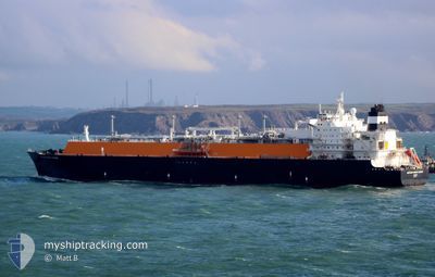
The vessel M.MICKIE HARPER (IMO: 9520376, MMSI: 352346000) is a Tanker A It's sailing under the flag of [PA] Panama.
In this page you can find informations about the vessels current position, last detected port calls, and current voyage information. If the vessels is not in coverage by AIS you will find the latest position.
The current position of M.MICKIE HARPER is detected by our AIS receivers and we are not responsible for the reliability of the data. The last position was recorded while the vessel was in Coverage by the Ais receivers of our vessel tracking app.
The current draught of M.MICKIE HARPER as reported by AIS is 10.9 meters
Weather
| Temperature | 27.2°C / 80.96°F |
|---|---|
| Wind Speed | 20 knots |
| Direction | 41° NE |
| Pressure | 1014 hPa |
| Humidity | 70 % |
| Cloud Coverage | 88 % |
Featured Company
Most Visited Ports (Last year)
| Port | Arrivals | |
|---|---|---|
| 11 | ||
| 2 | ||
| 1 | ||
| 1 | ||
| 1 | ||
| 1 |
Last Trips
| Origin | Departure | Destination | Arrival | Distance | |
|---|---|---|---|---|---|
| 2024-04-01 18:05 | 2024-04-28 15:22 | 7810.20 nm | |||
| 2024-03-20 13:17 | 2024-03-31 15:23 | 3939.21 nm | |||
| 2024-03-06 17:14 | 2024-03-19 10:20 | 3989.61 nm | |||
| 2024-02-21 14:35 | 2024-03-05 08:32 | 4204.87 nm |
Events
| Heure | Evenement | Détails | Position/ Destination | Info |
|---|---|---|---|---|
| 2024-04-29 12:41 | Etat Changé | Default Under way using engine |
-23.67799 / 151.53450
CN BHX
|
Vitesse: 14.5 kn Parcours: 0.5° |
| 2024-04-29 12:35 | Hors de la zone couverte |
-23.70171 / 151.53357
Coral Sea
CN BHX
|
Vitesse: 14.5 kn Parcours: 0.5° |
|
| 2024-04-29 12:15 | Etat Changé | Under way using engine Default |
-23.78003 / 151.53078
CN BHX
|
Vitesse: 12.5 kn Parcours: 355° |
| 2024-04-29 12:03 | Etat Changé | Default Under way using engine |
-23.81829 / 151.53336
CN BHX
|
Vitesse: 11 kn Parcours: 18.3° |
| 2024-04-29 10:16 | PORT DE DEPART |
|
-23.84326 / 151.29743
CN BHX
|
Vitesse: 9.3 kn Parcours: 114° |
| 2024-04-29 09:41 | Etat Changé | Under way using engine Default |
-23.80595 / 151.22730
[AU] GLADSTONE
|
Vitesse: 6.5 kn Parcours: 114° |
| 2024-04-29 09:39 | Etat Changé | Default Under way using engine |
-23.80493 / 151.22478
[AU] GLADSTONE
|
Vitesse: 6.5 kn Parcours: 133° |
| 2024-04-29 09:20 | Démarrage |
-23.78479 / 151.19830
[AU] GLADSTONE
|
Vitesse: 3.2 kn Parcours: 132° |
|
| 2024-04-29 09:09 | Tirant d'eau modifié | 10.9 9.1 |
-23.77903 / 151.19533
[AU] GLADSTONE
|
Vitesse: 1 kn Parcours: 142° |
| 2024-04-29 09:09 | Changement de destination | CN BHX AU GLT |
-23.77903 / 151.19533
[AU] GLADSTONE
|
Vitesse: 1 kn Parcours: 142° |