
M.MICKIE HARPER
Tanker D
Current Trip
| Time Travelled | 1 day |
|---|---|
| Remaining Time | --- |
| Distance Travelled | 47.51 nm |
| Remaining Distance | 1170.98 nm |
| AVG Speed | 11.1 Knots |
| MAX Speed | 13 Knots |
| AVG Wind | 5.9 knots |
| MAX Wind | 7 knots |
| MIN Temp | 17.9°C / 64.22°F |
| MAX Temp | 20.1°C / 68.18°F |
| Draught | 11.4 m |
| Position Received | 2024-12-06 12:46 |
Current Position
| Longitude | --- |
|---|---|
| Latitude | --- |
| Status | Under way using engine |
| Speed | 12.3 Knots |
| Course | 39.3° |
| Area | Indian Ocean |
| Station | T-AIS |
| Position Received | 2024-12-06 12:46 |
Info
Information
The current position of M.MICKIE HARPER is in Indian Ocean with coordinates -16.57578° / 117.67349° as reported on 2024-12-06 12:46 by AIS to our vessel tracker app. The vessel's current speed is 12.3 Knots and is heading at the port of DALIAN.
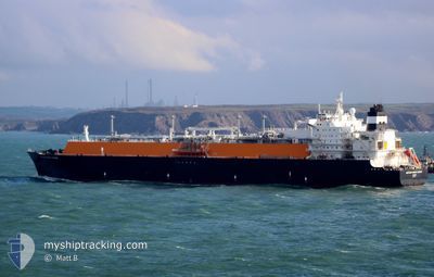
The vessel M.MICKIE HARPER (IMO: 9520376, MMSI: 352346000) is a Tanker D It's sailing under the flag of [PA] Panama.
In this page you can find informations about the vessels current position, last detected port calls, and current voyage information. If the vessels is not in coverage by AIS you will find the latest position.
The current position of M.MICKIE HARPER is detected by our AIS receivers and we are not responsible for the reliability of the data. The last position was recorded while the vessel was in Coverage by the Ais receivers of our vessel tracking app.
The current draught of M.MICKIE HARPER as reported by AIS is 11.4 meters
Weather
| Temperature | 23°C / 73.4°F |
|---|---|
| Wind Speed | 25 knots |
| Direction | 31° NNE |
| Pressure | 1017.8 hPa |
| Humidity | 86.7 % |
| Cloud Coverage | 100 % |
Featured Company
Last Port Calls
| Port | Arrival | Departure | Time In Port |
|---|---|---|---|
| 2025-01-13 00:17 | 2025-01-14 00:04 | 23 h | |
| 2024-12-18 03:28 | 2024-12-19 04:29 | 1 d | |
| 2024-12-04 12:02 | 2024-12-05 12:17 | 1 d | |
| 2024-11-26 01:27 | 2024-11-27 03:39 | 1 d | |
| 2024-11-07 18:31 | 2024-11-08 23:48 | 1 d |
Most Visited Ports (Last year)
| Port | Arrivals | |
|---|---|---|
| 6 | ||
| 4 | ||
| 2 | ||
| 1 | ||
| 1 | ||
| 1 |
Last Trips
| Origin | Departure | Destination | Arrival | Distance | |
|---|---|---|---|---|---|
| 2024-12-19 12:29 | 2025-01-13 08:17 | 4878.61 nm | |||
| 2024-12-05 20:17 | 2024-12-18 11:28 | 3565.44 nm | |||
| 2024-11-27 11:39 | 2024-12-04 20:02 | 1894.34 nm | |||
| 2024-11-09 09:48 | 2024-11-26 09:27 | 4789.97 nm | |||
| 2024-10-04 08:08 | 2024-11-08 04:31 | 11637.67 nm |
Events
| Time | Event | Details | Position / Dest | Info |
|---|---|---|---|---|
| 2025-01-14 00:04 | PORT DEPARTURE |
|
22.82619 / 120.18667
CN DAG
|
Speed: 4 kn Course: 321° |
| 2025-01-13 23:55 | START Moving |
22.81822 / 120.19488
[TW] YUNG AN
|
Speed: 4.2 kn Course: 322° |
|
| 2025-01-13 00:45 | STOP Moving |
22.81181 / 120.20093
[TW] YUNG AN
|
Speed: 0.3 kn Course: 350° |
|
| 2025-01-13 00:17 | PORT ARRIVAL |
|
22.81666 / 120.19587
[TW] YUNG AN
|
Speed: 3.1 kn Course: 141° |
| 2025-01-09 06:07 | START Moving |
21.78634 / 119.64444
CN DAG
|
Speed: 3.6 kn Course: 49° |
|
| 2025-01-09 00:21 | STOP Moving |
21.86872 / 119.58369
CN DAG
|
Speed: Course: 130° |
|
| 2025-01-08 12:32 | START Moving |
21.81335 / 119.66179
CN DAG
|
Speed: 4.4 kn Course: 68° |
|
| 2025-01-08 08:08 | STOP Moving |
21.86333 / 119.59666
CN DAG
|
Speed: Course: -1° |
|
| 2025-01-08 00:50 | START Moving |
21.79281 / 119.72900
CN DAG
|
Speed: 4.1 kn Course: 309° |
|
| 2025-01-08 00:07 | STOP Moving |
21.80007 / 119.73847
CN DAG
|
Speed: Course: 176° |