
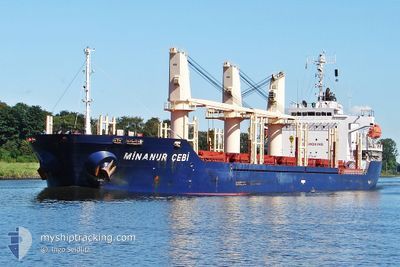
MINANUR CEBI 1
Bulk Carrier
Current Trip
| Time Travelled | 8 days |
|---|---|
| Remaining Time | --- |
| Distance Travelled | 892.05 nm |
| Remaining Distance | --- |
| AVG Speed | 10.4 Noeuds |
| MAX Speed | 12.3 Noeuds |
| AVG Wind | 10.7 knots |
| MAX Wind | 29 knots |
| MIN Temp | 4.8°C / 40.64°F |
| MAX Temp | 12.1°C / 53.78°F |
| Tirant d eau | 6.3 m |
| Position reçue | 2024-04-06 13:04 |
Current Position
| Longitude | -92.96493° |
|---|---|
| Latitude | 22.03375° |
| Etat | Under way using engine |
| Vitesse | 11.6 Noeuds |
| Parcours | 87.1° |
| Zone | Gulf of Mexico |
| Station | T-AIS |
| Position reçue | 2024-04-06 13:04 |
Info
Information
The current position of MINANUR CEBI 1 is in Gulf of Mexico with coordinates 22.03375° / -92.96493° as reported on 2024-04-06 13:04 by AIS to our vessel tracker app. The vessel's current speed is 11.6 Noeuds and is heading at the port of TAMPICO.
The vessel MINANUR CEBI 1 (IMO: 9480564, MMSI: 255806283) is a Bulk Carrier that was built in 2011 ( 13 Age ). It's sailing under the flag of [PT] Portugal.
In this page you can find informations about the vessels current position, last detected port calls, and current voyage information. If the vessels is not in coverage by AIS you will find the latest position.
The current position of MINANUR CEBI 1 is detected by our AIS receivers and we are not responsible for the reliability of the data. The last position was recorded while the vessel was in Coverage by the Ais receivers of our vessel tracking app.
The current draught of MINANUR CEBI 1 as reported by AIS is 6.3 meters
Weather
| Temperature | 9.2°C / 48.56°F |
|---|---|
| Wind Speed | 14 knots |
| Direction | 11° N |
| Pressure | 1017.6 hPa |
| Humidity | 87.1 % |
| Cloud Coverage | 100 % |
Featured Company
Last Port Calls
| Port | Arrival | Departure | Time In Port |
|---|---|---|---|
| 2024-05-01 00:58 | 2024-05-09 11:38 | 8 d | |
| 2024-04-13 21:48 | 2024-04-13 22:00 | 12 m | |
| 2024-04-13 08:48 | 2024-04-13 08:56 | 8 m | |
| 2024-04-10 09:59 | 2024-04-13 02:56 | 2 d | |
| 2024-04-02 14:51 | 2024-04-04 20:17 | 2 d | |
| 2024-03-24 15:58 | 2024-03-31 05:58 | 6 d | |
| 2024-03-03 23:11 |
Most Visited Ports (Last year)
| Port | Arrivals | |
|---|---|---|
| 2 | ||
| 2 | ||
| 1 | ||
| 1 | ||
| 1 | ||
| 1 |
Last Trips
| Origin | Departure | Destination | Arrival | Distance | |
|---|---|---|---|---|---|
| 2024-04-13 17:00 | 2024-05-01 00:58 | 4398.78 nm | |||
| 2024-04-13 03:56 | 2024-04-13 16:48 | 6.31 nm | |||
| 2024-04-12 21:56 | 2024-04-13 03:48 | 38.60 nm | |||
| 2024-04-04 14:17 | 2024-04-10 04:59 | 1248.32 nm | |||
| 2024-03-31 00:58 | 2024-04-02 08:51 | 508.38 nm | |||
| 2024-02-20 02:41 | 2024-03-03 20:11 | 467.65 nm |
Events
| Heure | Evenement | Détails | Position/ Destination | Info |
|---|---|---|---|---|
| 2024-05-17 01:09 | Démarrage |
60.00424 / -6.84835
TAMPICO OPL
|
Vitesse: 4.7 kn Parcours: 29° |
|
| 2024-05-16 15:03 | Arret |
60.13459 / -6.66719
TAMPICO OPL
|
Vitesse: 0.3 kn Parcours: 275° |
|
| 2024-05-16 01:32 | Arret |
60.21061 / -6.47194
TAMPICO OPL
|
Vitesse: 0.3 kn Parcours: 194° |
|
| 2024-05-15 18:15 | Arret |
60.24367 / -6.30917
TAMPICO OPL
|
Vitesse: 0.2 kn Parcours: 123° |
|
| 2024-05-15 15:51 | Démarrage |
60.12654 / -6.88760
TAMPICO OPL
|
Vitesse: 11 kn Parcours: 79° |
|
| 2024-05-15 14:44 | Arret |
60.11148 / -6.90094
TAMPICO OPL
|
Vitesse: 0.3 kn Parcours: 236° |
|
| 2024-05-15 07:03 | Arret |
60.14114 / -6.66683
TAMPICO OPL
|
Vitesse: 0.2 kn Parcours: 10° |
|
| 2024-05-09 11:38 | PORT DE DEPART |
|
64.34470 / -21.78010
TAMPICO OPL
|
Vitesse: 5.6 kn Parcours: 181° |
| 2024-05-09 11:36 | Démarrage |
64.35049 / -21.77832
[IS] GRUNDARTANGI
|
Vitesse: 5.6 kn Parcours: 181° |