
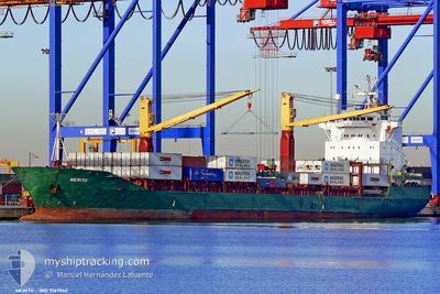
MERITO
Container Ship
Current Trip
| Time Travelled | 3 days |
|---|---|
| Remaining Time | --- |
| Distance Travelled | 683.55 nm |
| Remaining Distance | --- |
| AVG Speed | 12.4 Noeuds |
| MAX Speed | 14 Noeuds |
| AVG Wind | 11.4 knots |
| MAX Wind | 24 knots |
| MIN Temp | 12.6°C / 54.68°F |
| MAX Temp | 17°C / 62.6°F |
| Tirant d eau | 8.6 m |
| Position reçue | 2 d depuis |
Current Position
| Longitude | --- |
|---|---|
| Latitude | --- |
| Etat | Under way using engine |
| Vitesse | 12.9 Noeuds |
| Parcours | 262.6° |
| Zone | Tyrrhenian Sea |
| Station | T-AIS |
| Position reçue | 2 d depuis |
Info
Information
The current position of MERITO is in Tyrrhenian Sea with coordinates 38.26040° / 12.25649° as reported on 2025-01-08 13:51 by AIS to our vessel tracker app. The vessel's current speed is 12.9 Noeuds
The vessel MERITO (IMO: 9167942, MMSI: 249096000) is a Container Ship that was built in 1998 ( 27 Age ). It's sailing under the flag of [MT] Malta.
In this page you can find informations about the vessels current position, last detected port calls, and current voyage information. If the vessels is not in coverage by AIS you will find the latest position.
The current position of MERITO is detected by our AIS receivers and we are not responsible for the reliability of the data. The last position was recorded while the vessel was in Coverage by the Ais receivers of our vessel tracking app.
The current draught of MERITO as reported by AIS is 8.6 meters
Weather
| Temperature | 16.3°C / 61.34°F |
|---|---|
| Wind Speed | 12 knots |
| Direction | 241° WSW |
| Pressure | 1023.5 hPa |
| Humidity | 82.5 % |
| Cloud Coverage | 66 % |
Featured Company
Last Port Calls
| Port | Arrival | Departure | Time In Port |
|---|---|---|---|
| 2025-01-07 17:53 | 2025-01-08 00:38 | 6 h | |
| 2025-01-04 01:32 | 2025-01-04 07:12 | 5 h | |
| 2025-01-02 21:52 | 2025-01-03 08:44 | 10 h | |
| 2024-12-31 22:06 | 2025-01-01 17:57 | 19 h | |
| 2024-12-30 06:20 | 2024-12-30 15:16 | 8 h | |
| 2024-12-27 03:19 | 2024-12-28 03:59 | 1 d | |
| 2024-12-25 00:45 | 2024-12-25 02:03 | 1 h | |
| 2024-12-19 21:59 | 2024-12-21 16:04 | 1 d | |
| 2024-12-10 22:13 | 2024-12-18 07:25 | 7 d | |
| 2024-12-07 21:20 | 2024-12-08 11:18 | 13 h |
Last Trips
| Origin | Departure | Destination | Arrival | Distance | |
|---|---|---|---|---|---|
| 2025-01-04 10:12 | 2025-01-07 18:53 | 712.03 nm | |||
| 2025-01-03 11:44 | 2025-01-04 04:32 | 213.61 nm | |||
| 2025-01-01 20:57 | 2025-01-03 00:52 | 116.02 nm | |||
| 2024-12-30 17:16 | 2025-01-01 01:06 | 186.77 nm | |||
| 2024-12-28 07:59 | 2024-12-30 08:20 | 635.13 nm | |||
| 2024-12-25 05:03 | 2024-12-27 07:19 | 574.71 nm | |||
| 2024-12-21 17:04 | 2024-12-25 03:45 | 861.42 nm | |||
| 2024-12-18 08:25 | 2024-12-19 22:59 | 622.85 nm | |||
| 2024-12-08 12:18 | 2024-12-10 23:13 | 625.57 nm | |||
| 2024-12-07 07:57 | 2024-12-07 22:20 | 187.85 nm |
Events
| Heure | Evenement | Détails | Position/ Destination | Info |
|---|---|---|---|---|
| 2025-01-08 13:51 | Hors de la zone couverte |
38.26040 / 12.25649
Tyrrhenian Sea
DZALG
|
Vitesse: 12.9 kn Parcours: 262.6° |
|
| 2025-01-08 12:50 | Etat Changé | Under way using engine Default |
38.30353 / 12.53604
DZALG
|
Vitesse: 13.4 kn Parcours: 260° |
| 2025-01-08 12:31 | Etat Changé | Default Under way using engine |
38.31539 / 12.62340
DZALG
|
Vitesse: 12.7 kn Parcours: 271.4° |
| 2025-01-08 10:30 | Changement d'ETA | 2025/01/09 21:00 2025/01/09 22:00 |
38.32921 / 13.16726
DZALG
|
Vitesse: 12.3 kn Parcours: 270.7° |
| 2025-01-08 08:06 | Changement d'ETA | 2025/01/09 22:00 2025/01/10 12:00 |
38.32365 / 13.80971
DZALG
|
Vitesse: 13.3 kn Parcours: 270.4° |
| 2025-01-08 06:58 | Etat Changé | Under way using engine Default |
38.32038 / 14.13086
DZALG
|
Vitesse: 13.3 kn Parcours: 270° |
| 2025-01-08 06:58 | Dans la zone couverte |
38.32038 / 14.13086
Tyrrhenian Sea
DZALG
|
Vitesse: 13.4 kn Parcours: 273° |
|
| 2025-01-08 06:04 | Etat Changé | Default Under way using engine |
38.32002 / 14.38745
DZALG
|
Vitesse: 13.1 kn Parcours: 269.6° |
| 2025-01-08 05:28 | Hors de la zone couverte |
38.31737 / 14.55660
Tyrrhenian Sea
DZALG
|
Vitesse: 13.1 kn Parcours: 269.6° |
|
| 2025-01-08 00:52 | Tirant d'eau modifié | 8.6 8.8 |
38.46401 / 15.85255
DZALG
|
Vitesse: 12.6 kn Parcours: 257.8° |