
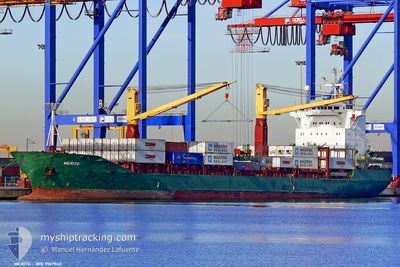
MERITO
Container Ship
Current Trip
| Time Travelled | 17 h, 41 mins |
|---|---|
| Remaining Time | --- |
| Distance Travelled | 169.30 nm |
| Remaining Distance | --- |
| AVG Speed | 13.7 Knots |
| MAX Speed | 14.8 Knots |
| AVG Wind | 14 knots |
| MAX Wind | 22.2 knots |
| MIN Temp | 9.6°C / 49.28°F |
| MAX Temp | 15.7°C / 60.26°F |
| Dybgang | 8.7 m |
| Position Modtaget | 11 h, 42 m siden |
Current Position
| Longitude | 16.32794° |
|---|---|
| Latitude | 37.64377° |
| Status | Under way using engine |
| Fart | 14.2 Knots |
| Kurs | 106.8° |
| Område | Ionian Sea |
| Station | T-AIS |
| Position Modtaget | 11 h, 42 m siden |
Info
Information
The current position of MERITO is in Ionian Sea with coordinates 37.64377° / 16.32794° as reported on 2024-04-20 02:24 by AIS to our vessel tracker app. The vessel's current speed is 14.2 Knots and is heading at the port of BURGAS. The estimated time of arrival as calculated by MyShipTracking vessel tracking app is 2024-04-23 02:00 LT
The vessel MERITO (IMO: 9167942, MMSI: 249096000) is a Container Ship that was built in 1998 ( 26 år gamle ). It's sailing under the flag of [MT] Malta.
In this page you can find informations about the vessels current position, last detected port calls, and current voyage information. If the vessels is not in coverage by AIS you will find the latest position.
The current position of MERITO is detected by our AIS receivers and we are not responsible for the reliability of the data. The last position was recorded while the vessel was in Coverage by the Ais receivers of our vessel tracking app.
The current draught of MERITO as reported by AIS is 8.7 meters
Weather
| Temperature | 15.6°C / 60.08°F |
|---|---|
| Wind Speed | 14 knots |
| Direction | 304° NW |
| Pressure | 1013.3 hPa |
| Humidity | 61.1 % |
| Cloud Coverage | --- |
Featured Company
Last Port Calls
| Port | Arrival | Departure | Time In Port |
|---|---|---|---|
| 2024-04-19 04:23 | 2024-04-19 20:25 | 16 h | |
| 2024-04-17 18:46 | 2024-04-18 18:10 | 23 h | |
| 2024-04-15 08:04 | 2024-04-16 19:35 | 1 d | |
| 2024-04-12 03:47 | 2024-04-13 21:22 | 1 d | |
| 2024-04-11 04:21 | 2024-04-11 16:03 | 11 h | |
| 2024-04-09 04:05 | 2024-04-10 19:53 | 1 d | |
| 2024-04-07 13:52 | 2024-04-08 16:57 | 1 d | |
| 2024-03-30 15:51 | 2024-04-04 04:09 | 4 d | |
| 2024-03-23 01:32 | 2024-03-23 18:19 | 16 h | |
| 2024-03-14 20:41 | 2024-03-19 22:16 | 5 d |
Last Trips
| Origin | Departure | Destination | Arrival | Distance | |
|---|---|---|---|---|---|
| 2024-04-18 20:10 | 2024-04-19 06:23 | 143.75 nm | |||
| 2024-04-16 21:35 | 2024-04-17 20:46 | 311.43 nm | |||
| 2024-04-13 23:22 | 2024-04-15 10:04 | 445.56 nm | |||
| 2024-04-11 18:03 | 2024-04-12 05:47 | 141.43 nm | |||
| 2024-04-10 21:53 | 2024-04-11 06:21 | 65.03 nm | |||
| 2024-04-08 18:57 | 2024-04-09 06:05 | 89.06 nm | |||
| 2024-04-04 05:09 | 2024-04-07 15:52 | 664.23 nm | |||
| 2024-03-23 19:19 | 2024-03-30 16:51 | 580.84 nm | |||
| 2024-03-19 23:16 | 2024-03-23 02:32 | 283.96 nm | |||
| 2024-03-10 06:32 | 2024-03-14 21:41 | 277.47 nm |
Events
| Tid | Hændelsen | Detaljer | Position / Dest | Info |
|---|---|---|---|---|
| 2024-04-20 02:28 | Status er ændret | Default Under way using engine |
37.63878 / 16.34934
BGBOJ
|
Fart: 14.2 kn Kurs: 106.8° |
| 2024-04-20 02:24 | Udenfor Dækning |
37.64377 / 16.32794
Ionian Sea
BGBOJ
|
Fart: 14.2 kn Kurs: 106.8° |
|
| 2024-04-20 02:19 | Status er ændret | Under way using engine Default |
37.64856 / 16.30747
BGBOJ
|
Fart: 14.1 kn Kurs: 106° |
| 2024-04-20 02:15 | Status er ændret | Default Under way using engine |
37.65280 / 16.28831
BGBOJ
|
Fart: 14.2 kn Kurs: 106° |
| 2024-04-20 02:09 | Status er ændret | Under way using engine Default |
37.65948 / 16.25855
BGBOJ
|
Fart: 14.2 kn Kurs: 106° |
| 2024-04-20 02:07 | Status er ændret | Default Under way using engine |
37.66182 / 16.24797
BGBOJ
|
Fart: 14.3 kn Kurs: 105.5° |
| 2024-04-19 21:53 | Ændre havområde | Italian part of the Ionian Sea Italian part of the Tyrrhenian Sea |
38.25430 / 15.64370
Ionian Sea
BGBOJ
|
Fart: 14.4 kn Kurs: 246.5° |
| 2024-04-19 21:50 | Status er ændret | Under way using engine Default |
38.25824 / 15.65461
BGBOJ
|
Fart: 13.7 kn Kurs: 240° |
| 2024-04-19 21:48 | Status er ændret | Default Under way using engine |
38.26171 / 15.66338
BGBOJ
|
Fart: 14.2 kn Kurs: 208.1° |
| 2024-04-19 21:05 | Dybgangen er ændret | 8.7 6.1 |
38.39815 / 15.77722
BGBOJ
|
Fart: 13.2 kn Kurs: 211.7° |