
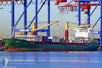
MERITO
Container Ship
Current Trip
| Trip Time | 3 days |
|---|---|
| Trip Distance | 990.26 nm |
| AVG Speed | 12.4 Knopen |
| MAX Speed | 16 Knopen |
| Diepgang | 8.7 M |
| AVG Wind | 11.2 knots |
| MAX Wind | 28.8 knots |
| MIN Temp | 9.6°C / 49.28°F |
| MAX Temp | 17.3°C / 63.14°F |
| Positie ontvangen | 1 d geleden |
Current Position
| Lengtegraad | 29.09830° |
|---|---|
| Breedtegraat | 41.49973° |
| Status | Under way using engine |
| Snelheid | 11.1 Knopen |
| Koers | 326.4° |
| Gebied | Black Sea |
| Station | T-AIS |
| Positie ontvangen | 1 d geleden |
Info
Information
The current position of MERITO is in Black Sea with coordinates 41.49973° / 29.09830° as reported on 2024-04-22 19:36 by AIS to our vessel tracker app. The vessel's current speed is 11.1 Knopen and is currently inside the port of BURGAS.
The vessel MERITO (IMO: 9167942, MMSI: 249096000) is a Container Ship that was built in 1998 ( 26 Jaar oud ). It's sailing under the flag of [MT] Malta.
In this page you can find informations about the vessels current position, last detected port calls, and current voyage information. If the vessels is not in coverage by AIS you will find the latest position.
The current position of MERITO is detected by our AIS receivers and we are not responsible for the reliability of the data. The last position was recorded while the vessel was in Coverage by the Ais receivers of our vessel tracking app.
The current draught of MERITO as reported by AIS is 8.7 meters
Weather
| Temperature | 12.2°C / 53.96°F |
|---|---|
| Wind Speed | 11 knots |
| Direction | 80° E |
| Pressure | 1007.7 hPa |
| Humidity | 91 % |
| Cloud Coverage | 100 % |
Featured Company
Last Port Calls
| Port | Arrival | Departure | Time In Port |
|---|---|---|---|
| 2024-04-23 15:08 | |||
| 2024-04-19 04:23 | 2024-04-19 20:25 | 16 h | |
| 2024-04-17 18:46 | 2024-04-18 18:10 | 23 h | |
| 2024-04-15 08:04 | 2024-04-16 19:35 | 1 d | |
| 2024-04-12 03:47 | 2024-04-13 21:22 | 1 d | |
| 2024-04-11 04:21 | 2024-04-11 16:03 | 11 h | |
| 2024-04-09 04:05 | 2024-04-10 19:53 | 1 d | |
| 2024-04-07 13:52 | 2024-04-08 16:57 | 1 d | |
| 2024-03-30 15:51 | 2024-04-04 04:09 | 4 d | |
| 2024-03-23 01:32 | 2024-03-23 18:19 | 16 h |
Last Trips
| Origin | Departure | Destination | Arrival | Distance | |
|---|---|---|---|---|---|
| 2024-04-19 22:25 | 2024-04-23 18:08 | 990.26 nm | |||
| 2024-04-18 20:10 | 2024-04-19 06:23 | 143.75 nm | |||
| 2024-04-16 21:35 | 2024-04-17 20:46 | 311.43 nm | |||
| 2024-04-13 23:22 | 2024-04-15 10:04 | 445.56 nm | |||
| 2024-04-11 18:03 | 2024-04-12 05:47 | 141.43 nm | |||
| 2024-04-10 21:53 | 2024-04-11 06:21 | 65.03 nm | |||
| 2024-04-08 18:57 | 2024-04-09 06:05 | 89.06 nm | |||
| 2024-04-04 05:09 | 2024-04-07 15:52 | 664.23 nm | |||
| 2024-03-23 19:19 | 2024-03-30 16:51 | 580.84 nm | |||
| 2024-03-19 23:16 | 2024-03-23 02:32 | 283.96 nm |
Events
| Tijd | Evenement | Details | Positie / Bestemming | Info |
|---|---|---|---|---|
| 2024-04-23 15:47 | Stop beweging |
42.48495 / 27.45790
[BG] BURGAS
|
Snelheid: 0.1 kn Koers: 21° |
|
| 2024-04-23 15:08 | Aankomsthaven |
|
42.47398 / 27.51067
[BG] BURGAS
|
Snelheid: 7.8 kn Koers: 253° |
| 2024-04-23 14:16 | Start beweging | 4.13 nm, South of POMORIE |
42.49141 / 27.60070
BGBOJ
|
Snelheid: 4.5 kn Koers: 252° |
| 2024-04-23 05:58 | Stop beweging | 3.94 nm, South West of POMORIE |
42.49617 / 27.59679
BGBOJ
|
Snelheid: Koers: 104° |
| 2024-04-22 19:40 | Status Changed | Default Under way using engine |
41.50811 / 29.08918
BGBOJ
|
Snelheid: 11.1 kn Koers: 326.4° |
| 2024-04-22 19:36 | Buitenbereik |
41.49973 / 29.09830
Black Sea
BGBOJ
|
Snelheid: 11.1 kn Koers: 326.4° |
|
| 2024-04-22 17:37 | Wijzig zee gebeid | Turkish part of the Black Sea Turkish part of the Sea of Marmara |
41.23403 / 29.15076
Black Sea
BGBOJ
|
Snelheid: 10.6 kn Koers: 42° |
| 2024-04-22 14:26 | Start beweging | 11.04 nm, South of YESILKOY |
40.77802 / 28.89026
BGBOJ
|
Snelheid: 3.1 kn Koers: 14° |
| 2024-04-22 08:52 | Stop beweging | 12.46 nm, South of YESILKOY |
40.75823 / 28.91199
BGBOJ
|
Snelheid: 0.3 kn Koers: 59° |
| 2024-04-22 01:50 | Status Changed | Under way using engine Default |
40.51593 / 27.01974
BGBOJ
|
Snelheid: 14.4 kn Koers: 68° |