
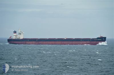
MARGRET OLDENDORFF
Cargo
Current Trip
| Time Travelled | 3 days |
|---|---|
| Remaining Time | 2 days |
| Distance Travelled | 1090.42 nm |
| Remaining Distance | 778.47 nm |
| AVG Speed | 11.8 Noeuds |
| MAX Speed | 13.9 Noeuds |
| AVG Wind | 5.4 knots |
| MAX Wind | 10.7 knots |
| MIN Temp | 26.9°C / 80.42°F |
| MAX Temp | 32.1°C / 89.78°F |
| Tirant d eau | 17.6 m |
| Position reçue | 2 d depuis |
Current Position
| Longitude | --- |
|---|---|
| Latitude | --- |
| Etat | Under way using engine |
| Vitesse | 12.9 Noeuds |
| Parcours | 353° |
| Zone | Indian Ocean |
| Station | T-AIS |
| Position reçue | 2 d depuis |
Information
The current position of MARGRET OLDENDORFF is in Indian Ocean with coordinates -14.30690° / 117.03067° as reported on 2025-03-06 21:52 by AIS to our vessel tracker app. The vessel's current speed is 12.9 Noeuds and is heading at the port of JURONG ISLAND. The estimated time of arrival as calculated by MyShipTracking vessel tracking app is 2025-03-11 11:48 LT
The vessel MARGRET OLDENDORFF (IMO: 9648908, MMSI: 636016352) is a Cargo It's sailing under the flag of [LR] Liberia.
In this page you can find informations about the vessels current position, last detected port calls, and current voyage information. If the vessels is not in coverage by AIS you will find the latest position.
The current position of MARGRET OLDENDORFF is detected by our AIS receivers and we are not responsible for the reliability of the data. The last position was recorded while the vessel was in Coverage by the Ais receivers of our vessel tracking app.
The current draught of MARGRET OLDENDORFF as reported by AIS is 17.6 meters
Weather
| Temperature | 28.4°C / 83.12°F |
|---|---|
| Wind Speed | 5 knots |
| Direction | 299° WNW |
| Pressure | 1007.9 hPa |
| Humidity | 72.4 % |
| Cloud Coverage | 97 % |
Featured Company
Last Port Calls
| Port | Arrival | Departure | Time In Port |
|---|---|---|---|
| 2025-03-03 11:53 | 2025-03-05 15:35 | 2 d | |
| 2025-02-01 11:21 | 2025-02-03 09:37 | 1 d | |
| 2025-01-26 16:33 | 2025-01-29 07:45 | 2 d | |
| 2025-01-22 05:08 | 2025-01-25 20:25 | 3 d |
Last Trips
| Origin | Departure | Destination | Arrival | Distance | |
|---|---|---|---|---|---|
| 2025-02-03 18:37 | 2025-03-03 19:53 | 4173.87 nm | |||
| 2025-01-29 16:45 | 2025-02-01 20:21 | 763.06 nm | |||
| 2025-01-26 05:25 | 2025-01-27 01:33 | 215.09 nm | |||
| 2024-12-27 10:02 | 2025-01-22 14:08 | 4290.18 nm |
Events
| Heure | Evenement | Détails | Position/ Destination | Info |
|---|---|---|---|---|
| 2025-03-06 21:57 | Etat Changé | Default Under way using engine |
-14.28896 / 117.02846
SINGAPORE PEBGC
|
Vitesse: 12.9 kn Parcours: 353° |
| 2025-03-06 21:52 | Hors de la zone couverte |
-14.30690 / 117.03067
Indian Ocean
SINGAPORE PEBGC
|
Vitesse: 12.9 kn Parcours: 353° |
|
| 2025-03-06 21:48 | Etat Changé | Under way using engine Default |
-14.32470 / 117.03286
SINGAPORE PEBGC
|
Vitesse: 12.7 kn Parcours: 353° |
| 2025-03-06 21:44 | Etat Changé | Default Under way using engine |
-14.33725 / 117.03429
SINGAPORE PEBGC
|
Vitesse: 12.6 kn Parcours: 353.9° |
| 2025-03-06 21:28 | Changement de zone | High seas of the Indian Ocean Australian part of the Indian Ocean |
-14.39212 / 117.04265
Indian Ocean
SINGAPORE PEBGC
|
Vitesse: 12.6 kn Parcours: 347.4° |
| 2025-03-06 21:27 | Etat Changé | Under way using engine Default |
-14.39678 / 117.04369
SINGAPORE PEBGC
|
Vitesse: 12.5 kn Parcours: 345° |
| 2025-03-06 21:16 | Dans la zone couverte |
-14.39212 / 117.04265
Indian Ocean
SINGAPORE PEBGC
|
Vitesse: 12.6 kn Parcours: 347.4° |
|
| 2025-03-06 15:17 | Etat Changé | Default Under way using engine |
-15.63690 / 117.38451
SINGAPORE PEBGC
|
Vitesse: 12.4 kn Parcours: 347.7° |
| 2025-03-06 15:09 | Hors de la zone couverte |
-15.66399 / 117.39063
Indian Ocean
SINGAPORE PEBGC
|
Vitesse: 12.4 kn Parcours: 347.7° |
|
| 2025-03-06 14:43 | Etat Changé | Under way using engine Default |
-15.74993 / 117.41031
SINGAPORE PEBGC
|
Vitesse: 12.5 kn Parcours: 347° |