
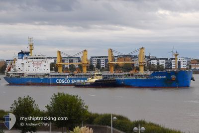
LV SONG HAI
Cargo
Current Trip
| Time Travelled | 3 days |
|---|---|
| Remaining Time | --- |
| Distance Travelled | 632.58 nm |
| Remaining Distance | --- |
| AVG Speed | 10.8 Noeuds |
| MAX Speed | 12.5 Noeuds |
| AVG Wind | 8.4 knots |
| MAX Wind | 14.9 knots |
| MIN Temp | 24.9°C / 76.82°F |
| MAX Temp | 29.2°C / 84.56°F |
| Tirant d eau | 10 m |
| Position reçue | 2 d depuis |
Current Position
| Longitude | -94.41970° |
|---|---|
| Latitude | 27.73150° |
| Etat | Under way using engine |
| Vitesse | 11.9 Noeuds |
| Parcours | 175.5° |
| Zone | Gulf of Mexico |
| Station | T-AIS |
| Position reçue | 2 d depuis |
Info
Information
The current position of LV SONG HAI is in Gulf of Mexico with coordinates 27.73150° / -94.41970° as reported on 2024-05-19 13:48 by AIS to our vessel tracker app. The vessel's current speed is 11.9 Noeuds
The vessel LV SONG HAI (IMO: 9751365, MMSI: 477027500) is a Cargo It's sailing under the flag of [HK] Hong Kong.
In this page you can find informations about the vessels current position, last detected port calls, and current voyage information. If the vessels is not in coverage by AIS you will find the latest position.
The current position of LV SONG HAI is detected by our AIS receivers and we are not responsible for the reliability of the data. The last position was recorded while the vessel was in Coverage by the Ais receivers of our vessel tracking app.
The current draught of LV SONG HAI as reported by AIS is 10 meters
Weather
| Temperature | 27.9°C / 82.22°F |
|---|---|
| Wind Speed | 4 knots |
| Direction | 287° WNW |
| Pressure | 1008.9 hPa |
| Humidity | 86.3 % |
| Cloud Coverage | 77 % |
Featured Company
Last Port Calls
| Port | Arrival | Departure | Time In Port |
|---|---|---|---|
| 2024-05-17 17:11 | 2024-05-19 03:35 | 1 d | |
| 2024-05-04 14:50 | 2024-05-05 20:45 | 1 d | |
| 2024-04-25 00:39 | 2024-05-02 09:22 | 7 d | |
| 2024-03-19 20:48 | 2024-04-01 12:42 | 12 d | |
| 2024-03-08 14:39 | 2024-03-17 23:06 | 9 d |
Most Visited Ports (Last year)
| Port | Arrivals | |
|---|---|---|
| 3 | ||
| 2 | ||
| 2 | ||
| 1 | ||
| 1 | ||
| 1 |
Last Trips
| Origin | Departure | Destination | Arrival | Distance | |
|---|---|---|---|---|---|
| 2024-05-05 15:45 | 2024-05-17 12:11 | 1381.31 nm | |||
| 2024-05-02 04:22 | 2024-05-04 09:50 | 89.49 nm | |||
| 2024-04-01 15:42 | 2024-04-24 19:39 | 6841.38 nm | |||
| 2024-03-18 02:06 | 2024-03-19 23:48 | 91.50 nm | |||
| 2024-02-21 09:55 | 2024-03-08 17:39 | 3431.14 nm |
Events
| Heure | Evenement | Détails | Position/ Destination | Info |
|---|---|---|---|---|
| 2024-05-21 11:45 | Arret | 2.6 nm, North West of VERACRUZ |
19.22445 / -96.16534
MXVER
|
Vitesse: 0.2 kn Parcours: 324° |
| 2024-05-19 13:54 | Etat Changé | Default Under way using engine |
27.71270 / -94.42131
MXVER
|
Vitesse: 11.9 kn Parcours: 175.5° |
| 2024-05-19 13:48 | Hors de la zone couverte |
27.73150 / -94.41970
Gulf of Mexico
MXVER
|
Vitesse: 11.9 kn Parcours: 175.5° |
|
| 2024-05-19 13:43 | Etat Changé | Under way using engine Default |
27.74956 / -94.42038
MXVER
|
Vitesse: 11.9 kn Parcours: 177° |
| 2024-05-19 12:50 | Etat Changé | Default Under way using engine |
27.92223 / -94.42388
MXVER
|
Vitesse: 11.6 kn Parcours: 184° |
| 2024-05-19 12:35 | Etat Changé | Under way using engine Default |
27.96910 / -94.42405
MXVER
|
Vitesse: 11.4 kn Parcours: 180° |
| 2024-05-19 12:30 | Etat Changé | Default Under way using engine |
27.98647 / -94.42400
MXVER
|
Vitesse: 11.3 kn Parcours: 178.8° |
| 2024-05-19 12:26 | Etat Changé | Under way using engine Default |
27.99752 / -94.42405
MXVER
|
Vitesse: 11.3 kn Parcours: 181° |
| 2024-05-19 12:14 | Etat Changé | Default Under way using engine |
28.03452 / -94.42486
MXVER
|
Vitesse: 11.2 kn Parcours: 174° |
| 2024-05-19 11:10 | Etat Changé | Under way using engine Default |
28.23366 / -94.43050
MXVER
|
Vitesse: 11.4 kn Parcours: 180° |