
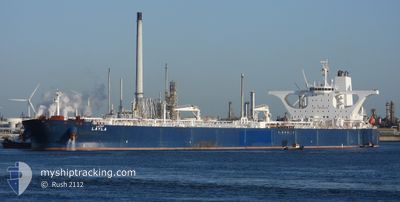
LAYLA
Crude Oil Tanker
Current Trip
| Time Travelled | 8 days |
|---|---|
| Remaining Time | 13 h, 18 mins |
| Distance Travelled | 2547.04 nm |
| Remaining Distance | 186.88 nm |
| AVG Speed | 11.8 Noeuds |
| MAX Speed | 14 Noeuds |
| AVG Wind | 9.9 knots |
| MAX Wind | 26 knots |
| MIN Temp | 25.8°C / 78.44°F |
| MAX Temp | 30.6°C / 87.08°F |
| Tirant d eau | 0 m |
| Position reçue | 1 m depuis |
Current Position
| Longitude | 38.90647° |
|---|---|
| Latitude | 20.19925° |
| Etat | Under way using engine |
| Vitesse | 12.3 Noeuds |
| Parcours | 337° |
| Zone | Red Sea |
| Station | T-AIS |
| Position reçue | 1 m depuis |
Info
Information
The current position of LAYLA is in Red Sea with coordinates 20.19925° / 38.90647° as reported on 2024-05-18 13:00 by AIS to our vessel tracker app. The vessel's current speed is 12.3 Noeuds and is heading at the port of RABIGH. The estimated time of arrival as calculated by MyShipTracking vessel tracking app is 2024-05-19 05:20 LT
The vessel LAYLA (IMO: 9336098, MMSI: 403507001) is a Crude Oil Tanker that was built in 2007 ( 17 Age ). It's sailing under the flag of [SA] Saudi Arabia.
In this page you can find informations about the vessels current position, last detected port calls, and current voyage information. If the vessels is not in coverage by AIS you will find the latest position.
The current position of LAYLA is detected by our AIS receivers and we are not responsible for the reliability of the data. The last position was recorded while the vessel was in Coverage by the Ais receivers of our vessel tracking app.
Weather
| Temperature | 28.6°C / 83.48°F |
|---|---|
| Wind Speed | 5 knots |
| Direction | 296° WNW |
| Pressure | 1005.2 hPa |
| Humidity | 75.7 % |
| Cloud Coverage | 100 % |
Featured Company
Last Port Calls
| Port | Arrival | Departure | Time In Port |
|---|---|---|---|
| 2024-05-08 13:11 | 2024-05-10 02:37 | 1 d | |
| 2024-04-20 19:27 |
Most Visited Ports (Last year)
| Port | Arrivals | |
|---|---|---|
| 4 | ||
| 2 | ||
| 1 |
Last Trips
| Origin | Departure | Destination | Arrival | Distance | |
|---|---|---|---|---|---|
| 2024-04-20 19:27 | 2024-05-08 13:11 | 3783.03 nm |
Events
| Heure | Evenement | Détails | Position/ Destination | Info |
|---|---|---|---|---|
| 2024-05-18 13:00 | Etat Changé | Under way using engine Default |
20.19822 / 38.90690
SARAB
|
Vitesse: 12.3 kn Parcours: 337° |
| 2024-05-18 12:47 | Etat Changé | Default Under way using engine |
20.15807 / 38.92510
SARAB
|
Vitesse: 12.3 kn Parcours: 334° |
| 2024-05-18 12:44 | Etat Changé | Under way using engine Default |
20.14762 / 38.93015
SARAB
|
Vitesse: 12.3 kn Parcours: 336° |
| 2024-05-18 12:29 | Dans la zone couverte |
20.14762 / 38.93015
Red Sea
SARAB
|
Vitesse: 12.3 kn Parcours: 334° |
|
| 2024-05-18 11:39 | Etat Changé | Default Under way using engine |
19.94622 / 39.03190
SARAB
|
Vitesse: 12.2 kn Parcours: 331° |
| 2024-05-18 11:29 | Hors de la zone couverte |
19.90792 / 39.05742
Red Sea
SARAB
|
Vitesse: 12.2 kn Parcours: 331° |
|
| 2024-05-18 11:26 | Etat Changé | Under way using engine Default |
19.90642 / 39.05827
SARAB
|
Vitesse: 12.2 kn Parcours: 332° |
| 2024-05-18 11:24 | Etat Changé | Default Under way using engine |
19.90145 / 39.06105
SARAB
|
Vitesse: 12.1 kn Parcours: 331° |
| 2024-05-18 10:59 | Etat Changé | Under way using engine Default |
19.82553 / 39.09867
SARAB
|
Vitesse: 12.4 kn Parcours: 338° |
| 2024-05-18 10:59 | Dans la zone couverte |
19.82553 / 39.09867
Red Sea
SARAB
|
Vitesse: 12.3 kn Parcours: 336° |