
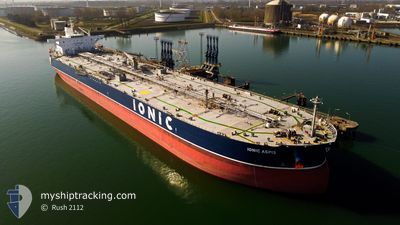
IONIC ASPIS
Crude Oil Tanker
Current Trip
| Time Travelled | 3 days |
|---|---|
| Remaining Time | 3 days |
| Distance Travelled | 879.97 nm |
| Remaining Distance | 798.34 nm |
| AVG Speed | 9.8 Noeuds |
| MAX Speed | 12.5 Noeuds |
| AVG Wind | 12.8 knots |
| MAX Wind | 22 knots |
| MIN Temp | 21.3°C / 70.34°F |
| MAX Temp | 26°C / 78.8°F |
| Tirant d eau | 8.8 m |
| Position reçue | 6 d depuis |
Current Position
| Longitude | -96.36939° |
|---|---|
| Latitude | 28.01882° |
| Etat | Under way using engine |
| Vitesse | 8.5 Noeuds |
| Parcours | 235.9° |
| Zone | Gulf of Mexico |
| Station | T-AIS |
| Position reçue | 6 d depuis |
Info
Information
The current position of IONIC ASPIS is in Gulf of Mexico with coordinates 28.01882° / -96.36939° as reported on 2024-04-20 03:59 by AIS to our vessel tracker app. The vessel's current speed is 8.5 Noeuds and is heading at the port of HOUSTON. The estimated time of arrival as calculated by MyShipTracking vessel tracking app is 2024-04-30 07:00 LT
The vessel IONIC ASPIS (IMO: 9523287, MMSI: 538007962) is a Crude Oil Tanker that was built in 2011 ( 13 Age ). It's sailing under the flag of [MH] Marshall Is.
In this page you can find informations about the vessels current position, last detected port calls, and current voyage information. If the vessels is not in coverage by AIS you will find the latest position.
The current position of IONIC ASPIS is detected by our AIS receivers and we are not responsible for the reliability of the data. The last position was recorded while the vessel was in Coverage by the Ais receivers of our vessel tracking app.
The current draught of IONIC ASPIS as reported by AIS is 8.8 meters
Weather
| Temperature | 25.3°C / 77.54°F |
|---|---|
| Wind Speed | 22 knots |
| Direction | 77° ENE |
| Pressure | 1018.2 hPa |
| Humidity | 66.4 % |
| Cloud Coverage | 19 % |
Featured Company
Last Port Calls
| Port | Arrival | Departure | Time In Port |
|---|---|---|---|
| 2024-04-22 19:58 | 2024-04-23 13:10 | 17 h | |
| 2024-03-12 15:25 | 2024-04-13 16:20 |
Most Visited Ports (Last year)
| Port | Arrivals | |
|---|---|---|
| 3 | ||
| 2 | ||
| 2 | ||
| 1 | ||
| 1 | ||
| 1 |
Last Trips
| Origin | Departure | Destination | Arrival | Distance | |
|---|---|---|---|---|---|
| 2024-04-13 11:20 | 2024-04-22 14:58 | 321.35 nm | |||
| 2024-01-12 09:13 | 2024-03-12 10:25 | 1140.99 nm |
Events
| Heure | Evenement | Détails | Position/ Destination | Info |
|---|---|---|---|---|
| 2024-04-23 13:10 | PORT DE DEPART |
|
27.81016 / -97.37159
US HOU
|
Vitesse: 7.1 kn Parcours: 92° |
| 2024-04-23 12:50 | Démarrage |
27.81375 / -97.40782
[US] CORPUS CHRISTI
|
Vitesse: 3.3 kn Parcours: 95° |
|
| 2024-04-22 19:58 | Arret |
27.81404 / -97.41153
[US] CORPUS CHRISTI
|
Vitesse: 0.1 kn Parcours: 89° |
|
| 2024-04-22 19:58 | Port d'arrivée |
|
27.81404 / -97.41153
[US] CORPUS CHRISTI
|
Vitesse: 3.6 kn Parcours: 95° |
| 2024-04-22 18:46 | Démarrage | 5.86 nm, West of CORPUS CHRISTI |
27.82795 / -97.49262
US HOU
|
Vitesse: 4.2 kn Parcours: 127° |
| 2024-04-20 20:34 | Arret | 6.37 nm, West of CORPUS CHRISTI |
27.83301 / -97.50152
US HOU
|
Vitesse: Parcours: 128° |
| 2024-04-20 14:59 | Démarrage | 11.72 nm, East of PORT ARANSAS |
27.77478 / -96.86005
US HOU
|
Vitesse: 3.2 kn Parcours: 255° |
| 2024-04-20 07:54 | Arret | 11.63 nm, East of PORT ARANSAS |
27.77741 / -96.86063
US HOU
|
Vitesse: 0.3 kn Parcours: 76° |
| 2024-04-20 04:06 | Etat Changé | Default Under way using engine |
28.00912 / -96.38544
US HOU
|
Vitesse: 8.5 kn Parcours: 235.9° |
| 2024-04-20 03:59 | Hors de la zone couverte |
28.01882 / -96.36939
Gulf of Mexico
|
Vitesse: 8.5 kn Parcours: 235.9° |