
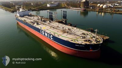
IONIC ASPIS
Crude Oil Tanker
Current Trip
SA JUB
| Time Travelled | 2 h, 51 mins |
|---|---|
| Remaining Time | --- |
| Distance Travelled | 14.46 nm |
| Remaining Distance | --- |
| AVG Speed | 11.3 Knots |
| MAX Speed | 11.6 Knots |
| AVG Wind | 14.2 knots |
| MAX Wind | 14.8 knots |
| MIN Temp | 16.4°C / 61.52°F |
| MAX Temp | 17.1°C / 62.78°F |
| Dybgang | 8.5 m |
| Position Modtaget | 2 h, 18 m siden |
Current Position
| Longitude | --- |
|---|---|
| Latitude | --- |
| Status | Under way using engine |
| Fart | 11.3 Knots |
| Kurs | 43.9° |
| Område | Persian Gulf |
| Station | T-AIS |
| Position Modtaget | 2 h, 18 m siden |
Info
Information
The current position of IONIC ASPIS is in Persian Gulf with coordinates 27.15480° / 49.83664° as reported on 2026-01-05 13:37 by AIS to our vessel tracker app. The vessel's current speed is 11.3 Knots
The vessel IONIC ASPIS (IMO: 9523287, MMSI: 538007962) is a Crude Oil Tanker that was built in 2011 ( 15 år gamle ). It's sailing under the flag of [MH] Marshall Is.
In this page you can find informations about the vessels current position, last detected port calls, and current voyage information. If the vessels is not in coverage by AIS you will find the latest position.
The current position of IONIC ASPIS is detected by our AIS receivers and we are not responsible for the reliability of the data. The last position was recorded while the vessel was in Coverage by the Ais receivers of our vessel tracking app.
The current draught of IONIC ASPIS as reported by AIS is 8.5 meters
Weather
| Temperature | 17.7°C / 63.86°F |
|---|---|
| Wind Speed | 13 knots |
| Direction | 335° NNW |
| Pressure | 1024.4 hPa |
| Humidity | 60.6 % |
| Cloud Coverage | 99 % |
Featured Company
Last Port Calls
| Port | Arrival | Departure | Time In Port |
|---|---|---|---|
| 2026-01-02 23:31 | 2026-01-05 16:05 | 2 d | |
| 2025-12-28 03:52 | 2025-12-29 17:29 | 1 d | |
| 2025-12-21 23:20 | 2025-12-22 23:44 | 1 d | |
| 2025-12-17 18:20 | 2025-12-18 22:44 | 1 d | |
| 2025-12-15 10:29 | 2025-12-16 13:55 | 1 d |
Most Visited Ports (Last year)
| Port | Arrivals | |
|---|---|---|
| 5 | ||
| 4 | ||
| 2 | ||
| 2 | ||
| 2 | ||
| 2 |
Last Trips
| Origin | Departure | Destination | Arrival | Distance | |
|---|---|---|---|---|---|
| 2025-12-29 17:29 | 2026-01-02 23:31 | 1257.08 nm | |||
| 2025-12-22 23:44 | 2025-12-28 03:52 | 965.93 nm | |||
| 2025-12-18 22:44 | 2025-12-21 23:20 | 969.52 nm | |||
| 2025-12-16 13:55 | 2025-12-17 18:20 | 334.53 nm | |||
| 2025-10-31 05:05 | 2025-12-15 10:29 | 12152.87 nm |
Events
| Tid | Hændelsen | Detaljer | Position / Dest | Info |
|---|---|---|---|---|
| 2026-01-05 13:40 | Status er ændret | Default Under way using engine |
27.16133 / 49.84369
SA JUB
|
Fart: 11.3 kn Kurs: 43.9° |
| 2026-01-05 13:37 | Udenfor Dækning |
27.15480 / 49.83664
Persian Gulf
|
Fart: 11.3 kn Kurs: 43.9° |
|
| 2026-01-05 13:37 | Status er ændret | Under way using engine Default |
27.15404 / 49.83581
SA JUB
|
Fart: 11.3 kn Kurs: 44° |
| 2026-01-05 13:28 | Indenfor Dækning |
27.15480 / 49.83664
Persian Gulf
|
Fart: 11.3 kn Kurs: 43.9° |
|
| 2026-01-05 13:05 | Afsejlet fra sidste havn |
|
27.08019 / 49.75728
SA JUB
|
Fart: 9.5 kn Kurs: 47° |
| 2026-01-05 12:43 | START Sejllads |
27.06391 / 49.70741
[SA] AL JUBAIL
|
Fart: 5.4 kn Kurs: 109° |
|
| 2026-01-03 04:12 | Status er ændret | Default Moored |
27.07471 / 49.70117
[SA] AL JUBAIL
|
Fart: Kurs: 1° |
| 2026-01-03 04:03 | Udenfor Dækning |
27.07471 / 49.70117
Persian Gulf
[SA] AL JUBAIL
|
Fart: Kurs: 307° |
|
| 2026-01-03 04:03 | Status er ændret | Moored Default |
27.07450 / 49.70128
[SA] AL JUBAIL
|
Fart: Kurs: 1° |
| 2026-01-03 03:49 | Indenfor Dækning |
27.07471 / 49.70117
Persian Gulf
[SA] AL JUBAIL
|
Fart: Kurs: 307° |