
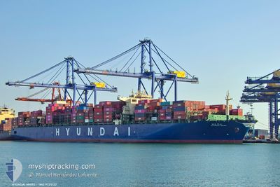
HYUNDAI MARS
Cargo
Current Trip
| Time Travelled | 14 days |
|---|---|
| Remaining Time | --- |
| Distance Travelled | 5144.73 nm |
| Remaining Distance | --- |
| AVG Speed | 17.8 Noeuds |
| MAX Speed | 20 Noeuds |
| AVG Wind | 13.8 knots |
| MAX Wind | 22 knots |
| MIN Temp | 12.8°C / 55.04°F |
| MAX Temp | 28.3°C / 82.94°F |
| Tirant d eau | 11 m |
| Position reçue | 2 d depuis |
Current Position
| Longitude | --- |
|---|---|
| Latitude | --- |
| Etat | Under way using engine |
| Vitesse | 15.7 Noeuds |
| Parcours | 139° |
| Zone | South Atlantic Ocean |
| Station | T-AIS |
| Position reçue | 2 d depuis |
Info
Information
The current position of HYUNDAI MARS is in South Atlantic Ocean with coordinates -34.34683° / 17.87689° as reported on 2025-02-13 23:30 by AIS to our vessel tracker app. The vessel's current speed is 15.7 Noeuds
The vessel HYUNDAI MARS (MMSI: 232024773) is a Cargo It's sailing under the flag of [GB] United Kingdom.
In this page you can find informations about the vessels current position, last detected port calls, and current voyage information. If the vessels is not in coverage by AIS you will find the latest position.
The current position of HYUNDAI MARS is detected by our AIS receivers and we are not responsible for the reliability of the data. The last position was recorded while the vessel was in Coverage by the Ais receivers of our vessel tracking app.
The current draught of HYUNDAI MARS as reported by AIS is 11 meters
Weather
| Temperature | 18.6°C / 65.48°F |
|---|---|
| Wind Speed | 18 knots |
| Direction | 159° SSE |
| Pressure | 1017.5 hPa |
| Humidity | 64.5 % |
| Cloud Coverage | 23 % |
Featured Company
Last Port Calls
| Port | Arrival | Departure | Time In Port |
|---|---|---|---|
| 2025-02-01 13:25 | 2025-02-02 00:39 | 11 h | |
| 2025-01-23 09:46 | 2025-01-25 05:02 | 1 d | |
| 2025-01-13 04:29 | 2025-01-16 02:38 | 2 d | |
| 2024-12-30 23:26 | 2025-01-03 06:46 | 3 d | |
| 2024-12-28 21:55 | 2024-12-29 23:53 | 1 d | |
| 2024-12-27 02:12 | 2024-12-27 17:58 | 15 h |
Most Visited Ports (Last year)
| Port | Arrivals | |
|---|---|---|
| 5 | ||
| 4 | ||
| 4 | ||
| 3 | ||
| 3 | ||
| 3 |
Last Trips
| Origin | Departure | Destination | Arrival | Distance | |
|---|---|---|---|---|---|
| 2025-01-25 07:02 | 2025-02-01 14:25 | 1534.17 nm | |||
| 2025-01-16 03:38 | 2025-01-23 11:46 | 1182.20 nm | |||
| 2025-01-03 07:46 | 2025-01-13 05:29 | 746.17 nm | |||
| 2024-12-30 00:53 | 2024-12-31 00:26 | 182.07 nm | |||
| 2024-12-27 18:58 | 2024-12-28 22:55 | 410.76 nm | |||
| 2024-11-27 20:09 | 2024-12-27 03:12 | 9671.65 nm |
Events
| Heure | Evenement | Détails | Position/ Destination | Info |
|---|---|---|---|---|
| 2025-02-13 23:30 | Hors de la zone couverte |
-34.34683 / 17.87689
South Atlantic Ocean
|
Vitesse: 15.7 kn Parcours: 139° |
|
| 2025-02-13 23:23 | Changement de destination | FOR ORDERS CAPE TOWN |
-34.32145 / 17.85081
FOR ORDERS
|
Vitesse: 15.6 kn Parcours: 140° |
| 2025-02-13 22:14 | Tirant d'eau modifié | 11 11.6 |
-34.10443 / 17.57837
CAPE TOWN
|
Vitesse: 16.8 kn Parcours: 130° |
| 2025-02-13 22:14 | Changement de destination | CAPE TOWN PKKHI |
-34.10443 / 17.57837
CAPE TOWN
|
Vitesse: 16.8 kn Parcours: 130° |
| 2025-02-13 22:12 | Etat Changé | Under way using engine Default |
-34.10443 / 17.57837
PKKHI
|
Vitesse: 17.1 kn Parcours: 132° |
| 2025-02-13 22:08 | Etat Changé | Default Under way using engine |
-34.09185 / 17.56129
PKKHI
|
Vitesse: 16.9 kn Parcours: 134° |
| 2025-02-13 22:02 | Changement de zone | South African part of the South Atlantic Ocean Spanish (Canary Islands) part of the North Atlantic Ocean |
-34.07194 / 17.53599
South Atlantic Ocean
PKKHI
|
Vitesse: 16.9 kn Parcours: 134° |
| 2025-02-13 22:02 | Etat Changé | Under way using engine Default |
-34.07194 / 17.53599
PKKHI
|
Vitesse: 17.3 kn Parcours: 134° |
| 2025-02-13 21:59 | Dans la zone couverte |
-34.07194 / 17.53599
South Atlantic Ocean
PKKHI
|
Vitesse: 16.9 kn Parcours: 134° |