
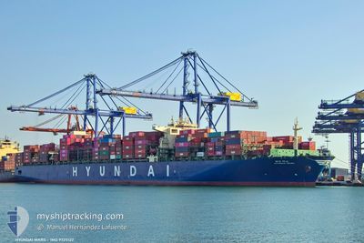
HYUNDAI MARS
Cargo
Current Trip
| Trip Time | 6 days |
|---|---|
| Trip Distance | 2201.47 nm |
| AVG Speed | 13.9 Knots |
| MAX Speed | 19.1 Knots |
| Draught | 15.8 m |
| AVG Wind | 5.8 knots |
| MAX Wind | 11 knots |
| MIN Temp | 25°C / 77°F |
| MAX Temp | 30.3°C / 86.54°F |
| Position Received | 7 d ago |
Current Position
| Longitude | --- |
|---|---|
| Latitude | --- |
| Status | Under way using engine |
| Speed | 18.3 Knots |
| Course | 304.2° |
| Area | Malacca Strait |
| Station | T-AIS |
| Position Received | 7 d ago |
Info
Information
The current position of HYUNDAI MARS is in Malacca Strait with coordinates 1.25334° / 103.38461° as reported on 2024-11-14 21:38 by AIS to our vessel tracker app. The vessel's current speed is 18.3 Knots and is currently inside the port of NHAVA SHEVA.
The vessel HYUNDAI MARS (IMO: 9725122, MMSI: 232024773) is a Cargo It's sailing under the flag of [GB] United Kingdom.
In this page you can find informations about the vessels current position, last detected port calls, and current voyage information. If the vessels is not in coverage by AIS you will find the latest position.
The current position of HYUNDAI MARS is detected by our AIS receivers and we are not responsible for the reliability of the data. The last position was recorded while the vessel was in Coverage by the Ais receivers of our vessel tracking app.
The current draught of HYUNDAI MARS as reported by AIS is 15.8 meters
Weather
| Temperature | 22.2°C / 71.96°F |
|---|---|
| Wind Speed | 4 knots |
| Direction | 69° ENE |
| Pressure | 1010.9 hPa |
| Humidity | 52.2 % |
| Cloud Coverage | 55 % |
Featured Company
Last Port Calls
| Port | Arrival | Departure | Time In Port |
|---|---|---|---|
| 2024-11-21 14:18 | |||
| 2024-11-14 10:56 | 2024-11-15 03:14 | 16 h | |
| 2024-11-09 09:17 | 2024-11-09 20:00 | 10 h | |
| 2024-11-06 01:58 | 2024-11-06 11:56 | 9 h | |
| 2024-10-29 19:43 | 2024-10-31 06:59 | 1 d | |
| 2024-10-22 18:22 | 2024-10-23 14:42 | 20 h | |
| 2024-10-18 04:34 | 2024-10-19 00:36 | 20 h | |
| 2024-10-18 03:50 | 2024-10-18 04:04 | 13 m | |
| 2024-10-12 07:39 | 2024-10-13 23:00 | 1 d | |
| 2024-10-07 06:43 | 2024-10-08 15:55 | 1 d |
Most Visited Ports (Last year)
| Port | Arrivals | |
|---|---|---|
| 8 | ||
| 6 | ||
| 5 | ||
| 4 | ||
| 3 | ||
| 3 |
Last Trips
| Origin | Departure | Destination | Arrival | Distance | |
|---|---|---|---|---|---|
| 2024-11-15 03:14 | 2024-11-21 14:18 | 2201.47 nm | |||
| 2024-11-09 20:00 | 2024-11-14 10:56 | 1577.82 nm | |||
| 2024-11-06 11:56 | 2024-11-09 09:17 | 788.18 nm | |||
| 2024-10-31 06:59 | 2024-11-06 01:58 | 877.91 nm | |||
| 2024-10-23 14:42 | 2024-10-29 19:43 | 1274.24 nm | |||
| 2024-10-19 00:36 | 2024-10-22 18:22 | 1469.09 nm | |||
| 2024-10-18 04:04 | 2024-10-18 04:34 | 2.05 nm | |||
| 2024-10-13 23:00 | 2024-10-18 03:50 | 1605.37 nm | |||
| 2024-10-08 15:55 | 2024-10-12 07:39 | 1571.58 nm | |||
| 2024-10-04 16:23 | 2024-10-07 06:43 | 455.52 nm |
Events
| Time | Event | Details | Position / Dest | Info |
|---|---|---|---|---|
| 2024-11-21 08:48 | STOP Moving |
18.93840 / 72.93485
[IN] NHAVA SHEVA
|
Speed: 0.3 kn Course: 222° |
|
| 2024-11-21 08:48 | PORT ARRIVAL |
|
18.93840 / 72.93485
[IN] NHAVA SHEVA
|
Speed: 0.5 kn Course: 214° |
| 2024-11-14 21:44 | Status Changed | Default Under way using engine |
1.27160 / 103.36028
FOR ORDERS
|
Speed: 18.3 kn Course: 304.2° |
| 2024-11-14 21:38 | OUT of Coverage |
1.25334 / 103.38461
Malacca Strait
|
Speed: 18.3 kn Course: 304.2° |
|
| 2024-11-14 21:23 | Change Sea Area | Malaysian part of the Malacca Strait Malaysian part of the Singapore Strait |
1.21869 / 103.45529
Malacca Strait
FOR ORDERS
|
Speed: 18.4 kn Course: 285.5° |
| 2024-11-14 20:59 | Change Sea Area | Malaysian part of the Singapore Strait Indonesian part of the Singapore Strait |
1.19861 / 103.57849
Singapore Strait
FOR ORDERS
|
Speed: 19 kn Course: 280.1° |
| 2024-11-14 20:29 | Change Sea Area | Indonesian part of the Singapore Strait Singaporean part of the Singapore Strait |
1.14560 / 103.71591
Singapore Strait
FOR ORDERS
|
Speed: 16.7 kn Course: 299.2° |
| 2024-11-14 19:14 | PORT DEPARTURE |
|
1.26039 / 103.77242
FOR ORDERS
|
Speed: 5.9 kn Course: 182° |
| 2024-11-14 19:08 | START Moving |
1.26766 / 103.77505
[SG] SINGAPORE
|
Speed: 3.1 kn Course: 210° |
|
| 2024-11-14 18:39 | Status Changed | Under way using engine Moored |
1.27354 / 103.77404
[SG] SINGAPORE
|
Speed: 0.1 kn Course: 32° |