
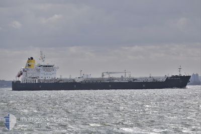
HELLAS CALAFIA
Tanker
Current Trip
| Time Travelled | 9 days |
|---|---|
| Remaining Time | --- |
| Distance Travelled | 1776.44 nm |
| Remaining Distance | --- |
| AVG Speed | 12 Noeuds |
| MAX Speed | 17.8 Noeuds |
| AVG Wind | 14.3 knots |
| MAX Wind | 24.6 knots |
| MIN Temp | 22.6°C / 72.68°F |
| MAX Temp | 27.8°C / 82.04°F |
| Tirant d eau | 9.3 m |
| Position reçue | 1 m depuis |
Current Position
| Longitude | -89.43031° |
|---|---|
| Latitude | 28.88263° |
| Etat | Under way using engine |
| Vitesse | 9.2 Noeuds |
| Parcours | 352.7° |
| Zone | Caribbean Sea |
| Station | T-AIS |
| Position reçue | 1 m depuis |
Info
Information
The current position of HELLAS CALAFIA is in Caribbean Sea with coordinates 28.88263° / -89.43031° as reported on 2024-04-30 22:55 by AIS to our vessel tracker app. The vessel's current speed is 9.2 Noeuds and is heading at the port of BATON ROUGE. The estimated time of arrival as calculated by MyShipTracking vessel tracking app is 2024-04-30 22:00 LT
The vessel HELLAS CALAFIA (IMO: 9798088, MMSI: 215744000) is a Tanker It's sailing under the flag of [MT] Malta.
In this page you can find informations about the vessels current position, last detected port calls, and current voyage information. If the vessels is not in coverage by AIS you will find the latest position.
The current position of HELLAS CALAFIA is detected by our AIS receivers and we are not responsible for the reliability of the data. The last position was recorded while the vessel was in Coverage by the Ais receivers of our vessel tracking app.
The current draught of HELLAS CALAFIA as reported by AIS is 9.3 meters
Weather
| Temperature | 24.8°C / 76.64°F |
|---|---|
| Wind Speed | 5 knots |
| Direction | 205° SSW |
| Pressure | 1012.9 hPa |
| Humidity | 72.4 % |
| Cloud Coverage | --- |
Featured Company
Last Port Calls
| Port | Arrival | Departure | Time In Port |
|---|---|---|---|
| 2024-04-19 14:45 | 2024-04-21 02:55 | 1 d | |
| 2024-04-12 06:49 | 2024-04-14 05:43 | 1 d | |
| 2024-03-25 05:24 | 2024-03-28 11:14 | 3 d | |
| 2024-03-20 11:11 | 2024-03-21 12:08 | 1 d | |
| 2024-03-09 10:46 | 2024-03-13 19:08 | 4 d | |
| 2024-03-01 00:00 | 2024-03-03 02:08 | 2 d | |
| 2024-02-15 07:39 | 2024-02-15 08:22 | 42 m | |
| 2024-02-10 22:45 | 2024-02-15 06:40 | 4 d | |
| 2024-02-10 21:20 | 2024-02-10 22:01 | 40 m | |
| 2024-02-02 19:46 | 2024-02-04 10:06 | 1 d |
Last Trips
| Origin | Departure | Destination | Arrival | Distance | |
|---|---|---|---|---|---|
| 2024-04-14 00:43 | 2024-04-19 10:45 | 1697.05 nm | |||
| 2024-03-28 07:14 | 2024-04-12 01:49 | 2318.15 nm | |||
| 2024-03-21 08:08 | 2024-03-25 01:24 | 467.29 nm | |||
| 2024-03-13 14:08 | 2024-03-20 07:11 | 2035.28 nm | |||
| 2024-03-02 21:08 | 2024-03-09 04:46 | 1363.79 nm | |||
| 2024-02-15 09:22 | 2024-02-29 19:00 | 4153.69 nm | |||
| 2024-02-15 07:40 | 2024-02-15 08:39 | 4.64 nm | |||
| 2024-02-10 23:01 | 2024-02-10 23:45 | 5.44 nm | |||
| 2024-02-04 11:06 | 2024-02-10 22:20 | 665.29 nm | |||
| 2024-01-31 18:33 | 2024-02-02 20:46 | 550.33 nm |
Events
| Heure | Evenement | Détails | Position/ Destination | Info |
|---|---|---|---|---|
| 2024-04-30 22:39 | Etat Changé | Under way using engine Default |
28.84095 / -89.42693
US BTR
|
Vitesse: 11.9 kn Parcours: 1° |
| 2024-04-30 22:38 | Etat Changé | Default Under way using engine |
28.83962 / -89.42694
US BTR
|
Vitesse: 12.1 kn Parcours: 2.2° |
| 2024-04-30 22:29 | Tirant d'eau modifié | 9.3 8.7 |
28.80983 / -89.42512
US BTR
|
Vitesse: 13.5 kn Parcours: 344.7° |
| 2024-04-30 22:29 | Changement de destination | US BTR HOUSTON |
28.80983 / -89.42512
US BTR
|
Vitesse: 13.5 kn Parcours: 344.7° |
| 2024-04-30 22:29 | Changement d'ETA | 2024/04/30 22:00 2024/04/19 15:30 |
28.80983 / -89.42512
US BTR
|
Vitesse: 13.5 kn Parcours: 344.7° |
| 2024-04-30 22:28 | Changement de zone | United States part of the Gulf of Mexico Cuban part of the Caribbean Sea |
28.80983 / -89.42512
Gulf of Mexico
|
Vitesse: 13.5 kn Parcours: 344.7° |
| 2024-04-30 22:27 | Etat Changé | Under way using engine Default |
28.80676 / -89.42411
HOUSTON
|
Vitesse: 13.9 kn Parcours: 329° |
| 2024-04-30 22:27 | Dans la zone couverte |
28.80983 / -89.42512
Gulf of Mexico
|
Vitesse: 13.5 kn Parcours: 344.7° |
|
| 2024-04-27 14:16 | Démarrage |
24.26382 / -90.14779
HOUSTON
|
Vitesse: 5.8 kn Parcours: 85° |
|
| 2024-04-26 16:23 | Arret |
24.27217 / -89.50366
HOUSTON
|
Vitesse: 0.2 kn Parcours: 132° |