
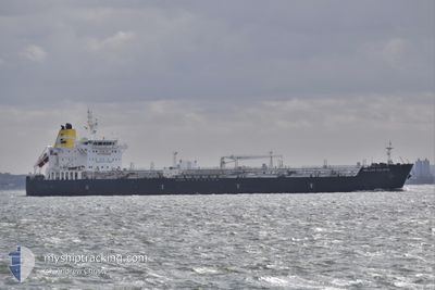
HELLAS CALAFIA
Tanker
Current Trip
| Time Travelled | 6 days |
|---|---|
| Remaining Time | 2 days |
| Distance Travelled | 1250.61 nm |
| Remaining Distance | 171.56 nm |
| AVG Speed | 10 Knots |
| MAX Speed | 14.9 Knots |
| AVG Wind | 15.3 knots |
| MAX Wind | 30 knots |
| MIN Temp | -4.4°C / 24.08°F |
| MAX Temp | 8.7°C / 47.66°F |
| Dybgang | 8 m |
| Position Modtaget | 1 m siden |
Current Position
| Longitude | --- |
|---|---|
| Latitude | --- |
| Status | Under way using engine |
| Fart | 3 Knots |
| Kurs | 108° |
| Område | Gulf of Finland |
| Station | T-AIS |
| Position Modtaget | 1 m siden |
Info
Information
The current position of HELLAS CALAFIA is in Gulf of Finland with coordinates 59.55990° / 23.74873° as reported on 2026-02-26 14:19 by AIS to our vessel tracker app. The vessel's current speed is 3 Knots and is heading at the port of PRIMORSK. The estimated time of arrival as calculated by MyShipTracking vessel tracking app is 2026-02-28 22:48 LT
The vessel HELLAS CALAFIA (IMO: 9798088, MMSI: 215744000) is a Tanker It's sailing under the flag of [MT] Malta.
In this page you can find informations about the vessels current position, last detected port calls, and current voyage information. If the vessels is not in coverage by AIS you will find the latest position.
The current position of HELLAS CALAFIA is detected by our AIS receivers and we are not responsible for the reliability of the data. The last position was recorded while the vessel was in Coverage by the Ais receivers of our vessel tracking app.
The current draught of HELLAS CALAFIA as reported by AIS is 8 meters
Weather
| Temperature | 1.2°C / 34.16°F |
|---|---|
| Wind Speed | 27 knots |
| Direction | 207° SSW |
| Pressure | 1014.6 hPa |
| Humidity | 82.5 % |
| Cloud Coverage | 100 % |
Featured Company
Last Port Calls
| Port | Arrival | Departure | Time In Port |
|---|---|---|---|
| 2026-02-18 02:48 | 2026-02-20 11:03 | 2 d | |
| 2026-02-15 17:03 | 2026-02-18 02:41 | 2 d | |
| 2026-02-13 20:16 | 2026-02-15 13:59 | 1 d | |
| 2026-02-10 02:15 | 2026-02-13 18:20 | 3 d | |
| 2026-02-08 13:24 | 2026-02-09 22:46 | 1 d | |
| 2025-12-25 03:22 | 2025-12-26 11:17 | 1 d | |
| 2025-12-19 23:22 | 2025-12-20 22:42 | 23 h | |
| 2025-12-03 14:01 | 2025-12-05 10:29 | 1 d |
Last Trips
| Origin | Departure | Destination | Arrival | Distance | |
|---|---|---|---|---|---|
| 2026-02-18 02:41 | 2026-02-18 02:48 | 0.59 nm | |||
| 2026-02-15 13:59 | 2026-02-15 17:03 | 20.18 nm | |||
| 2026-02-13 18:20 | 2026-02-13 20:16 | 16.74 nm | |||
| 2026-02-09 22:46 | 2026-02-10 02:15 | 20.39 nm | |||
| 2025-12-26 11:17 | 2026-02-08 13:24 | 10683.86 nm | |||
| 2025-12-20 22:42 | 2025-12-25 03:22 | 1350.59 nm | |||
| 2025-12-05 10:29 | 2025-12-19 23:22 | 2022.70 nm | |||
| 2025-11-13 12:18 | 2025-12-03 14:01 | 4173.16 nm |
Events
| Tid | Hændelsen | Detaljer | Position / Dest | Info |
|---|---|---|---|---|
| 2026-02-26 11:59 | START Sejllads | --- |
59.50010 / 23.51922
RU PRI
|
Fart: 3.3 kn Kurs: 114° |
| 2026-02-26 11:35 | STOP Sejllads | --- |
59.50087 / 23.51335
RU PRI
|
Fart: 0.3 kn Kurs: 208° |
| 2026-02-26 11:06 | Ændre havområde | Estonian part of the Gulf of Finland Finnish part of the Gulf of Finland |
59.51252 / 23.49338
Gulf of Finland
|
Fart: 3.1 kn Kurs: 152.9° |
| 2026-02-26 10:16 | Ændre havområde | Finnish part of the Gulf of Finland Estonian part of the Gulf of Finland |
59.52709 / 23.48276
Gulf of Finland
|
Fart: 2.6 kn Kurs: 347.5° |
| 2026-02-26 09:26 | Ændre havområde | Estonian part of the Gulf of Finland Finnish part of the Gulf of Finland |
59.50652 / 23.50714
Gulf of Finland
|
Fart: 7.7 kn Kurs: 187.7° |
| 2026-02-26 09:15 | Status er ændret | Under way using engine Default |
59.53081 / 23.51223
RU PRI
|
Fart: 6.4 kn Kurs: 181° |
| 2026-02-26 09:10 | Status er ændret | Default Under way using engine |
59.54190 / 23.51494
RU PRI
|
Fart: 6.1 kn Kurs: 103° |
| 2026-02-26 08:44 | Ændre havområde | Finnish part of the Gulf of Finland Estonian part of the Gulf of Finland |
59.52866 / 23.50406
Gulf of Finland
|
Fart: 2.6 kn Kurs: 2.1° |
| 2026-02-26 07:10 | START Sejllads | --- |
59.56402 / 23.69381
RU PRI
|
Fart: 3.2 kn Kurs: 124° |
| 2026-02-26 07:03 | Status er ændret | Under way using engine Default |
59.56194 / 23.68590
RU PRI
|
Fart: 2.5 kn Kurs: -1° |